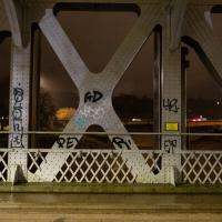
Tagged: bristol
To Bedminster
19 Dec 2020
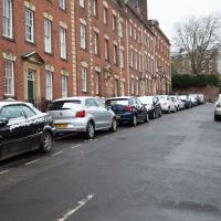
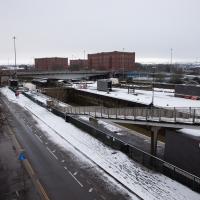
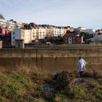
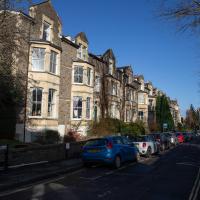
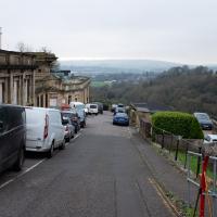
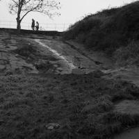
Despite a mild headache, I enjoyed this wander over to Bedminster. The light was lovely, especially toward the end. I always enjoy the view down the streets south of North Street at this time of day/year, with the distant hills backdropping the Victorian terraces.
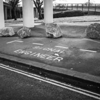
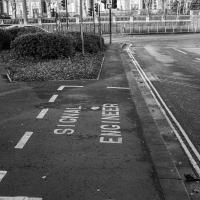
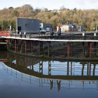
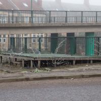
I have to think that if you need a specific parking place marked out for your signal engineer, it might be an indicator that your traffic lights aren't terribly reliable.
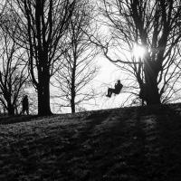

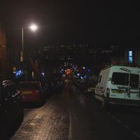
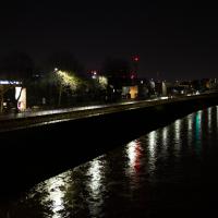
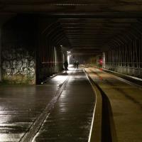
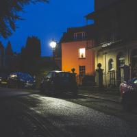
Coming Home in the Dark
19 Dec 2020
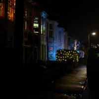
A nice walk home in the dark early evening—we're only a couple of days away from the winter solstice—found me getting a bit lost in Southville as I tried to knock a few new streets of my list. Happily getting lost in Southville at this time of year is in no way unpleasant, and just lets you look at more Christmas lights, really.
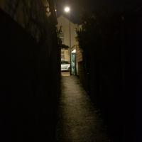
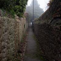
Having got lost in Southville, I took a punt on there being a way through for pedestrians at the end of the no-through road Langton Park. I lucked out, and found this little cut-through to Greville Street
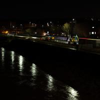
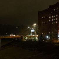
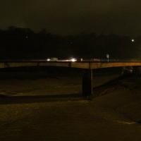
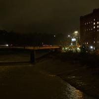
Solstice Rain
21 Dec 2020
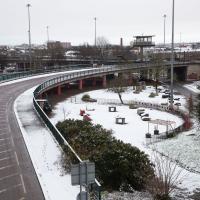
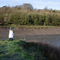
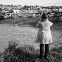
Despite the weather, Sarah and Vik and I wandered around Ashton Court a bit as the sun rose. Not that you could really tell. Sadly, the bit we wanted to watch the sunrise from was closed, because people hadn't been treating the deer with appropriate respect. Ah well, at least it was some exercise.
The yellow is the lights of Ashton Gate Stadium. I know nothing of football or its stadia, but it seems a bit odd to leave them on all night.
On Christmas Day in the Morning
25 Dec 2020
A Christmas Day walk with my friends Sarah and Vik, taking in the shipwrecked Shadow and a hilly chunk of Leigh Woods.
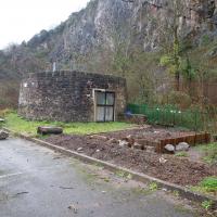
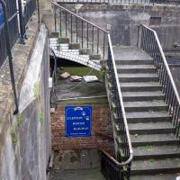
I went to have a peep at the giant sinkhole that's opened up in Canynge Square—ironically, having recently discovered the gardens were public I'd had the (triangular!) square on my list to re-visit for a few days, but now there's no entrance to the gardens due to the danger. The area was well fenced-off for safety, but I tried to get a couple of photos from behind the barriers.
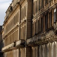
I also explored the area around Camp Road, an real melange of architectures, one of the most mixed-up areas I've seen in Clifton, in fact, and confirmed my friend Claire's suspicion that an earlier snap of a sign from Manilla Road was in fact for a fire hydrant. Nice.
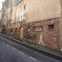
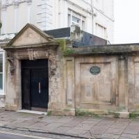
A homeless guy used to live in that doorway. I don't know if the boarding up coincided with the religious order that used to run Emmaus House as a retreat centre moving to Whitchurch or not...

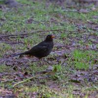
I'd assumed I'd be taking a picture of a squirrel, because that seems to be the main population of St Andrew's Churchyard, but hey, I'll take a blackbird.
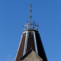
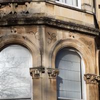
Nice top to the turret on the corner of this house on the end of Mortimer Road. Anywhere else, you'd expect it to be listed, I'd've thought...
Saint Vincent's Spring
28 Dec 2020
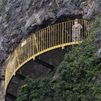
Fractionally outside my one-mile zone, but I got curious about Saint Vincent's spring, whose last remnants you can see in a defunct drinking fountain on the Portway. Along the way I passed Gyston's cave, sometimes called St Vincent's cave, in the sheer wall of the gorge. It's now accessible by a tunnel from the observatory—I tried it about twenty years ago, I think, and still recall the vertiginous moment of looking down from the protruding balcony and realising that you could see straight through the grille floor to the drop below—but from what I can work out the tunnel is relatively recent. Before the tunnel was dug it was accessible only by access across the cliff face, which must have been even more terrifying.
This cave was first mentioned as being a chapel in the year AD 305 and excavations, in which Romano-British pottery has been found, have revealed that it has been both a holy place and a place of refuge at various times in its history.
A few different sources say that the cave became a hermitage and chapel to St Vincent following Bristol's early trading in Iberian wines; St Vincent of Saragossa is Lisbon's patron saint, and a lot of nearby things bear the name.
I'm not sure where the crossover of Vincent and Ghyston happens, though. On the giants Goram and Vincent (or Ghyston), Wikipedia says:
The name Vincent for one of the giants rests on the fact that at Clifton, at the narrowest point of the Avon Gorge, there was formerly an ancient hermitage and chapel dedicated to St Vincent, at or near the present cave in the cliff-face which bears his name. Another (apparently modern) version of the story calls the Clifton giant Ghyston, which is in fact the name, of obscure origin, for the whole of the cliff-face of the Avon Gorge at least as early as the mid-fifteenth century, in the detailed description of the Bristol area by William Worcestre. The place-name was personified to produce the giant's name. Vincent's Cave is called Ghyston cave or The Giant’s Hole in an article in the July 1837 issue of Felix Farley’s Bristol Journal.
In my research on the original Hot Well House, I've seen quite a few contemporary paintings which state their viewpoint as "from St. Vincent's Rock", so in the 16th century it seems the cliff-face name was typically St Vincent Rock rather than Ghyston's Rock, perhaps.
I am, as you can tell, no historian!
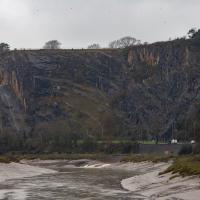
On the way, I also wandered around the base of the popular climbing area, which I think is the site of the old Black Rock quarry.
The interesting-looking modern block at the top of the cliff on the left is Seawalls, on Seawalls Road, built in 1977. Zoopla's estimated price for a two-bedroom flat there looks to be around half a million pounds.
There are a lot of crashes on the Portway, which has always felt like a well-designed, safe, wide road with a reasonable speed limit to me. Maybe someone's trying to figure out why...
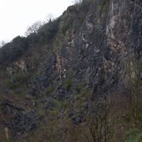
What can I say? I went to a quarry in the Avon Gorge. Most of my pictures are going to be of rocks. Sorry.
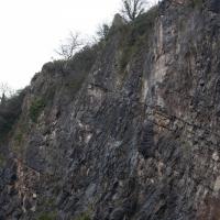
These are all in the rock-climibing area in the old quarry below Peregrine Watch Point. I saw no peregrines.
Prince's Lane
06 Jan 2021
The International Grotto Directory website says:
Prince’s Lane might have been one of the original ancient tracks from Hotwells to Clifton, in the Avon Gorge. The site later formed part of Rownham Woods which comprised some thirteen acres. By the end of the 18th century and the early 19th century, the Society of Merchant Venturers granted to Samuel Powell a building lease, for The Colonnade (1786), St. Vincent’s Parade (1790), Prince’s Buildings (1796), and Rock House. Rock House is generally considered to be the oldest surviving building associated with the Hotwell (see Chapter 20). John Power conveyed part of the woods to William Watts for the construction of Windsor Terrace (1790-1808).
The above development of the Avon Gorge cleared Rownham Woods, and created a triangle of land on the north side of the gorge, that became enclosed as a result, by Mansion Houses, whose garden walls all entered on to Prince’s Lane. The Lane started at the bottom of the gorge, at the base rock of Windsor Terrace, and came out half way up Sion Hill. It is clearly shown as a public footpath, dotted with trees, in Ashmead’s map of 1828. Some of the gardens were quite steep in parts and therefore, had to be terraced, because of the gradient of the gorge.
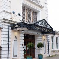
I've passed Prince's Lane literally thousands of times in my life, every time I've walked past the Avon Gorge Hotel, which itself started (in 1898) as the Grand Clifton Spa and Hydropathic Institution and pumped water up from the Hot Well for its hydropathic treatments. I've never actually ventured down it until today, or at least nothing like as far down it as I did this afternoon—I may have poked my head around the back of the hotel to see the original pump rooms at some point in the past.
This was a great wander, though it does very much feel like a private road, and frankly I may have been pushing my luck a bit by winding my way between the astoundingly big back gardens of the houses of some presumably very wealthy Cliftonites, but I felt vaguely justified in exploring the history of one of the oldest footpaths in my part of Bristol...
Or the first sight of them in the distance, anyway. The terrace on the left is Prince's Buildings; we'll be walking being their gardens in a bit...
This building is 1894, but commemorates the original Hot Well House down in actual Hotwells, built in 1694.
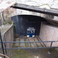
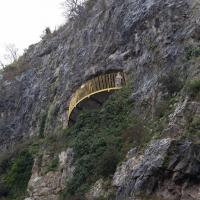
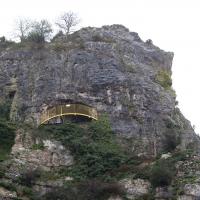
The nice folk who look after the Clifton Rocks Railway have an example of what one of the carriages would look like at the top, though the tunnel here has been bricked up for a long, long time. If you get the chance to visit on one of their open days, it's pretty fascinating.
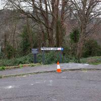
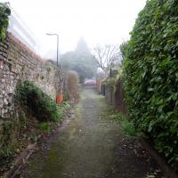
One of the oldest paths from Clifton to Hotwells, though there's sadly no way through to the Hotwell Road from about the halfway point now. Apparently it was rather charming in its day, and I could sense some of that history as soon as I got away from modern traffic and street furniture and further into the woodland.
I always enjoy peeping down Prince's Lane on the way past and enjoyin the view of distant hills.
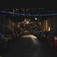
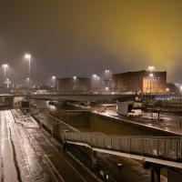
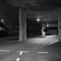
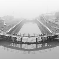
A Little Local Wander
07 Jan 2021
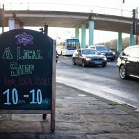
Which included a literal "local", the Pump House, to try out their shop/deli/cafe. A flat white, some apples and a New York Deli toastie. Eleven quid, mind, but the Pump House was never a cheap pub...
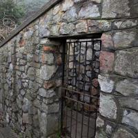
I enjoyed the fog, and wandering down a few more out-of-the-way back alleys and what-have-you on the Hotwell Road.
I'm thinking of getting up early and going for a morning walk tomorrow, weather-depending, but at the moment my motivation to do things like this seems to be much strong in the evenings when I'm just thinking about it rather than in the morning when I actually have to do it. But it's going to be cold, and low tide is quite early, so there's always a chance of getting some footage of the hot well actually being visibly hot; you never know...
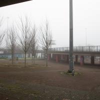
I decided to explore the Freeland Place car park briefly today. As expected it's basically just a car park, though at least it links up with Hinton Lane at the bottom so I didn't have to retrace my steps.
From the article I was reading to accompany yesterday's Prince's Lane wander:
"In the 1970s, access to Prince’s Lane from Hotwell Road was walled off, and a gate was put in the wall on Hinton Lane, which was locked and prevented people from using it."
I think this is likely to be that gate. It's certainly close to the most likely path for Prince's Lane to shimmy between the back gardens of St Vincent's Parade and the back gardens of Windsor Terrace to emerge from the Clifton hillside onto Hinton Lane, anyway.
I seem to recall from the community newsletter that when coming to plant trees and flowers and generally make Cumberland Piazza a bit more pleasant, the local team of volunteers found that they had no easy access to a water supply. This is one part of their cunning plan to provide one—see the adjacent phtoo for the other part that feeds the rainwater butts.
The fake "roof" here is a rainwater collector, complete with guttering, that feeds the rainwater butts for the community gardening efforts in Cumberland Piazza. Neat.
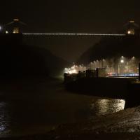
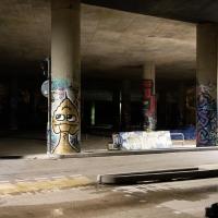
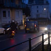
Morning Walk
08 Jan 2021
Tempted by a hopeful repeat of yesterday's weather, I got up early this morning and went for a short walk up into Clifton Village, around Observatory Hill, back down the Zig Zag and home. Instead of beautiful and mysterious fog and crisp freezing brightness I got some murk and slight dampness which included witnessing a road-raging van driver and finding that it still wasn't cold enough for the hot well to be even gently steaming when I got down there. I've still never seen it steaming, but I've been told it does, on colder days.
The van driver, who'd nearly driven into the side of the motorcyclist while doing a three-point turn just this side of the blind bend at the top of Sion Hill, became increasingly aggressive in the ensuing "discussion", including pointedly shouting that it didn't matter who was right, because he was in a van and the other man was on a bike, "so who'd be working afterwards?" in the event of a crash.
I'd stopped to make sure nothing terrible happened; when he got out of his van, walked right up to the motorcyclist and started shouting in his face, I started walking back towards them, taking the occasional photograph in the hopes that realising his actions were being witnessed and documented might make him think twice about turning physically violent. I don't know whether it helped, whether it was the car coming up behind us, or something else that made him get back in the van. Whatever, he got back in and screamed off far too quickly down the hill.
As you can tell, I didn't have time to change the camera settings. Getting the monopod back unfolded was also not much of an option :)
A Bristol tradition. Not quite sure what I was focusing on here, but it was early and dark and I quite like the picture anyway.
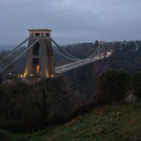
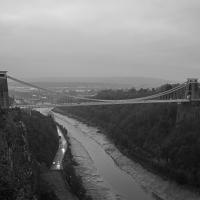
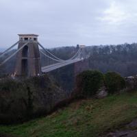
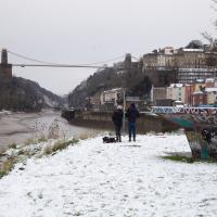
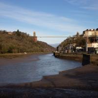
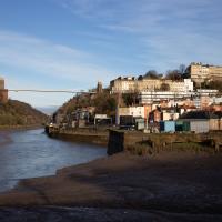
There are a few traditional vantage points for snapping the suspension bridge from Observatory Hill
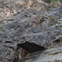
...and another rock slide in the background. Also, just on the left in the wall at the back there may be a bricked-up opening; a geological field trip guide I found says:
In the back wall is a bricked-up adit, presumably representing the entrance to a former iron ore or lead mine.
I may have to go back and take another snap of that.
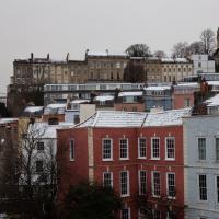
Snowy Leigh Wander
24 Jan 2021
I started this wander with my "support bubble" Sarah and Vik, after Sarah texted me to say "SNOW!" We parted ways on the towpath and I headed up into the bit of Leigh Woods that's not actually the woods—the village-like part in between Leigh Woods and Ashton Court, where I'd noticed on a map a church I'd not seen before. I found St Mary the Virgin and quite a few other things I'd never experienced, despite having walked nearby them many, many times over many years, including a castellated Victorian water tower that's been turned into a house...