Tagged: bristol
A Day Off Wander in Clifton
26 Feb 2021
I'm on the first day of a long weekend, and I certainly picked the right one for it. This may be the first proper spring-like day of the year in Bristol; it was glorious.
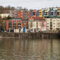
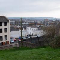
I headed up to Clifton, around the area where I got my Covid vaccine jab the other day, to knock off a few remaining roads in that area and because it would be good exercise for an extended lunchtime walk.
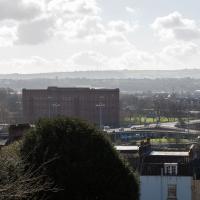
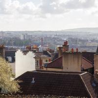
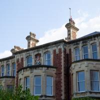
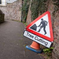
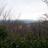
Along the way I saw some very Clifton sights, including an Aston Martin, some Jacobethan architecture, and some private college sports grounds. Mostly, though, I just enjoyed the sunshine, and took every opportunity I could to snap views across the city.
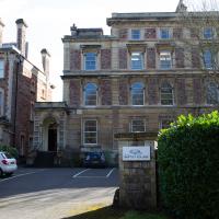
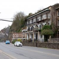
Trafalgar House, Clifton Down. Not to be confused with the one on Sion Hill that I walked past on the way here.
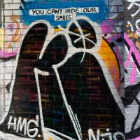
I like the way Gromit peers over the balustrade.
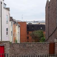
This becomes Cecil Road in a bit. Sadly the sun wasn't really in the right place to take snaps of the rather nice architecture that runs down this road
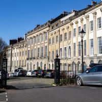
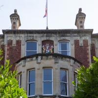
Say what you like about the Society of Merchant Venturers, their clubhouse does have a fine, fine tree in its garden.
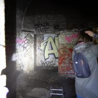
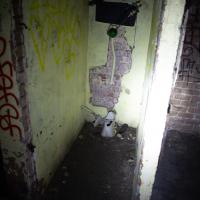
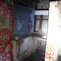
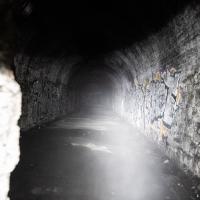
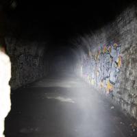
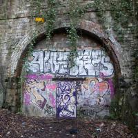
I'm glad my friend Lisa joined me today; she drove in from Shirehampton and told me that the Portway was looking rather lovely, so we set off that way. She's also braver than I am when it comes to doing urbex stuff, so this was just the opportunity to take a peek into the Portnalls Number One Railway Tunnel/Bridge Road Deep Valley Shelter whose entrance I'd found on a previous wander.
It was definitely dark and spooky and impressively big, with a side tunnel that Lisa explored that leads to a little door I don't think I've previously noticed on the side of the Portway. I didn't get many photos—even my astoundingly powerful little torch (£) didn't do much to light things up, and you're not going to get much joy hand-holding a camera in that darkness—but I did shoot a little video, which I might edit and add later.
After plumbing the bowels of the earth, we went up Bridge Valley Path to Clifton, explored some bits around the College and Pembroke Road, then came home via Foliage Cafe for coffee. Nice.
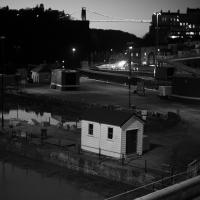
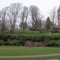
A Bristol estate agent would probably sell this as having an excellent view, too.
Clifton Down Dash
02 Mar 2021
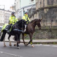
A quick wander up to Clifton Village to wander down a path or two either around Observatory Road that I'd missed out previously. On the way around I took a moment to take in the incongruous 11 Windsor Terrace, smiled at a couple of mounted police, stopped to smell the crocuses, grabbed a coffee in Foliage and came home through the Polygon accompanied by the delightful Spring sound of a woodchipper running at full blast. Nice.
According to the listing, the "attached house" at the end of Windsor Terrace was built c. 1840, about 33 years after the rest of the terrrace was completed. It's interesting, the way it seems to have its back turned to the main terrace. I wonder if there were objections from the people at number ten?
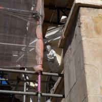
A lot of Scion Hill seems to be scaffolded at the moment. They're taking it down at the Avon Gorge Hotel, though. I think they've been repainting, among other things—the White Lion bar seems no longer to be white.
If the half on the right were there on its own, it would probably look fine. As it is, it seems to be being shown up by the more-recently-cleaned half on the left.
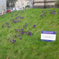
"The Crocus was chosen as the purple colour matched the dye painted on the fingers of children who have been immunised."
I'm still not entirely clear on how the crocuses are helping to eliminate polio, but the website's here...
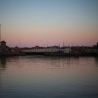
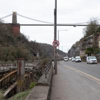
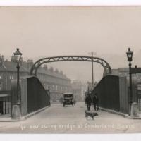
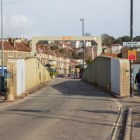
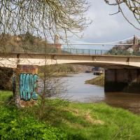
Of Bridges and Buoys
04 Mar 2021
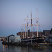
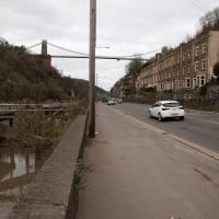
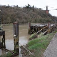
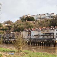
A trip to Imagine That coffee, so no fresh roads knocked off my list, but I stopped off to snap a couple of the engineering-related bits of the docks: the Campbell Buoy (used by P&A Campbell for mooring their paddle steamers) and Brunel's "other" bridge, the foot/horse swing bridge that now sits sadly disused in the shadow of the Plimsoll Bridge at Howard's Lock.
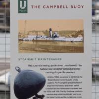
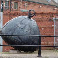
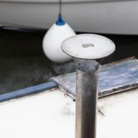
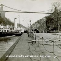
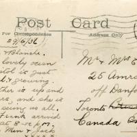
I bought a vintage post card from eBay this week. It's a well-known photo of the Hotwells landing stage, showing what's likely to be a P&A Campbell paddle steamer moored there. (Just yesterday I snapped a photo of their buoy on display at Underfall Yard with its information sign.) It was posted from here to Canada in 1936, and has now returned via a presumably quite circuitous route.
Local journalist Maurice Fells (really local—I could probably hit his house with a well-flung teacake from here) notes in The A-Z of Curious Bristol (£) that:
For tens of thousands of people, the pier at Hotwells was the starting point of their day trip as they boarded steamers with names like Glen Avon, Glen Usk and Britannia. The salty tang of the sea was never far away as the steamers headed for Ilfracombe, Weston-super-Mare, Clevedon and Portishead on the Devon and Somerset coast and Barry, Porthcawl and Tenby in South Wales.
The landing stage is long-abandoned. A variety of economic issues, including fuel prices, the increasing prevalence of the motor car, the construction of the Severn Crossing giving easier access to Wales, and the collapse of Clevedon Pier during safety testing in 1970, which prevented larger pleasure boats from stopping at the resort, all led to dwindling trade.
I went to have a poke about there today, not staying for long as it's a cold day and the wind was biting. I couldn't reproduce the postcard's view—you'd need to risk life, limb and presumably a trespass prosecution—but I did try to judge the rough viewpoint and angle of the photo by lining up with Rock House, the Colonnade and the Suspension Bridge and snapped a photo looking back to where the original photographer would have stood on the pontoon.
This Bristol City Docks history page has many good photos of the landing stage and the nearby Port and Pier Railway line (whose tunnel I was in the other day) and the Hotwells Halt railway station, which was just the other side of the suspension bridge from here.
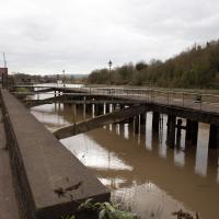
Not sure what the gap was for, or what the metal bridge-like-thingy that's gently rusting into the water was for, either.
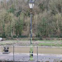
On closer inspection, this looks similar, but not the same as the lamp posts in the picture.
I think this roughly lines up with the viewpoint in the picture. You can just see the suspension bridge stanchion in about the right place behind the tree above the Colonnade.
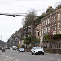
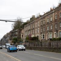
Leigh Woods Walk
14 Mar 2021
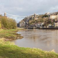
An enormous walk today, or at least it felt enormous. My feet are sore, anyway. I started off recreating a couple of local historical photos in Hotwells, but then headed for my traditional walk along the towpath in the Avon Gorge to the far extreme of Leigh Woods, up and through the woods to the height of the Suspension Bridge, finally crossing into Clifton Village for a well-deserved vanilla latte.
I say "traditional" because this used to be a very regular route for me, first walking, years and years ago, and later jogging—this route combined with a circuit of the Downs on the other side used to be my way of making sure I was fit to do a half-marathon (I did six of them in total, between 2010 and 2014).
I miss the routine of this walk, even though it's a long way and it used to pretty much wipe me out when I did it—I'd come back home and collapse and do very little for the rest of the day. But perhaps that's what Sundays are for, and I should try to remember that.
Doing this walk regularly was quite a meditative experience. Not so much of that today, but once I got to the further extreme of the towpath, where the roar of the Portway traffic on the other side of the river dwindles and I turned into Leigh Woods to climb ever closer to birdsong and further from rushing cars, I did seem to recapture a little of the feeling of previous walks. (I would say my mind cleared, but I was mentally singing along to Life Without Buildings' The Leanover for most of the wander. There are worse songs to have stuck in one's head, though; it's a great track...)
Anyway. Apparently the walk made me more likely to ramble in words, too. I'll stop now :)
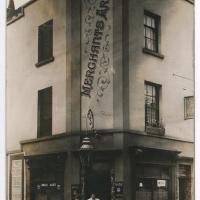
"Untitled. handwritten note on reverse 'Merchants Arms, Merchants Road, Hotwells. Licencee 1912 Mrs Florence Norris (over right hand door)'"
Sadly closed for lockdown at the moment, of course. Hopefully they'll weather the storm, because it's a great little pub and it's been there since at least 1847.
Photograph by L. Worsell, Bristol. Courtesy Bristol Archives/The Vaughan Collection
I'm not sure what the cross-beam over the top with the height restriction on is called, but I much prefer the original one. Although the bridge is very utilitarian in looks, anyway.
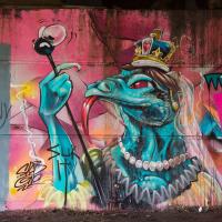
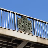
Presumably this is how David Icke views the British monarchy.
(It's Queen Lizzie, by sledone.)
Mardyke then and Now
18 Mar 2021
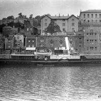
Reproducing historical photos seems to be a developing interest for me. On today's wander I just went for my normal coffee at Imagine That, but along the way I stopped at Baltic Wharf (the modern housing estate; historically-speaking, I was probably in between Canada Wharf and Gefle Wharf—about here, in fact) to reproduce a 1930s photo of the Mardyke area from the Tarring collection.
Mardyke, from what I can work out, means "a ditch along the margins". Before my researches, I only really knew the name from the Mardyke pub, a big place on the Hotwell Road. Everyone knows the Mardyke, partly because of its size and signage, but I've only been in once or twice, too long ago to remember much of what it was like. However, the wharf there used to be known as Mardyke Wharf, and the area in general as Mardyke. (I just found an 1826 painting by Thomas Leeson Rowbotham of "Mardyke seen from near Hilhouse's Dock, showing the 'Clifton Ark' floating chapel" that shows the area before much development had happened, incidentally, and now I feel like I need to find out a bit more about the floating chapel...)
I enjoyed snapping the "after" photo; the process involved moving a group of swans out of the place I needed to stand to get the photo; luckily I've started carrying waterfowl food along with my on my harbourside jaunts, so I could use bribery rather than a more confrontational approach. Not sure I'd fancy my chances against a swan, though I did once team up with another passerby to shoo a recalcitrant one off the Redcliffe bascule bridge so a busful of commuters could continue their journey to work...
Via Know Your Place Bristol/the Tarring Collection.
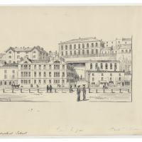
The Mardyke area—apparently Mardyke means a dyke on the margins, which would make sense for the location—in the 1930s. That's got to be a Campbell paddle steamer from their White Funnel fleet, but I don't know which one. Looks to be a similar configuration to the Princess May, though the paddles look a bit different. In the background, the Mardyke Pub still stands today, but the three largest buildings do not. They are:
Top right: the Clifton National School (there's a Loxton sketch uploaded to this Wander where you can see the name on the front.)
Directly in front and below the Clfiton National School, on the main Hotwell Road: The Clifton Industrial School, Mardyke building.
Standing halfway up the hill, more towards the middle of the picture: the Clifton Industrial School, Church Path Steps building.
Lots of info to be found on the Industrial Schools here:
In addition to their classroom lessons, the boys were employed in tailoring, shoemaking and brush-making, with basket making later added. The boys also assisted with the kitchen, laundry, and house work. In 1870, some additional rooms were rented in the locality for use as an infirmary if required. A School band was established.
I can't find so much on the National School (though apparently the Bristol Archives have some of their records) but the Clifton & Hotwells Character Appraisal suggest it was built in 1835 and, along with the Industrial School buildings, destroyed during WWII:
A bomb also largely destroyed the Clifton National School and Mardyke House School. The lack of bomb- proof shelters in Clifton led to the Clifton Rocks Railway to be used as shelter, which was prepared for occupation in 1940.
Showing both the Clifton Industrial School on the Hotwell Road, and the Clifton National Schools building on the hill above.
(via the Loxton Collection from Bristol Libraries on Flickr.)
The colourful modern flats stand on School Road, presumably the last hint that the Clifton National Schools building was there before. It's nice to see both the Mardyke Pub and some of the ordinary houses from the terrace dead centre still there and looking much the same.
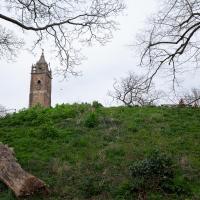
I wasn't going to take a very long walk on this nice spring evening; it just happened. I was going to knock off a path or two on Brandon Hill, home over centuries to hermits and windmills, cannons and Chartists, and then just wander home, stopping only to fill up my milk bottle at the vending machine in the Pump House car park.
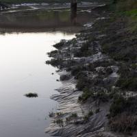
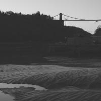
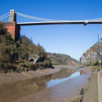
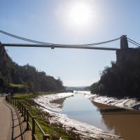
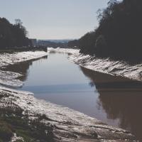
However, when I heard a distant gas burner I stayed on the hill long enough to see if I could get a decent photo of both the hot air balloon drifting over with Cabot Tower in the same frame (spoiler: I couldn't. And only having the fixed-focal-length Fuji with me didn't help) and then, on the way home, bumped into my "support bubble", Sarah and Vik, and extended my walk even further do creep carefully down the slipway next to the old paddle steamer landing stage and get some photos from its furthest extreme during a very low tide...
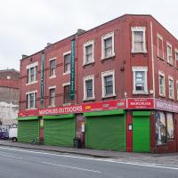
I've bought many things from Marcuss over the years. A pair of secondhand German para boots got me started, I think, and I've bought snowboarding gear, camping gear, winter coats and sundry other things like the Opinel No. 06 knife I use for hunting and skinning the geek's natural prey: Amazon parcels.
Towpath Evening
25 Mar 2021
I was honestly just about to do the homework from my oh-so-thrilling ITIL course when my friends Sarah and Vik asked me if I'd like to come out for a wander down the towpath with them. I enjoyed the company, the evening light and the delicate clouds.
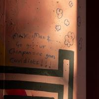
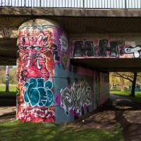
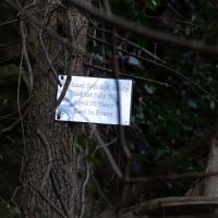
I liked the way the light hit this Cumberland Basin flyover pillar, but I'm not illuminated by the message.
Hotwells Evening
29 Mar 2021
Just a little potter around Hotwells with Sarah and Vik. I didn't visit any new streets, but I liked a couple of the photos a lot.