Tagged: history
Mirror Maze
10 Jan 2021
Went for a wander with my friend Lisa—the current lockdown rules seem to be that one local walk for exercise per day with a maximum of one person not in one's "bubble" is fine—up to the University of Bristol area right at the edge of my one-mile perimeter to see the Jeppe Hein Mirror Maze, among other things. On the way we mused about Merchant Venturers, the slave and tobacco trades, and dating in the time of Covid.
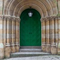
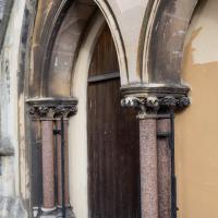
And, as if to compensate for the not-a-door down the hill, now that's what I call a door.
Northern Clifton
16 Jan 2021
A raggedy wander with my friend Lisa, picking up a few stray streets and venturing only briefly onto Whiteladies Road, where it was too damn busy, given the current pandemic. We retreated fairly quickly. Found a couple of interesting back alleys, and got a very pointed "can I help you?" from a man who was working in his garage in one of the rather run-down garage areas behind some posh houses, and clearly didn't want us just wandering around there.
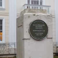
The first woman in the UK to qualify and work as a doctor, says Wikipedia. Among other things, she established The Read Dispensary for Women and Children in Hotwells, so I'll have to see if I can track down where that was. It might, of course, have been in the bit of Hotwells that was demolished to make way for the flyovers, though.
Oh! No, a quick check seems to show that it's the building on St George's Road that now houses Oryx Recruitment. I know the building well.
There's more than one Whiteladies House in Bristol. Not sure what this one is, but I'd imagine it's residential.
Birthday Coffee
21 Jan 2021
A quick jaunt to Clifton Village to grab a birthday coffee and cake (courgette, lime & pistachio, thanks for asking) from Twelve, and rubberneck at the demolition of the block that used to house the WH Smith, among other things. I remember the Havana Cafe, Mail Boxes Etc (for those who wanted a Clifton postcode without living there?) and others.
Snowy Leigh Wander
24 Jan 2021
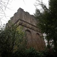
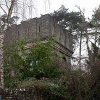
I started this wander with my "support bubble" Sarah and Vik, after Sarah texted me to say "SNOW!" We parted ways on the towpath and I headed up into the bit of Leigh Woods that's not actually the woods—the village-like part in between Leigh Woods and Ashton Court, where I'd noticed on a map a church I'd not seen before. I found St Mary the Virgin and quite a few other things I'd never experienced, despite having walked nearby them many, many times over many years, including a castellated Victorian water tower that's been turned into a house...
In Between
06 Feb 2021
A lovely walk in the early spring sunshine with my friend Lisa. We headed directly for Jacobs Wells Road, to start off around the scene of one of our earlier walks, but this time took in Jacobs Wells from QEH upward, stopping to snap some photos of a Bear With Me, some interesting areas between Park Street and Brandon Hill including a peculiarly quiet enclave with a ruined old build I'd never found before, then crossed the Centre to grab take-away pies from Pieminister (I had the Heidi Pie) and head back to my place down the harbourside.
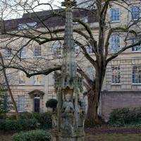
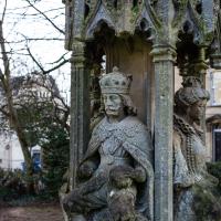
Berkeley Square's garden has the remaining part a replica of the Bristol High Cross. The original, erected in 1373, stood in the centre of Bristol, bearing four monarchs. These extra four were added as a later tier in 1663. Charles here would have faced down Broad Street, with Elizabeth looking down Corn Street.
It was moved in 1733 as it had become an obstruction to "modern" traffic, and a local man complained that it had become unstable and dangerous in high winds. It was taken down and later re-erected on College Green.
Later, prosperous visitors to the Hot Well wanted to promenade across College Green many-abreast and again complained that it was getting in the way. Eventually it was moved to the Stourhead estate in Wiltshire, and it remains there to this day.
This replica was created in the late 1800s and originally erected on College Green (where the statue of Victoria now stands), only to be moved to the middle, and then later taken down when College Green was lowered in 1950 (by around 4' 6", apparently better to set off the new City Hall building), with the upper stage of the cross being relocated here in Berkeley Square.
Quite the history!
Well, given who occupies this place, you'd expect good masonry work. This is the home of the Freemasons' Provincial Grand Lodge of Bristol. The inside is meant to be pretty special, too, but sadly I missed the last open day. (Not kidding; the hall opens up to visitors on Bristol's popular Open Doors days)
A wander to knock off a couple of bits around Clifton Park that I'd missed out on previous excursions. This one took in the drinking fountain near Sion Hill and explained a little of how the Seven Years War, which ended in 1763, still has some history on display near Manilla Road.
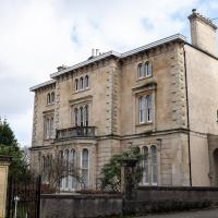
Vyvyan House is pretty grand.
I imagine it was built for some branch of this Vyvyan family, but I'm only guessing. One of them was MP for Bristol, though...
Ah! Interestingly, the Clifton and Hotwells Character Appraisal says of neighbouring Vyvyan Terrace:
Vyvyan Terrace (1832 -1846) by Richard Shackleton Pope, was named after the Tory MP Sir Richard Vyvyan, who won the 1832 parliamentary election by defying the Reform Bill & bribing 1200 voters.
Arlington Villas and WH Smith Destruction
10 Feb 2021
I actually dashed up to Clifton to take a look at Arlington Villas, just around the back of St Paul's Road, one of those slightly odd little enclaves of overlooked housing that you know is there, but you never have a reason to visit or travel down. As it turned out, interesting though the (public) garden is, I actually took far more pictures of the now-completely-demolished site bounded by King's Road, Boyce's Avenue and Clifton Down Road where WH Smith and other places used to stand.
It's interesting to imagine how nice this little area would be if turned into a permanent public square, but of course the developers already have their planning permission to build it right back up again.
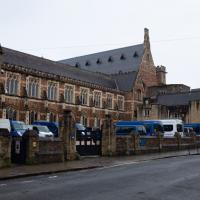
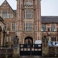
I went to get my first dose of the Oxford/AstraZeneca Covid-19 vaccine today. Handily, the vaccination centre was Clifton College Prep School in Northcote road, next to Bristol Zoo, a road that's just within my 1-mile range that I hadn't visited before.
I parked up near Ladies Mile and tried to find a few of the tracks marked on the map I'm using, but couldn't see most of them. Whether that's just because they've disappeared over time, or with the recent lack of use or waterlogging from the 24 hours of rain we just had, I'm not sure. It was a pretty fruitless search, anyway.
The vaccine shot was virtually the same setup as when I got my winter flu jab back in November, except for the venue. I snapped a couple of pictures of the school while I was there, but I was in and out in five minutes, and you probably don't want to linger around a vaccination centre, I suppose.
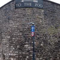
Instead I wandered around the compact block of the Zoo, now sadly scheduled for closure. By coincidence I finished E H Young's Chatterton Square this morning: set in Clifton (fictionalised as "Upper Radstowe") near the Zoo, the occasional roars of the lions that can be heard by the residents of the square (Canynge Square in real life) form part of the background of the novel. The book's set in 1938 (though written and published post-war, in 1947). It seems a shame that the incongruous sounds of the jungle will no longer be heard from 2022. All I heard today were some exotic birds and, I think, some monkeys.
I was told not to drive for fifteen minutes following the jab, so I wandered out of my area up to the top of Upper Belgrave Road to check out an interesting factoid I'd read while looking into the history of the reservoir at Oakfield Road, that the site of 46 Upper Belgrave Road was a bungalow, shorter than the adjacent houses, and owned by Bristol Water, kept specifically low so that the pump man at Oakfield Road could see the standpipe for the Downs Reservoir (presumably by or on the water tower on the Downs) and turn the pump off when it started overflowing. Sadly I couldn't confirm it. There is one particularly low house on that stretch, but it's number 44, and though small, it's two-storey, not a bungalow, so nothing really seems to quite fit in with the tale.
I'm writing this about nine hours after getting the jab, by the way, and haven't noticed any ill effects at all. My arm's not even sore, as it usually would be after the normal flu jab. In twelve weeks I should get an appointment to get the second dose.
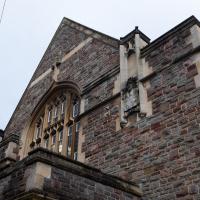
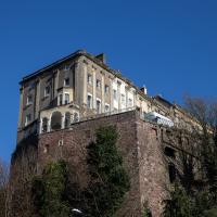
This is the building where I had the first AstraZeneca Covid-19 vaccine shot.
Not sure whose coat of arms it is; it's not Clifton College's. The motto, Nemo Sibi Nascitur, means "No one is born unto himself". This grand building isn't actually listed—well, it's on the local list, but that doesn't tell you much—and I can't see much in the way of information about it from a quick squint around the web.
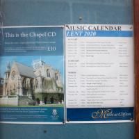
Must've been the last event planned. I wonder how far they got through the programme? Tuesday just gone was Shrove Tuesday this year, and the first lockdown started (for me, at least) on 17th March 2020.
Downs Wander
23 Feb 2021
Just a quick trip to knock off a path or two on Clifton Down. I'm not actually convinced I walked down the paths I was hoping to, but I suppose I'll see once I upload this and look at it on the map :)
Today's highlight turned out to be retrospective—looking up Gertrude Hermes' amazing wood engravings when I got home. (By complete coincidence, I was trying to discover the location of the Stella Matutina's former Hermes Lodge in Bristol as part of my researches last night...)
I'm glad my friend Lisa joined me today; she drove in from Shirehampton and told me that the Portway was looking rather lovely, so we set off that way. She's also braver than I am when it comes to doing urbex stuff, so this was just the opportunity to take a peek into the Portnalls Number One Railway Tunnel/Bridge Road Deep Valley Shelter whose entrance I'd found on a previous wander.
It was definitely dark and spooky and impressively big, with a side tunnel that Lisa explored that leads to a little door I don't think I've previously noticed on the side of the Portway. I didn't get many photos—even my astoundingly powerful little torch (£) didn't do much to light things up, and you're not going to get much joy hand-holding a camera in that darkness—but I did shoot a little video, which I might edit and add later.
After plumbing the bowels of the earth, we went up Bridge Valley Path to Clifton, explored some bits around the College and Pembroke Road, then came home via Foliage Cafe for coffee. Nice.
