Tagged: road
Fresh Fields
17 Oct 2021
For the first time in a while, I had the time and energy to go further afield and knock off some new roads from my "to do" list. I headed through the first Hotwells Festival to Ashton and Bedminster to cross off a few of the suburban roads south of North Street.
First, though, I decided to try to reproduce an old photo of the now-demolished Rownham Hotel just around the corner from where I live...
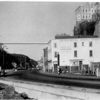
Here's the view I wanted to take a stab at reproducing. Bristol's Lost Pubs—a great website, which sadly currently seems to be lost itself—said:
Originally known as the Hotwells Tavern. Around 1873 when the entrance to Cumberland Basin was enlarged, a pub named the Rownham Tavern was demolished and Rownham ferry moved downstream towards the Hotwells Tavern, not long afterwards the name was changed to the Rownham Hotel. The pub was removed in 1969 for road Widening.
This particular image is from Brewerypedia; I'm afraid I don't know its original provenance.
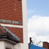
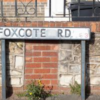
I presume a foxcote is like a dovecote, only for foxes. Nice to imagine them all there in their array of little foxholes.
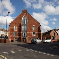
This was St David's Church; it was originally a mission church for St Paul's Southville, which is further east, just outside my mile radius. It was turned into a church hall for a while, but reverted to church status a couple of times, most notably while St Paul's was rebuilt after the Luftwaffe destroyed most of it in 1941.
It is, of course, flats now.
Know Your Place has a pic of it ca. 1910 from the Vaughan collection (BRO 43207/9/13/105).
Bower Ashton is an interesting little area just south of the river from me—in fact, the Rownham Ferry used to take people over from Hotwells to Bower Ashton, operating from at least the twelfth century to around the 1930s.
It's a strangely contradictory little area, with a cluster of old and new houses sandwiched in between the busy A-roads and significantly more industrial area of Ashton and the bucolic country estate of Ashton court roughly east to west, and also between Somerset and Bristol, north to south.
I've been around here before, mostly poking around Bower Ashton's arguably most well-known bit, the Arts faculty campus of the University of the West of England, but I'd missed at least Parklands Road and Blackmoors Lane, so I initially planned just to nip across briefly and wander down each in turn. On a whim, though, I texted my friends Sarah and Vik in case they were out and about, and ended up diverting to the Tobacco Factory Sunday market first, to grab a quick flat white with them, extending my journey a fair bit.
To start with, though, I nipped to a much more local destination, to see something that you can't actually see at all, the Gridiron...
(I also used this wander as a test of the cameras in my new phone. I finally upgraded after a few years, and the new one has extra, separate wide and telephoto lenses compared to the paltry single lens on my old phone. Gawd. I remember when speed-dial was the latest innovation in phones...)
I decided to try out the three lenses on my new iPhone camera. This is the "telephoto" lens. It does a reasonably creditable job, though the phone is oversharpening things a bit and I'm not sure I like the colours much.
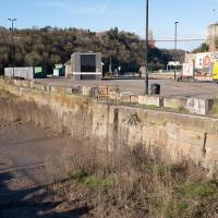
And here's the middling lens on the camera. Not bad, though on every shot I've taken on the iPhone so far where it's been able to see blue sky it's managed to oversaturate it for my tastes. Still, I guess they're aiming at the mass market, and the mass market does seem to like oversaturated colour and the sharpening turned up to eleven.
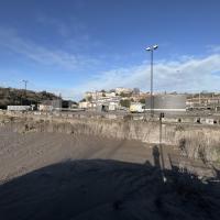
Not bad, and it's certainly better than not having a wide-angle lens in your pocket everywhere you go. I won't complain too much. "My iPhone oversaturates my photos. Also my wallet is too small for my fifties and my diamond shoes are pinching..."
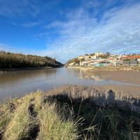
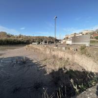
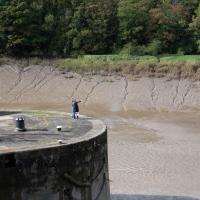
You can't actually see the Gridiron in this photo, but I believe it's still there, under that amazing buildup of silt.
The Gridiron—one of the few photos of it can be seen on the Maritime Mud and Miasma page of About Bristol—was a cheaper alternative to putting your boat in a dry dock. It was a 200-foot long grid (there seems to be some debate over whether the grid itself is actually metal, or in fact timber; I'll have to try to find out), 38 feet wide, nestled here between the north and south entrance locks. A ship captain could sail his vessel over here at high tide, then as the tide gradually receded, the ship—up to 250 feet, as overhanging a bit was apparently okay—would settle onto the gridiron.
At that point an inspection and repair crew could make their way down to the gridiron by ladder and do whatever work they could manage before the tide rose up again.
You can still see some ladders in place, I can only presume they were there to get you down to the gridiron, but that is just a guess; information on it seems quite hard to find.
One last snap before we move on. I'm using the wide lens on the iPhone here, and have managed to include a silhouette selfie...
Okay, diversion to Tobacco Factory for a flat white complete, now it's time to figure out how to find Blackmoor Lane or Parklands Road from this direction.
Trying to get somewhere around here is a bit like following the White Rabbit, except when you pop back up again there's more industrial estates and fewer hookah-smoking caterpillars.
“Cat: Where are you going?
Alice: Which way should I go?
Cat: That depends on where you are going.
Alice: I don’t know.
Cat: Then it doesn’t matter which way you go.”
The original entrance to the Ashton Court Estate, apparently. The Clifton Lodge entrance is rather grander.
A Constitutional to Burwalls and Back
21 Dec 2021
The recent lack of posts here is mostly due to my feeling very run down following having a couple of wisdom teeth extracted. Having had an emergency appointment yesterday1, hopefully I'll be on the mend now, though it does mean I'm on the kind of antibiotics where you can't touch alcohol for the whole of the Christmas period. I have tried to keep myself a little distracted from the pain by working on the nuts and bolts of this website—you should notice that the front page loads rather faster now than it used to, and that there's a shiny new statistics page that I'll probably be continuing to work on. Oh, and you should find that the tags below the photos are now clickable and will take you to a page of all other wanders that have photos with the same tag.
Today I felt like I needed to drag myself out of the house, but I didn't want to go too far, and I needed to get to the Post Office up in Clifton Village to post a Christmas card (spoiler for my parents: it's going to be late. Sorry.) As luck would have it, idly looking at the map I spotted that I'd missed off a section of Burwalls Road in the past, and that's basically one of the long-ways-round to Clifton Village, crossing the river to Rownham and walking up the hill on the Somerset side before coming back across the Suspension Bridge.
As I was heading for Burwalls Road I decided to make Burwalls itself the focal point of the walk, but unfortunately the mansion grounds are private and the place is hard to snap. Still, at least it gave me a destination. Burwalls was the mansion built by Bristol press magnate Joseph Leech, who I've mentioned before after buying a vintage book he wrote on a previous wander. There's a good article about the house on House and Heritage which has some photos from angles I couldn't ever get to. (Well, maybe with a drone, but it seems like the kind of area where they may be kitted out for clay pigeon shooting, so I probably wouldn't risk it.)
1 My dentist admitted that she probably needed to keep her internal monologue a bit more internal after we started the appointment with her staring into my mouth and immediately saying, "oh, that's weird." These are words one doesn't want to hear from a medical professional.
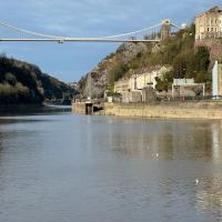
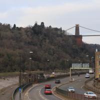
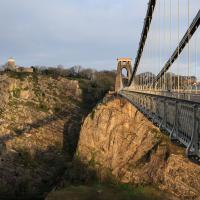
As my plan was to knock off the remaining section of Burwalls Road, my first photo is the small segment of Burwalls itself that you can see from near my house. Burwalls is the mansion on the hilltop, peeping out about halfway from the left edge of the photo and the Suspension Bridge.
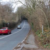
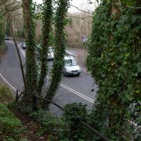
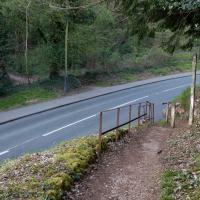
Speaking of major roads, this is why you wont' see a track down the actual road here on my maps: no pavements. On the plus side, there's the forested path with the amazing name of Dead Badger's Bottom starting on my right, and a little raised off-road walkway in the trees on the left, starting about where you can see the speed limit sign.
A delightful little return to the road, which peters out in a disconcerting rough slope in between two blind bends on a busy road with no pavement. It's not spectacularly pedestrian-friendly over here. This might explain why I never walked down the bit of Burwalls Road opposite. The forest path up Dead Badger's Bottom1 on the far side of the road skips the first section.
1 No, I will never get tired of saying that.
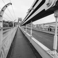
Most every time I cross the bridge, I remember one of the first times I walked over it, back in the late 1990s or early 2000s, when some wag—possibly even Banksy, who knows?—had painted a sign on the footway about here: a rectangle of yellow caution stripes containing the words "WARNING. CONCEALED TRAPDOORS IN OPERATION".
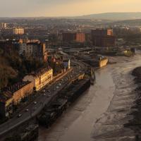
Technically that's still actually the Hotwell Road down there, and it doesn't become the Portway until the Bridge Valley Road junction, but I needed the alliteration, okay?
This is the kind of photograph that I really like, but is harder to find appreciation for these days—the Panavision aspect ratio I've chosen, 2.35:1, doesn't play nicely with today's standard media consumption device of a mobile phone held in portrait orientation. Maybe one day we'll all be using the internet through VR headsets and landscape orentation will make a comeback.
Shop Fronts of Regent Street
22 May 2021
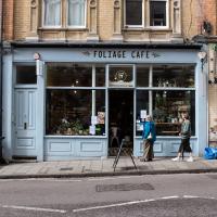
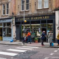
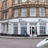
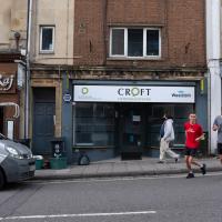
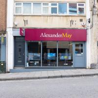
I didn't even think I'd manage to get out today, such was the weather forecast. As it turned out, it's been quite a nice day, and I managed to nip up to Clifton Village to pop to the Post Office. As with my last outing, I decided after snapping one shop-front on Regent Street that I might as well snap the whole row, and muse on a few of them, the only service I really offer over and above Google Street View for a lot of my pictures 😀
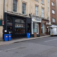
The gentleman kicking the recycling bag is not in the queue for Foliage; he's one of the proprietors of Clifton Hardware, next door.
Foliage was Wainwright's Coffee for a while before it changed hands; I think the current people are doing a much better job of giving the place a distinctive feel and attracting people in. Before that it was a boutique called Grace and Mabel.
One of those places where if you go in and ask for some fly spray, a socket set and some tachyon conduit for a Type 40 TARDIS they'll just start rummaging in the back room and ask you whether you want the socket set in metric or Imperial.
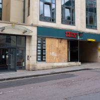
And the pedestrian and vehicle entrances to Regent House, the offices above. Looks like someone's managed to smash Knight Frank's window; maybe it's a protest against the house prices in the area.
I think this replaced Pizza Provençal; they've got a much bigger branch on Whiteladies Road, which is the only one I've been to.
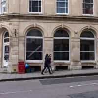
At the time I was a little annoyed to lose the cashpoint at this former HSBC branch (it used to be at the bottom of the middle window; they were stone-faced up to about the height of where the railings reach now.
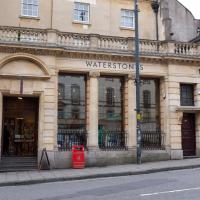
Then it turned into a Waterstones, and now I have to be careful not to go in too often as I will inevitably buy something to add to my vast tsundoku pile.
Sequel Injection
07 May 2021
I saw this tweet the other day and started thinking of my second Covid-19 vaccination as my "Sequel Injection" (to a geek, it's funny. You'll have to take my word for it.) Whatever you call it, this morning I went and got it.
It was in the same place I got my initial injection—my left arm! No, okay, it was at the Clifton College Prep School. I didn't take any photos of the event itself; the NHS production line is so efficient you barely have time to do anything else, even if the privacy of other patients wasn't a factor.
Along the way I mused at all the road resurfacing going on in Clifton, and also discovered a secret (okay, not-well-known and possibly slightly trespassey) way into Canynge Square, and on the way back I knocked off a few streets from my "leftovers list" of north-east Clifton. I've got much of Clifton done now, with the only obvious "to dos" on the east side of Whiteladies Road...
It was quite a long walk, and I'm feeling pretty tired now, though that might be the effects of the jab too, I suppose. Anyway. Tomorrow and Monday I'm walking outside Bristol, I think, and I imagine my feet will need some recovery time on Sunday, so it might be a while before I post another Wander.
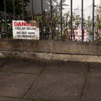
Told you they were doing a lot of resurfacing.
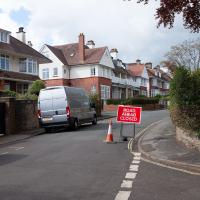
Here's a related fun fact to go with a dull picture, at least: the "greatest advance in road construction since Roman times" is the process of "Macadamisation": crushed stone bound with gravel on a firm base of large stones, with a camber, raised above the surrounding ground. It was invented by Bristol Turnpike Trust surveyor John McAdam, and was later refined by the addition of tar as a binding agent, giving us tarmacadam, or "tarmac", as we generally call it today.
So, basically, this ROAD CLOSED AHEAD sign, due to resurfacing, can be traced back to 1820s Bristol, where the very idea of surfacing roads was invented.
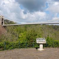
The Fujifilm X100T that I mostly use for these trips is a great camera, but it's also a fixed lens, approximately that of a 35mm focal length on a full-frame camera. So I quite often can't fit in whole buildings, whole terraces, or whole suspension bridges :D
I tried to figure out what this used to be—didn't have a lot of luck, but the next snap is taken from an old OS map showing that this area has been a stand for public transport since long before the modern bus stop here.
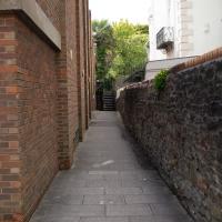
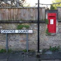
Yup, what I thought led to a back garden or something is actually a strange little cut-through to the back of the Redgrave.
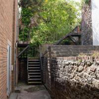
I wonder if this is the stage door to the Redgrave? And how it came to be connected to the corner of Canynge Square? Either way, I love finding these little cut-throughs that are normally only known by locals.
This is my normal view of South Parade, so it's unsurprising I'd never really noticed the little terrace before.
Down the side of the Bristol Water building you can see the side of the mound that marks the covered Oakfield Road reservoir.
Avoiding the Accounts
26 Nov 2020
I took the day off my day job to do my accounts—or at least do enough bookkeeping to send them to my accountant. I hate doing the books. I woke up late, tired and with a headache and decided to bunk off for a walk around Cliftonwood, Clifton Village and Clifton instead, taking in a couple of good coffees along the way. Thanks, Foliage Café, and Twelve for the flat whites.
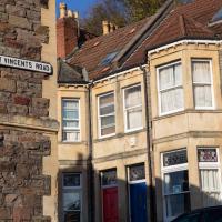
From what I've worked out so far, the use of St Vincent's name around so much of Bristol, especially Hotwells and Clifton, dervies from the ancient hermitage and chapel dedicated to St Vincent of Saragossa, which (possibly) was in Ghyston’s Cave, the cave in the rock face now accessible through a tunnel from the observatory, but at the time only by a perilous cliff climb (which I can only presume is what made it so appropriate for a hermitage.)
Why St Vincent of Saragossa? Anthony Adolph says:
It should be explained that the connection of Bristol with the Iberian wine trade led, in the Middle Ages, to Bristol’s importing of the cult of Lisbon’s patron saint, Vincent.
I have done very little real research on this so far, though, so don't take my word for any of it. I am not a historian, etc.
I don't know who named Canynge Square, but I respectfully suggest they attend a remedial geometry class. (image courtesy Google)
A month after I took this picture, a 40-foot sinkhole opened up inside the square's garden, along the edge of this side of the square, apparently into vaulted chambers below. Makes you wonder exactly what was built below Canynge Square and why! Maybe it's where the Merchant Venturers sacrificed the poor to Cthulu...
I noticed I'd missed a bit of Circular Road and Ladies Mile, and it was a nice evening for a sunset wander up to Clifton. There was something I recorded along the way, not photographically but in video.
Bristol Zoo, the world's oldest provincial zoo, has recently decided to close its Clifton site after 185 years of occupation, which means that the sounds of wild animals will no longer drift incongruously through this leafy Georgian area. They're moving everything up to their existing second site, The Wild Place Project near Cribbs Causeway. As I was wandering the Downs, I heard some fierce roaring noises, so I decided to see if I could get a little closer while they were still going on and record a sound that's soon to disappear.
I don't have a way yet to put video directly on this site, so here's a link to the video of my attempt to catch a bit of the zoo noises that I just popped on YouTube. It's sad that this might be the last time I hear such noises in Clifton.
The Very Special Wildflower Meadow hasn't got any flower in it yet, that I could see. But I suppose it's only April.
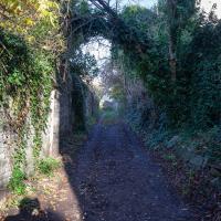
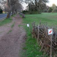
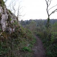
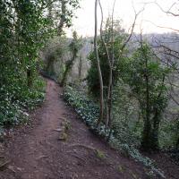
I thought this was a fairly short shortcut to Bridge Valley road that I was tryihg to knock off my list. I was wrong, and I retreated. There's a big network of paths all through this (literal) neck of the woods.
Well, I may not have gone in where I intended to, but this was the exit I was heading for...
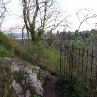
There was barbecue smells and Michael Jackson from around the corner, plus I'm scared of heights, so coming back seemed like the better choice. Don't want do gatecrash any socially-distanced parties right now...
Arlington Villas and WH Smith Destruction
10 Feb 2021
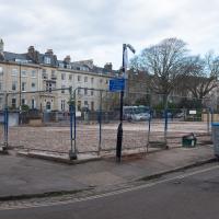
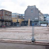
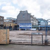
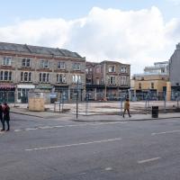
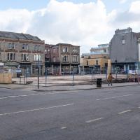
I actually dashed up to Clifton to take a look at Arlington Villas, just around the back of St Paul's Road, one of those slightly odd little enclaves of overlooked housing that you know is there, but you never have a reason to visit or travel down. As it turned out, interesting though the (public) garden is, I actually took far more pictures of the now-completely-demolished site bounded by King's Road, Boyce's Avenue and Clifton Down Road where WH Smith and other places used to stand.
It's interesting to imagine how nice this little area would be if turned into a permanent public square, but of course the developers already have their planning permission to build it right back up again.
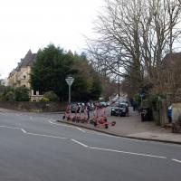
It might be useful to know that this is a Voi scooter parking place, if I ever slim down enough to fit under their 100kg weight limit. Sigh.
I recently indulged myself by buying a little piece of history. I've mentioned Samuel Loxton and featured and linked to his drawings before, often in the eminently browsable Loxton Collection albums that Bristol Libraries has on Flickr. So when I saw a Loxton drawing of Hotwells pop up on eBay, I decided to get myself a little treat.
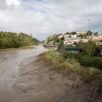
I don't think there's any Loxton drawing that features the road I actually live in—it's not very visible from anywhere else, not being one of these Clifton terraces that's perched at the top of a hill, or anything like that, and it's invisible in most views of the area. However, this Loxton drawing, Hotwells, Looking across the river from near the Clifton Bridge station, is probably the closest near-miss I've seen.
I decided to wander out one morning and see if I could reproduce the picture, and also take a photo or two of what's now become of the Clifton Bridge Station, which is still just about discernible in places.
(Then on an even stranger whim I decided to check out a possible little cut-through from Cumberland Road to the harbourside I'd been eyeing up on my commute to work, so walked to Wapping Wharf for a croissant via this potential new route, but that bit's not quite as interesting...)
Which is why swapping to this side of the river seemed like a good plan. Coronation Road is bloody noisy at the best of times, and it's currently got all of Cumberland Road's traffic diverted down it.
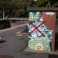
There's a frankly disturbing and gruesome reason why this rabbit has been crossed out. I'll tell you why in a few photos time.
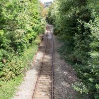
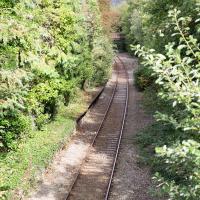
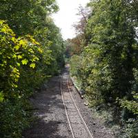
You can just about make out the platform still, there on the left. There used to be a second line and an eastern platform, too.
Clifton Bridge Railway Station was also known as Rownham Station from 1891 to 1910.
It was part of the Port and Pier railyway (as was Hotwells/Clifton station on the north side, nearer my house), opened in 1867, and closed, inevitably, by Beeching, with passenger services stopping in 1964 and freight a year later.
Wikipedia says "Freight trains continued to pass through the station, but their number decreased over time, with the line falling out of regular use from 30 March 1981. The route however was kept intact by British Rail, with occasional freight trains, and in 2002 a single track was relaid to allow rail access to Royal Portbury Dock", so I suppose even the single line we see here is newish.
Adjacent to the station was the New Inn, Rownham, which you can see a bit of in this photo from the Tarring Collection on KYP (or in this Tweet.
People will know the station site as the place where the local police's mounted and dog sections had their headquarters/stables/kennels, though they moved out a couple of years ago, I think.
Although the line is scheduled to return to passenger service as part of MetroWest, the nearest station will still be Temple Meads, so even though there may be passenger trains heading out to Pill and Portishead through here, ten minutes' walk from my house, I'd have to get all the way into town to come back out again, so it would probably be quicker for me to drive. Shame.
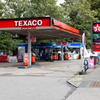
Here's a sign of the times: a petrol station that's out of petrol. According to the BBC, the current petrol supply crisis is still biting in the south of England, but easing elsewhere in the country.
I've got about 50 miles' worth of petrol in my Mini right now, but my car is a luxury rather than a necessity, and that amount could last me months at my current average rate of consumption, so I'm not planning on panic-buying, personally...
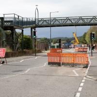
Hurrah! Cumberland Road is fully closed again, this time apparently for stabilisation works on the Chocolate Path, one of my favourite footpaths in Bristol, whcih has been closed since even before part of it actually fell into the river.
That there is an actual plan to re-open the path, that it's got funding, and that work is being done are all good signs, but I'm still trying not to hold my breath. This path's been closed since 2016. (And the entire new cut didn't take this long to dig in the first place...)
A London Wander in Southville
10 Apr 2021
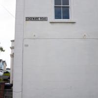
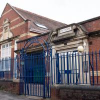
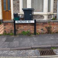
There's a bit of Southville that I've been meaning to get to for some time, where the streets seem to take some strong inspiration from London. There's a Camden Road that crosses with an Islington Road, and a Dalston Road, even an Edgeware Road. For me these names are more evocative than the rather more exotic names I passed by to get there—Sydney Row or Hanover Place, say, because I've actually been to the places in London. The last time I was in Islington I saw Monkey Swallows the Universe play at The Angel, and I can't think of Camden without remembering a gondola trip with my friend Tara where a cheery youth played Beatles music for us on a saz...
I really liked this little area, with its mostly well-kept pretty houses and hints here and there of the creative side of the residents. It's arty and down-to-earth at the same time, and I wouldn't mind living there, I think.
On the way there I got the chance to walk through Underfall Yard for the first time in a while, and on the way back I had my first take-away hot food for many months, grabbing some crispy fried squid from the excellent Woky Ko at Wapping Wharf.
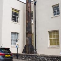
Or, I imagine, chimney. But the fins at the bottom really do make it seem quite rockety, and when I asked about it on Twitter someone did find a strong resemblance to some NASA hardware.
As to why Charles Hill & Sons apparently needed an industrial incinerator in the basement of their office, I've not yet found out.
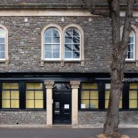
Like the building with the clock tower around the corner, this was apparently offices for the shipbuilding firm. The listing says it's mid-nineteenth century, and:
Originally offices for Charles Hill & Sons, formed 1848, shipbuilders at the Albion Dockyard (qv). Their last ship was launched in 1976
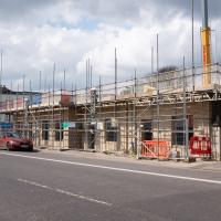
The former stone mason's place. Geograph has a good photo of what it looked like before. From what I can see from the planning website, it might be becoming offices, rather than the flats I'd assumed would emerge. I may have been mis-reading the vast array of planning applications, though; I suppose we'll see...
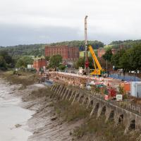
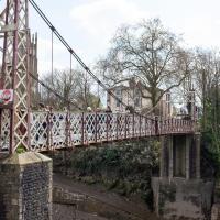
Leading diagonally down the bank opposite you can see a ramp which I believe would have led down to the actual ferry that the bridge replaced.
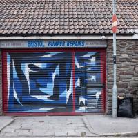
I've actually looked this place up with a view to getting a bumper repaired. Apparently he's very good.
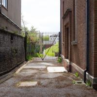
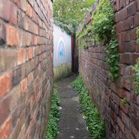
I didn't explore. Most of these little alleys in this area are gated or blocked off, and clearly the residents don't want people ambling down them. I did like the NHS-supporting mural, though.
