Tagged: road
Museum of the Moon, and a Bit of Redland
21 Aug 2021
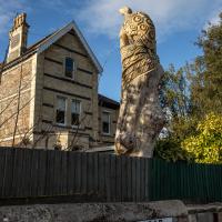
Lisa and I mostly went out to have a look at Luke Jerram's Museum of the Moon as its tour hit Bristol Cathedral—I missed it when it was previously in town, at Wills Hall, I think—but we also took a trek up to Redland. Lisa's kind enough to indulge my strange current fascination with the Edwardian eccentrics that made up the Stella Matutina, so we swung by a couple of places with a vague connection to the Bristol branch of the organisation. Well, it was good walking, anyway...
As a stunning bonus, one of the picture's descriptions has more information than you'd probably want on the Bristol Port Railway and Pier's Clifton Extension Railway line, but I did happen to coincidentally write up this wander after reading about the extension line during my lunch hour at work today. It's a thrilling life, I tell you...
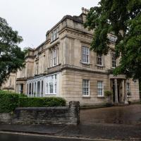
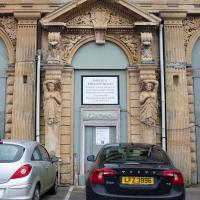
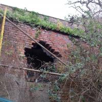
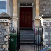
Yes, I'm back on the magical research. According to RA Gilbert's Golden Dawn Companion, this was one of the meeting places of the Hermes Temple of the Stella Matutina. I'm guessing one of the members lived there, but I'm not sure who. I'd probably need to cross-check the census records with the membership rolls, and the latter are quite patchy, anyway.
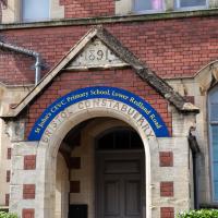
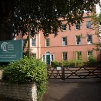
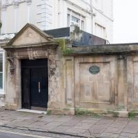
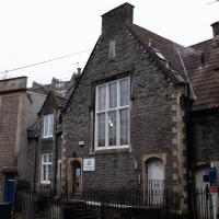
I don't know if there's any connection between the Bristol Hermes Temple and the Bristol Steiner School specifically, but I know that at least one of the Temple Chiefs met Rudolf Steiner and became quite enamoured of anthroposophy, so it's interesting that the school is so close to where Catherine Hughes, one of the first three chiefs, used to live, just down the road from here.
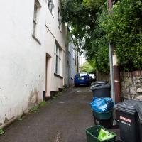
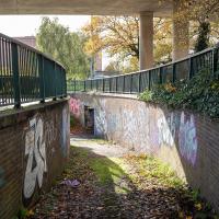
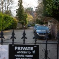
This is also St Vincent's Hill, but apparently it's just a dead-end private service road for these little residences built into the back of bigger places on Whiteladies Road. We didn't fancy it.
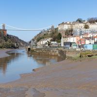
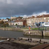
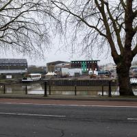
I mostly went out to hang out with my friends Sarah and Vik in Bedminster, but along the way I thought I'd take a closer look at something a little nearer home: the last crossing point of the Rownham Ferry.
You don't often see Entrance Lock cycle at this kind of tide, but a little boat like that doesn't need a lot of water in the river to manoeuvre.
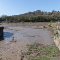
Again, the slipway is easy to miss. I like these little barely-visible curiosities that hide such heritage. The site of the crossing moved around—it's fairly obvious it wasn't right here in the 12th century, for example, because the river was only diverted into the New Cut, which the ferry crosses here, in the early 1800s. Earlier it was further downstream.
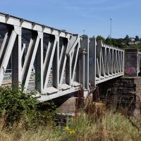
Getting back to the Rownham Ferry, the Ashton Avenue Bridge is one of the reasons it was closed. On the excellent Bristol City Docks website you can find a photo called "Rownham Ferry c1906 with Ashton Avenue Bridge nearly built.".
As you'll see in that photo, at low tide the Rownham Ferry was basically just a bridge made out of boats, so it probably still seemed a quick shortcut compared to walking all the way to Ashton Avenue Bridge. I imagine the foot traffic gradually migrated to the new bridge as the ferry was a more daunting prospect at high tide, from what I can gather. Also, the combined road/rail bridge would have allowed people to get the train across the river, rather than stopping at Clifton Bridge Station and using the ferry, I think.
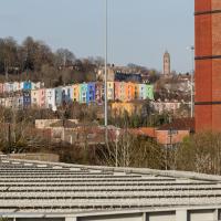
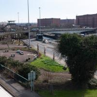
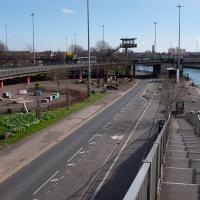
I'm in the habit of going over to the Tobacco Factory Market on a Sunday. I think I've walked all the routes around that way, but as a Plimsoll Bridge swing let me cross the road to the far side of Brunel Way on my return journey and I took a couple of photos of the brownfield development at the old Ashton Gate Depot site I thought I'd call it a Wander and pop some photos up.
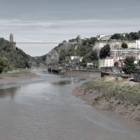
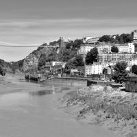
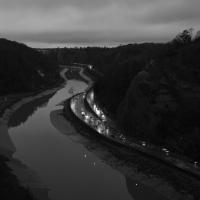
I took two shots from the south side of Brunel Way, a slightly different vantage point from my usual snapping point at the end of Spike Island down below. I'm not sure if I prefer this colour one...
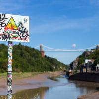
"STEEP DROP INTO MUD AND FAST FLOWING WATER".
This sign has been mildly annoying photographers since it was put up, getting a bit in the way of several alternative views from this bit of land. I presume it was installed in response to some kind of accident, but I'd hazard a guess that whatever difficulties someone got into probably wouldn't have been prevented by a sign that stated the completely bloody obvious.
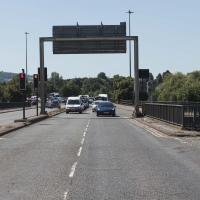
But, of course, no Metrobuses, as they don't do anything as useful as running on a Sunday.
Ah, but it seems like the bridge is closing, which might make it nice and safe to cross over and have more of a look from the other side. First, though, we'll nip down and have a look at what's causing the swing.
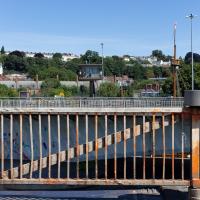
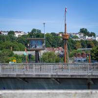
One of the things I like about Bristol is the strange contrasts. Here we have two crow's nests. The first is the Cumberland Basin Flyover System's Plimsoll Bridge control room, used to give the swing bridge operator a good view of the whole area surrounding the bridge. The second is the reason for the swing, the crow's nest on the tall mast of the replica of John Cabot's Matthew, as it passes through into Entrance Lock.
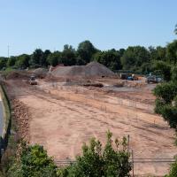
I walked back to the point I'd spotted all this activity from the far side of the road. This is the old tile merchant/concrete works/Ashton Gate Railway Depot/Bristol International Exhibition site. I imagine it was plenty of other things along the way, too. Here's an earlier snap with a bad photo from the far side of the site, but some detail on what the site was/will be along with a link to planning documents.
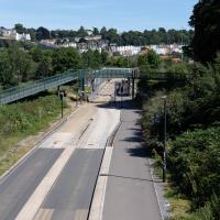
I'm currently toying with the idea of a little mini-website that takes a digitised and vectorised version of the Bristol International Exhibition plan (from 1914) and superimposes it on the same area today. It'd be interesting to see exactly where things were. My best guess from eyeballing it at the moment is that in 1914, this view would be looking towards the International Pavilion, Concert Hall and Art Gallery areas of the Exhibition, and we'd be standing on the train tracks that used to head for Ashton Avenue Bridge, which back then would have been a double-decker road and rail swing bridge, with the trains on the ground level deck, the road on the top deck, and a high-level swing control room above it all. Quite some feat of engineering.
Solstice Rain
21 Dec 2020
Despite the weather, Sarah and Vik and I wandered around Ashton Court a bit as the sun rose. Not that you could really tell. Sadly, the bit we wanted to watch the sunrise from was closed, because people hadn't been treating the deer with appropriate respect. Ah well, at least it was some exercise.
Local
03 Nov 2020
A very local exploration today, but there are still bits of the near field that I never need to walk down, so it didn't take me long to find somewhere I haven't been in a decade or more, the little enclave of smaller Victorian houses around Oldfield Road and Sandford Road. I'd really like to live in one of those houses, but I doubt I could afford it.
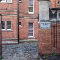
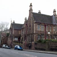
Another place I've passed so many times that I forget it's there. Haberfield House is a giant Victorian almshouse on Joy Hill, hidden from the Hotwell Road by a tall brick wall, but apparently with gardens around that side. I believe it's now privately-owned bedsit-style accommodation, but it's hard to find out much about it. It doesn't help that there's at least one other Haberfield house in Bristol (also an ex-almshouse, now and old people's home) which makes searches a little difficult.
There are ongoing proposals from the owner to convert the roofpace into more flats, in Bristol's ongoing mission to cram even more poeple into even less space, it seems.
The Rose of Denmark, there, trying their best to ply some kind of trade during the lockdown.
Prince's Lane
06 Jan 2021
The International Grotto Directory website says:
Prince’s Lane might have been one of the original ancient tracks from Hotwells to Clifton, in the Avon Gorge. The site later formed part of Rownham Woods which comprised some thirteen acres. By the end of the 18th century and the early 19th century, the Society of Merchant Venturers granted to Samuel Powell a building lease, for The Colonnade (1786), St. Vincent’s Parade (1790), Prince’s Buildings (1796), and Rock House. Rock House is generally considered to be the oldest surviving building associated with the Hotwell (see Chapter 20). John Power conveyed part of the woods to William Watts for the construction of Windsor Terrace (1790-1808).
The above development of the Avon Gorge cleared Rownham Woods, and created a triangle of land on the north side of the gorge, that became enclosed as a result, by Mansion Houses, whose garden walls all entered on to Prince’s Lane. The Lane started at the bottom of the gorge, at the base rock of Windsor Terrace, and came out half way up Sion Hill. It is clearly shown as a public footpath, dotted with trees, in Ashmead’s map of 1828. Some of the gardens were quite steep in parts and therefore, had to be terraced, because of the gradient of the gorge.
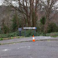
I've passed Prince's Lane literally thousands of times in my life, every time I've walked past the Avon Gorge Hotel, which itself started (in 1898) as the Grand Clifton Spa and Hydropathic Institution and pumped water up from the Hot Well for its hydropathic treatments. I've never actually ventured down it until today, or at least nothing like as far down it as I did this afternoon—I may have poked my head around the back of the hotel to see the original pump rooms at some point in the past.
This was a great wander, though it does very much feel like a private road, and frankly I may have been pushing my luck a bit by winding my way between the astoundingly big back gardens of the houses of some presumably very wealthy Cliftonites, but I felt vaguely justified in exploring the history of one of the oldest footpaths in my part of Bristol...
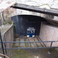
The nice folk who look after the Clifton Rocks Railway have an example of what one of the carriages would look like at the top, though the tunnel here has been bricked up for a long, long time. If you get the chance to visit on one of their open days, it's pretty fascinating.
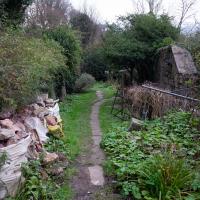
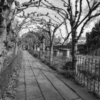
One of the oldest paths from Clifton to Hotwells, though there's sadly no way through to the Hotwell Road from about the halfway point now. Apparently it was rather charming in its day, and I could sense some of that history as soon as I got away from modern traffic and street furniture and further into the woodland.
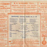
Since setting up a search for Hotwells on eBay I've mostly managed to restrain myself from buying much (or in one case, was outbid, luckily for my finances.) However, I couldn't resist a 1902 flyer for a singalong at the Terrett Memorial Hall, which would have stood five minutes' walk from my flat, overlooking Howard's Lock.
I've found out a fair bit about this non-denominational seaman's mission, including tracking down both a Loxton drawing and an aerial photo of it. The main thing that's eluded me, ironically enough, is finding out who Terrett was, so as a Memorial Hall it didn't do a very good job 😀.
EDIT: Ah! Did a little more digging and found that the Bristol Archives has a Bristol Dock Company document on file called "William Terrett, Esq.; corresp. etc. re proposed erection of a Mission Hall at Cumberland Basin, 1892", so that might be worth a look once the Archives are properly open again. Given that:
Sarah Terrett died suddenly on 25 November 1889, aged 53, after speaking at a meeting of the White Ribbon Army, the temperance organization she had founded in 1878. Following her death many people sent letters of sympathy to her bereaved husband, William. One of these, from the Rev. W. F. James, a minister of the Bible Christians, makes for especially interesting reading. The Bible Christian denomination, to which Sarah and William belonged, was one of the smaller Methodist connexions, and had its heartland in rural Devon, the area where she had grown up. James recalled the hospitality he enjoyed when visiting the Terretts’ home, Church House, in Bedminster, south Bristol...
...I wonder if William Terrett built the hall in memory of his late wife. They were clearly just the kind of temperance movement people who would've founded a seaman's mission to get people together to have a nice non-alcoholic singsong rather than a night out on the tiles.
Anyway. This walk to grab a coffee from Hopper Coffee in Greville Smyth Park was mostly an excuse to post the leaflet, a few other things I found related to it, and some pictures of how the site looks now. I would suggest that the present day is not an improvement.
I find the adverts fascinating. My first optician in Bristol was Dunscombe's on St Augustine's Parade, so they were there a long time. They've closed now (or at least moved) but were still there as recently as 2008, I think. Interesting to see gas lighting systems being advertised, too!
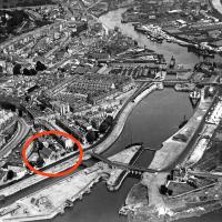
I was fairly sure the Terrett Memorial Hall would have faced Entrance Lock—after all, they'd be wanting to drum up trade from sailors!—and I eventually came across an aerial photo from 1934 on the ever-helpful Bristol City Docks website's Cumberland Basin page that confirmed my hunch.
I haven't had the time to find out when it was demolished, but the whole Cumberland Basin Flyover System (which you can see being built on that web page) had replaced this area by the mid-1960s.
This is photo PBA487 on that page, I think courtesy Bristol Museums Galleries and Archives.
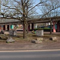
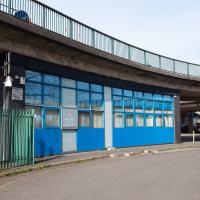
If the Terrett Memorial Hall were still there, its frontage would be roughly where those boulders are between the curve of railing in the middle of the picture and the flyover up to the Plimsoll Bridge a little further back, facing towards the lock gate you can just see on the other side of the road.
Here we'd be facing Terrett Hall square on. Crouching at work in the middle of the picture is one of the tireless people who are constantly found sprucing up Cumberland Piazza (or at least trying their best to make it look a little less awful.)
Which sounds imposing, but apparently it wasn't that secure, at least as far as a place to store the golden regalia of Bristol's mayor and mayoress goes, anyway. Oops.
An Evening Wander to the Gallows
06 Apr 2021
I'd originally intended just to pop up to the area around Alma Road, where I'd missed a few streets on earlier wanders. It was such a nice evening, though, I decided to extend my walk up to the very top of Pembroke Road, just outside my one mile radius, to take a few snaps of something intriguing I'd found in my researches.
I've driven, walked and jogged past the little triangle of land at the top of Pembroke road a great deal in my time in Bristol, but I didn't know that it used to be the site of a gibbet, in fact that the road itself there used to be called Gallows Acre Lane. According to the Durdham Down history trail, by Francis Greenacre (an excellent name for a Downs researcher!) among other sources:
...it was below this quarry near the top of Pembroke Road, once called Gallows Acre Lane, that a gibbet stood. It was sometimes occupied by those who had committed robberies on the Downs and was last used in 1783 to hang Shenkin Protheroe for the murder of a drover. Stories quickly spread that he descended from the gibbet at midnight every night and stalked through Clifton. Such was the alarm that his body was cut down
and buried.
Also very close to this little triangle of land was one of the gates of the extensive turnpike system...
Anyway. Along the way I encountered a wooden tortoise and a real squirrel, among other things. It was a good walk, and more light in the evenings means I can move my wanders out of the ticking countdown clock of work lunch-hours and be a bit more leisurely.
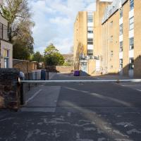
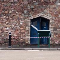
Another snap to remind myself that while it looks like a road on the map, I don't have to walk it because it's private. This is one of the many access roads to Clifton College.
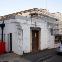
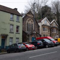
I only snapped this so I'd remember that I didn't miss this "street", but that it was a private car park.
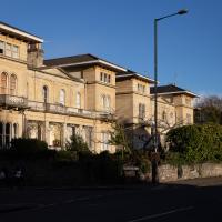
Both the left-hand and right-hand pairs get similar listings, unsurprisingly. Attached houses, c1850.
Jacob's Well Wander
01 Feb 2021
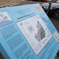
I just wanted to get some exercise, really, so I set out to knock off the lower bit of Jacobs Wells Road that I'd not managed to walk up yet. I set the new signboard that the community association had had erected as my destination, after reading about it on their blog.
As it turned out, I couldn't even read it, as the building that houses the actual Jacob's Well had water flooding out onto the pavement. I wonder if it was actual Jacob's Well water? Have the soles of my walking shoes been mystically blessed now?
You can't see much of the flood in the photos I snapped, but I did shoot a little video, too. Ed on Twitter said:
I spoke to the seller at the time with a view to buying it - I mentioned an old friend who grew up nearby remembers it flooding regularly. He swore blind my friend was wrong.
Sandwiched between residences, the Brandon Free Methodist Church is now also, of course, residential. In its time it's been "a Buddhist Centre, a martial arts school, and Bristol Society of Magic."
Now home to a tax accountant. It's on the "local list" but without much in the way of detail.
Easter Monday Gardens and Flowers
18 Apr 2022
I didn't really set out with a theme of flowers and gardens in mind for this walk. I just fancied heading up to Clifton Village to get lunch. As it turned out, though, Spring was springing, so a minor theme emerged as I started off with the graveyard flowers of Hope Chapel and wandered up to see the beginnings of the new wildflower garden at Clifton Hill Meadow.
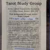
From the window of the community bookshop. A book I'm vaguely thinking of writing involves the Tarot, and I'm a little tempted to go on this.
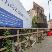
Where fly tipping happens, more like. This scrap of land (with a public bench hidden on the far end, against the back fence behind the red bins) has been a bit of an eyesore for years. I've never been a fan of public billboards.
Recently, though, a property developer has applied for planning permission for a block of flats here, and apparently fenced off the bit where the main entrance will be, even though it's fenced in this little corner of land that everyone assumed was public, council bench and all. And now it's attracted fly tippers, it seems.
I've tweeted at the councillor for the area, Alex Hartley, and he's said he's alerted the council and will try to investigate it/get it cleaned up, so here's hoping...
In the long run, maybe there will be some new flats instead of an ugly billboard and some dull fencing, and I'm all for that.
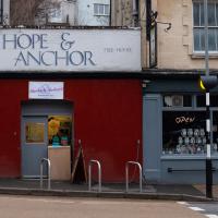
They're never open on Easter Monday, are they? Answer in two pic's time. Don't hold your breath.
I bought a fantastic sausage roll in The Mall Deli and decided to have it here in the Mall Gardens, seeing as it's finally become warm enough to eat outside...
On the way back home, it's always worth a poke around the book section at the front of Rachel's and Michael's Antiques.
Also always worth a look, of course, is Audrey Hepburn, who seems to be peering at us from the right-hand end.
And on that somewhat random note, it's time to end our wander. I headed back home to tuck into a bit of work-supplied Easter egg, which was an unexpected bonus of being physically in the office last week!
