Tagged: groundcover
A Random New Year's Day Wander
01 Jan 2022
I picked a fairly arbitrary reason for a wander today. Really, I just wanted to do a New Year's Day wander just to get out of the house and to set a precedent for the year to come.
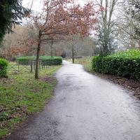
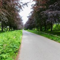
My ostensible reason was to investigate what looked like a road on my map that quartered the lawn in front of the Ashton Court mansion. As it turned out, this is just a muddy footpath/desire line similar to a half-dozen other tracks nearby, and must be some kind of bug or misclassification with the mapping system I'm using, but that's not important. What's important is that I went for a little walk on the first day of the year. As a bonus, I did happen to wander down a couple of sections of new footpath, so technically I broke some new ground too, which is nice.
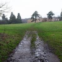
This bit that's marked on my map in the same style as a normal, tarmac road. Clearly it's not. I think perhaps I need to figure out what's going on with the mapping on this website, as the main openstreetmap site, which is where I'm getting my data from, does seem to have it as a simple track.
A small challenge for the new year, I suppose... Perhaps a refresh of the way the map looks on the site would be a nice start to the year anyway!
There were quite a lot of people about; I think a New Year's Day walk is still quite the tradition. Good.
However, it just leads you onto a footpath at the edge of the playing fields I wandered across last time I was in the area. Still, it's nice to know where it goes.
Bedminster Trip for New Walking Shoes
26 Feb 2022
I needed to buy new walking shoes—my old ones were squeaking and it was driving me up the wall—so I ordered some for collection from Taunton Leisure on East Street in Bedminster, and decided to make picking them up an official wander.
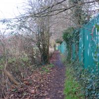
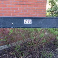
I didn't cover any new ground within my mile, but I did take advantage of the trip to take in a few interesting things just outside my normal radius, mostly New Gaol-related. Along the way there are a couple of sanitation-related diversions, including a visit to a rare manhole cover. You can hardly wait, I can tell!
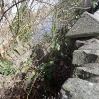
Well, it slopes down to the riverside at the top of the slipway. I presume there are still steps under there.
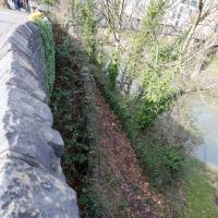
Leaning over the wall, we can see the overgrown steps from the bricked up gate leading down to the start of the ramp down to the ferry crossing.
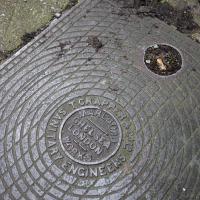
I thought I'd pop down an inconspicuous alley in between a couple of shops in East Street to show you a little local marvel: An original Thomas Crapper & Company manhole cover. Until I looked him up on Wikipedia I didn't know he was the actual inventor of the U-bend! That's quite a claim to fame...
Leigh Woods Purple Path
12 Mar 2022
There's a few tracks in Leigh Woods that lie within my mile and show up on my map but that I've not walked yet, so I decided to take one of my traditional big long walks through the woods on this nice crisp sunny morning.
For years—decades, even—I've been doing a similar route from my place, along the towpath to the far woods entrance, up the hill for a varied walk on one of the marked tracks and then across the Suspension Bridge to Clifton Village for a coffee-based reward. It's my default "long walk", really, and I almost always enjoy it. Today, at last, spring actually seemed to be springing, which made for some extra positivity...
I mostly went out to hang out with my friends Sarah and Vik in Bedminster, but along the way I thought I'd take a closer look at something a little nearer home: the last crossing point of the Rownham Ferry.
The Tobacco Factory, Bedminster's will-known theatre and bar, bought a farm in 2018 and now has a farm shop attached. always trying to be innovative, bought a farm in 2018 and now has a farm shop attached. I sometimes pop in on a Sunday, though it's the Sunday market that pops up in the back yard that actually lures me over there.
A Coffee and a Curve
27 Mar 2022
I wanted to have a wander along to the Tobacco Factory Market for some shopping, and checking the map for any leftover nearby streets I noticed a tiny curve of road on the way into the modern flats at Paxton Drive that it didn't look like I'd walked down before. I wouldn't take me too far out of my way, so I decided to head there first and then across to North Street to get my groceries and a coffee...
Well, I hope he's bringing the sign he nicked from this end of Paxton Drive with him.
I noticed I had a few things on my "potential wanders" list that could all be done relatively close to home, and in a fairly straight line, so I set off at lunchtime to recreate a photo of a now-defunct pub, wander behind a Spar (which turned out to be more interesting than I'd expected, but I admit it's a low bar) and spend some time browsing in Dreadnought Books before coming home via a coffee from Spoke & Stringer, a little diversion up Gasworks Lane and a tiny bit of the Rownham Mead estate I'd somehow previously skipped.
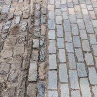
Just around the corner, you can see the old and newly-halved-and-relaid cobbles next to each other. (Technically I think these are actually setts, being squared off, but I think everyone in Bristol just calls them all cobbles.)
On my way home I popped through Rownham Mead estate and snapped a few things, starting with this house number that I've always enjoyed. This used to be my regular cut-through to the commuter ferry service back when I used to get the boat to work, so I'm very familiar with this little area.
As usual, the somewhat bland housing estate is elevating itself by means of the horticulture—I really do like the job their landscapers do in general, but most of the houses also seem to take a lot of pride in the individual gardens, too.
Easter Monday Gardens and Flowers
18 Apr 2022
I didn't really set out with a theme of flowers and gardens in mind for this walk. I just fancied heading up to Clifton Village to get lunch. As it turned out, though, Spring was springing, so a minor theme emerged as I started off with the graveyard flowers of Hope Chapel and wandered up to see the beginnings of the new wildflower garden at Clifton Hill Meadow.
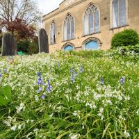
There will be a minor theme of flowers and gardens for this little trip. We'll start at Hope Chapel, though this is more a graveyard than a garden.
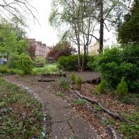
A lovely garden. Sadly a little lacking in facilities at the moment, after some scrote (or presumably a team thereof) had it away with their cast iron table and chair set at the end of March. This is why we can't have nice things, etc. etc.
This is the south end of Camden Terrace's little private garden, seeing as I seem to be on a bit of a garden and flower theme at the mo.
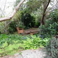
The bench at the top of Clifton Vale doesn't really have a view, and it's squeezed into an awkward little corner in the tight dogleg turn up to Goldney Avenue. On the plus side, Clifton Vale is very steep and many people are grateful for the opportunity it provides for a breather.
I last used it when showing my friend Heather the way back to her hotel in Berkeley Square after a meal in the Pump House. It's a fairly direct route to take, but even a local like me who's used to the hills around here can feel the need for a short rest here before pressing on to the heights of Clifton.
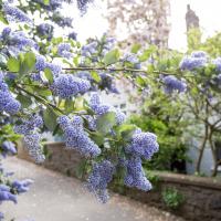
Well, I think it's a California Lilac, Ceanothus. I could be wrong. Whatever it is, it's pretty.
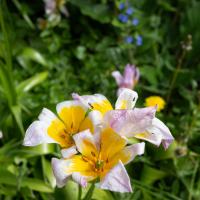
Even with the help of my plant consultant* I haven't identified this. I thought it was some kind of lily; she rather thought it might be some variety of either crocus or a tulip that was rather past its best.
- i.e. my friend Sarah, for whom I did not take enough good photos of leaves, stems, etc., to give a decent number of clues.
Moving on from Clifton Hill, I fancied wandering through Lime Walk.
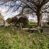
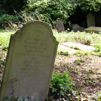
I always take a look for interesting graves as I wander through St Andrew's churchyard, and there's been quite a lot of ivy clearing recently, so there's more on display.
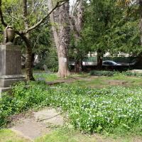
I rather like the stone drape across the funerary urn on the pedestal. Plenty more flowers on show, too. This is the bit where most of the squirrels hang out; I imagine they're in favour of the new dogs-on-leads rule.
A Swing of the Plimsoll Bridge
24 Apr 2022
I was originally going to head over to the Ashton area to see if I'd missed any bits around the football stadium—and also to grab some lunch from the Tobacco Factory Market—but in the end I got a little distracted by having accidentally chosen exactly the right time to see the Plimsoll Bridge swing on one of the first busy days of Spring, where a lot of pleasure trips tend to head out down the Avon (and possibly the New Cut) from Hotwells.
In the end I mostly snapped that, and just a couple of photos from the Ashton area where I grabbed some lunch but didn't do any new exploring.
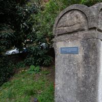
This is a plaque to the Cumberland Basin Stabilisation Works, completed in 1991, about which I can find virtually nothing on the internet. The face is too crumbled to read all the words, but I seem to remember that it's a lot more legible at certain times of year/day when the sunlight slants across its face. I'll keep an eye out for a better photo opportunity.
In the meantime, there's a picture of this entire area being resurfaced while the basin is drained and dredged on this selection of 1991 photos on the Evening Post site, which I'm assuming might have been part of this project.
Ticking Off a Pocket of Paths in Leigh Woods
03 Jun 2022
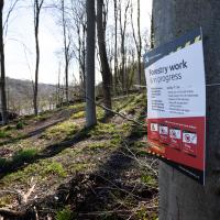
I managed to go for a wander a while ago that was meant to finish off a little tangle of paths in Leigh Woods, or at the very least finish off my wandering of the Purple Path there. And I managed to miss doing either of those things through some kind of navigational incompetence.
Today I woke up with a bit of a headache, feeling a bit knackered as soon as I dragged myself out of bed, but at least with the energy to realise that I'd be better off (a) going for a walk in what looked likely to be the last of the Jubilee weekend sunshine than (b) moping around the flat until it started raining, at which point I could mope more thoroughly.
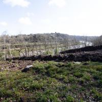
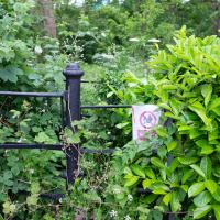
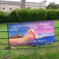
I had a look at my map, considered going to Ashton Court, but remembered that there was a music festival there today, and instead found these little leftovers of Leigh Woods and decided to have one more try at walking them.
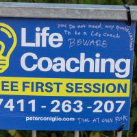
It's quite the commentary. But then if someone believes they can have their life turned around by a fly-posting stranger, perhaps a warning is a reasonable addendum.
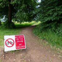
Guessing this is a polite hint from the golf club. In my mind's eye I can see an irate greenkeeper chasing a couple of mountain bikers in his golf buggy.
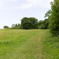
To the left is the edge of the golf course. I'm looking to wander along the edge and the behind the railway, which is behind those trees.
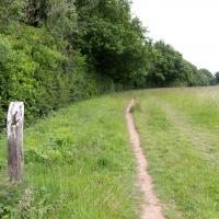
I think I'm pretty much a mile away from my house right here. Nice of someone to erect a marker.
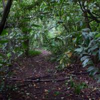
I rarely come in this way to Leigh Woods—it's basically the car entrance, and I almost always walk here. On those few occasions I've driven here, I've mostly parked on North Road near my usual pedestrian entrance through sheer habit, rather than driving in and using the official car park that's actually in the woods.
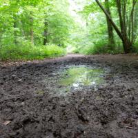
If it's rained for a few days in a row in Leigh Woods, some of the lower paths can get pretty muddy; in some past years I've even had to turn back and find another route, given that I mostly just wear ankle-high walking shoes. Today wasn't too bad.
A Quick Swing Past Ashton Court
05 Jun 2022
Another day not dissimilar to my last wander: I'm feeling a bit tired and rather than just moping around the house I thought I'd find some tiny bit of somewhere that I'd not yet walked and get outdoors. This time I headed for the Tobacco Factory Market in Bedminster, as I often do, but went the long way around via Ashton Court Mansion as I knew there were some footpaths and a small section of road I'd not ticked off up there. Finishing all the Ashton Court footpaths will be quite a long job, but you've got to start somewhere...
I did feel rather better by the time I got home, and, pretty much astoundingly given the weather forecast, managed to avoid the rain completely.
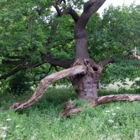
Hard to do this tree justice, as it was both wider and taller than the widest angle of my camera, and any further back the fence gets in the way.
Of course, if I'd brought a full-frame camera with a wide-angle lens, this is exactly the moment when a peregrine falcon would land on a branch at the same time a magnificent stag wandered past in the middle distance. You never have the right lens...
Well, it's giant, it's got a definite red hue and it's made of wood. I wonder what it could be...
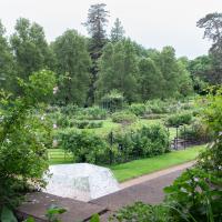
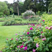
Alan Barber, late campaigner for public parks and green spaces, helped design this rose garden at Ashton Court, and it was dedicated to him in 2008.
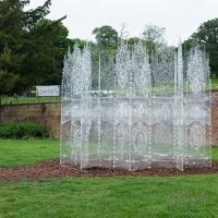
Trasparenza, by Andrea Greenlees, originally built for Burning Man in 2016. It has transparent benches inside, but it looked a bit of a tight squeeze, so I left the children of the family that arrived a couple of minutes later to it. They seemed to enjoy exploring. There's a view from the inside on Andrea's Instagram.
I got a bit distracted by a tempting little entrance into a little network of paths in the little patch of trees just north of the UWE campus. There wasn't much of note in there.