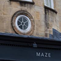
Tagged: clifton-village
Leigh Woods Walk
14 Mar 2021
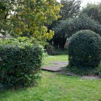
An enormous walk today, or at least it felt enormous. My feet are sore, anyway. I started off recreating a couple of local historical photos in Hotwells, but then headed for my traditional walk along the towpath in the Avon Gorge to the far extreme of Leigh Woods, up and through the woods to the height of the Suspension Bridge, finally crossing into Clifton Village for a well-deserved vanilla latte.
I say "traditional" because this used to be a very regular route for me, first walking, years and years ago, and later jogging—this route combined with a circuit of the Downs on the other side used to be my way of making sure I was fit to do a half-marathon (I did six of them in total, between 2010 and 2014).
I miss the routine of this walk, even though it's a long way and it used to pretty much wipe me out when I did it—I'd come back home and collapse and do very little for the rest of the day. But perhaps that's what Sundays are for, and I should try to remember that.
Doing this walk regularly was quite a meditative experience. Not so much of that today, but once I got to the further extreme of the towpath, where the roar of the Portway traffic on the other side of the river dwindles and I turned into Leigh Woods to climb ever closer to birdsong and further from rushing cars, I did seem to recapture a little of the feeling of previous walks. (I would say my mind cleared, but I was mentally singing along to Life Without Buildings' The Leanover for most of the wander. There are worse songs to have stuck in one's head, though; it's a great track...)
Anyway. Apparently the walk made me more likely to ramble in words, too. I'll stop now :)

I test drove one of these in 2005 and loved it, but the more practical Mini Cooper won out in the end.
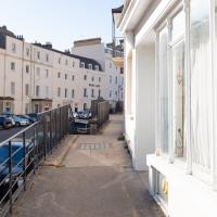
I should see if there's actually a little public street set back between Princess Victoria Street and The Mall. I did consider having a look the last time I passed, but I think there was a lorry backing out of the way into the little back road at the time.
John Carr's Terrace
16 Mar 2021
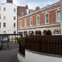
I wanted a nice simple lunch-hour walk that took me past a cafe today, and I managed to find the perfect road to knock off my list of targets to do it. Situated just off Jacobs Wells Road, right next to Queen Elizabeth's Hospital, John Carr's Terrace, and Rosebery terrace above it, which I'd completely forgotten existed, are a little cul-de-sac that many Bristolians will have wandered past a thousand times without ever seeing.
There's a reason it's next to QEH:
Known traditionally as "The City School", Queen Elizabeth's Hospital was founded by the will of affluent merchant John Carr in 1586, gaining its first royal charter in 1590.
John Carr's terrace itself isn't much to write home about, architecturally, but I like the secluded feel of it, and I really liked Rosebery Terrace with its little houses, commanding position and friendly, slightly tumbledown feel.
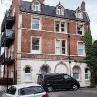
On the way home I popped into Foliage Cafe for a coffee and a very pleasant nutella and banana pastry, then walked home past the refurbishment of the old Thali Cafe into a new and interesting clinic...
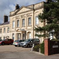
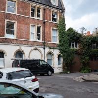
Adjacent to the hospital, this is apparently now a nursing home. The listing says:
Formerly known as: No.3 Clifton Court CLIFTON GREEN Clifton. House, now nursing home. 1742. Possibly by William Halfpenny
It's just the kind of grand old Clifton Hill house that got Clifton's posh houses off to a start in the mid-18th century. It sounds like it's remained rather posh inside, too:
Fully-panelled right-hand rooms connected by an arch with fluted Ionic pilasters, panelled, arched recesses, good marble fire surrounds with rocaille woodwork, an eared overmantel in the front room with foliate festoons and bracketed pediment; doorways with raised pediment, and 4-panel mahogany doors.
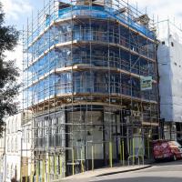
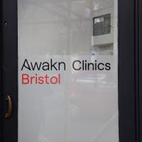
The old Thali Cafe will, according to the Guardian, be re-opening as "the first UK high-street clinic offering psychedelic-assisted therapy":
Though alcoholism is a focus, Awakn will also offer psychedelic-assisted therapy to treat depression, anxiety, eating disorders and most addictions.
On a Monday in late February, the Bristol clinic is abuzz with builders and workmen. Formerly the site of an Indian restaurant, it sits in a 19th-century building on the corner of Regent Street and Hensmans Hill in Bristol’s chi-chi Clifton area. Its position, next to a barber shop and cocktail bar, and overlooking a small park, was picked for its ordinariness. As Awakn’s CEO Anthony Tennyson explains, “Our strategy is to normalise the industry; we want to integrate into the mainstream, so that popping in for mental health treatment is as normal as… ” he trails off. Getting your teeth whitened? “Something like that,” he laughs.
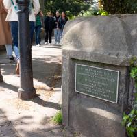
I got interested in Bristol's medieval water supplies after poking around near Jacobs Wells Road and Brandon Hill. It was during that research I found out about a pipe that's still there today, and, as far as I know, still actually functioning, that was originally commissioned by Carmelite monks in the 13th century. They wanted a supply of spring water from Brandon Hill to their priory on the site of what's now the Bristol Beacon—Colston Hall, as-was. It was created around 1267, and later, in 1376, extended generously with an extra "feather" pipe to St John's On The Wall, giving the pipework its modern name of "St John's Conduit".
St John's on the Wall is still there, guarding the remaining city gate at the end of Broad Street, and the outlet tap area was recently refurbished. It doesn't run continuously now, like it did when I first moved to Bristol and worked at the end of Broad Street, in the Everard Building, but I believe the pipe still functions. One day I'd like to see that tap running...
There are a few links on the web about the pipe, but by far the best thing to do is to watch this short and fascinating 1970s TV documentary called The Hidden Source, which has some footage of the actual pipe and also lots of fantastic general footage of Bristol in the seventies.
On my walk today I was actually just going to the building society in town, but I decided to trace some of the route of the Carmelite pipe, including visiting streets it runs under, like Park Street, Christmas Street, and, of course, Pipe Lane. I also went a bit out of my way to check out St James' Priory, the oldest building in Bristol, seeing as it was just around the corner from the building society.
There are far too many pictures from this walk, and my feet are now quite sore, because it was a long one. But I enjoyed it.

And there was me thinking that a leprechaun was a polar bear's natural enemy in the wild. Or in the back of a Toyota Hilux.
I noticed I'd missed a bit of Circular Road and Ladies Mile, and it was a nice evening for a sunset wander up to Clifton. There was something I recorded along the way, not photographically but in video.
Bristol Zoo, the world's oldest provincial zoo, has recently decided to close its Clifton site after 185 years of occupation, which means that the sounds of wild animals will no longer drift incongruously through this leafy Georgian area. They're moving everything up to their existing second site, The Wild Place Project near Cribbs Causeway. As I was wandering the Downs, I heard some fierce roaring noises, so I decided to see if I could get a little closer while they were still going on and record a sound that's soon to disappear.
I don't have a way yet to put video directly on this site, so here's a link to the video of my attempt to catch a bit of the zoo noises that I just popped on YouTube. It's sad that this might be the last time I hear such noises in Clifton.
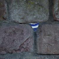
Is it still a potsherd if it's from a plate? (I just checked the dictionary, and apparently it is...) This one's embedded in a wall on Windsor Place.
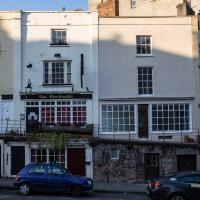
I was trying to take a photo of the Portcullis and what I thought was also a disused pub next door, assuming it was big building on the right, but according to this discussion on Flickr, the Gaping Goose was actually next-door-but-one. I'll have to see if I can reproduce that photo of the sign...
An Evening Wander to the Gallows
06 Apr 2021
I'd originally intended just to pop up to the area around Alma Road, where I'd missed a few streets on earlier wanders. It was such a nice evening, though, I decided to extend my walk up to the very top of Pembroke Road, just outside my one mile radius, to take a few snaps of something intriguing I'd found in my researches.
I've driven, walked and jogged past the little triangle of land at the top of Pembroke road a great deal in my time in Bristol, but I didn't know that it used to be the site of a gibbet, in fact that the road itself there used to be called Gallows Acre Lane. According to the Durdham Down history trail, by Francis Greenacre (an excellent name for a Downs researcher!) among other sources:
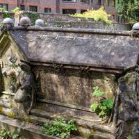
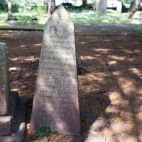
...it was below this quarry near the top of Pembroke Road, once called Gallows Acre Lane, that a gibbet stood. It was sometimes occupied by those who had committed robberies on the Downs and was last used in 1783 to hang Shenkin Protheroe for the murder of a drover. Stories quickly spread that he descended from the gibbet at midnight every night and stalked through Clifton. Such was the alarm that his body was cut down and buried.
Also very close to this little triangle of land was one of the gates of the extensive turnpike system...
Anyway. Along the way I encountered a wooden tortoise and a real squirrel, among other things. It was a good walk, and more light in the evenings means I can move my wanders out of the ticking countdown clock of work lunch-hours and be a bit more leisurely.
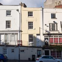
I came across this photo of 5 Wellington Terrace back when it was the Gaping Goose, two doors down from the Portcullis, and decided to snap the site as it is today. Interesting comparison!
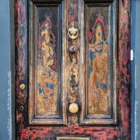
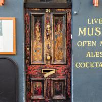
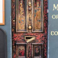
It's a great door, and I really couldn't find the best way of capturing it. Ah well.
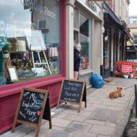
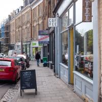
Clifton Village Lunchtime Coffee
07 Apr 2021
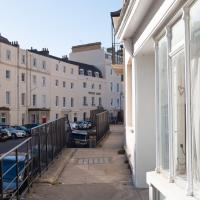
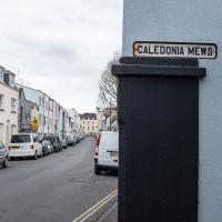
Unusually for my recent lunchtime coffee trips, I managed to find a new road to walk down: Caledonia Mews, which has a little entrance off Princess Victoria Street and runs between it and Caledonia Place. I've noticed it before a couple of times—if you look up from Princess Victoria Street you can see some of it, standing tall above the low buildings on the street itself—but until last night I'd not set foot in it, I think.
As well as focusing on this charming little mews, I looked in on the demolished site of the old WH Smith, and spotted what I think is part of the now-private-houses St Vincent Rocks Hotel that I'd not really noticed before, tucked away between Sion Lane and Sion Hill.
The entrance is on Princess Victoria Street, but I imagine based on the name that it was built as a mews for Caledonia Place, which lies on the other side, forming, with West Mall, the surrounding streets of the Mall garden.
The end of the road. Looks like there's some garden access by a little footpath, but that's obviously rather more private
For some reason I always think of Princess Victoria Street as running north-to-south, but that's because of my terrible sense of direction, I suppose, as it's really more east-north-east.
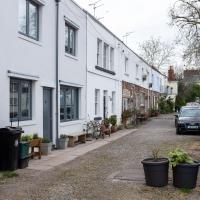
It's a lovely little mews, and looks very well-kept. I like the way that despite being fairly uniform in size and height that things are a bit more mismatched and higgledy-piggledy once you look a little closer.
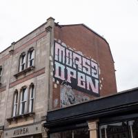
I'm glad I added a search feature to the site recently, as it let me find this earlier photo when the name rang a vague bell. Morsa clearly gets about a bit.
I think the corridor you can see running from the back of the building on Sion Hill to the building on the right, on Sion Lane, is part of the old Saint Vincent Rocks Hotel. It was converted into houses, and the front bit, just the main building on Sion Hill, called Trafalgar House now, was on the market for £1,550,000 back in 2019.
The listing mentions:
To the rear a late C19 long brick extension raised on open arches
...anyway. I think it's likely the Sion Lane building was a hotel annex, though I think it's separate flats now. I wonder which of the two sides owns the corridor between them, assuming it really is a corridor? Or maybe even that's flats now...
Next time maybe I'll wander across the green bit and see what I can see over the wall. I think the area just used to be the hotel car park, but there might be more interesting things to see.
Better Look at an Extension
14 Apr 2021
Apart from a lovely coffee and a slice of Victoria sponge from Twelve, there weren't any new sights on this little lunchtime jaunt except for a slightly better look at the long raised extension at the back of the St Vincent's Rocks Hotel, where I at least got to see the arches it's raised up on. I also got a fair bit of exercise by walking up the Zig Zag to get there, and saw far more people out than I have in months, what with the lockdown having just been significantly lifted. As I walked past The Mall pub they were turning people away from their already-full garden, and the (outdoor) cafe tables were pretty full up.
I only found out that this was a raised extension when I read the listing after snapping the last photo. Today I ventured as close as I could and got to glimpse a bit of the rather nice support arches.
I'm guessing there used to be a grand front door, but then later the hotel annexed the building and didn't need it any more? But it's only surmise.
These aren't listed per se, but they're on the "local list" and named as 8-14 St Vincents Rocks, so I think that confirms that it used to be part of the hotel.
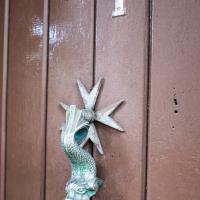
Maybe I'm starting a knocker fixation after last weekend's walk. Interesting that it's mounted on a Maltese cross. I wonder if it was a holiday souvenir?
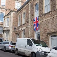
Surely if you want to mark the passing of the Royal Consort you'd move your dangling flag to the lower window...
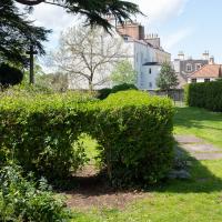
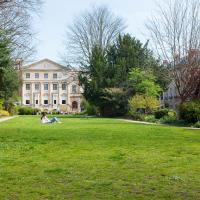
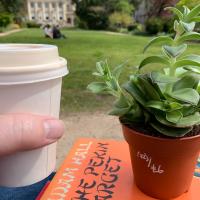
The Mall Gardens
19 Apr 2021
Just a quick errand to the Post Office to send off Mollog's Mob, but afterwards I bought a flat white and a new plant from Foliage Cafe and headed for The Mall Gardens to enjoy sitting in the sun and reading a book on the first day this year that's been properly warm enough for it. Nice.
The Mall Gardens does actually have some signs up letting people know it's a public garden, but I think it was only my researches for this project that brought the number of public gardens there are in Clifton to my attention, and reminded me that I could make use of this space in Clifton Village, a little closer to the coffee shops and a little more sheltered than Clifton Down.
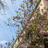
Hard to capture how nice this big magnolia in the Cornwallis Crescent back garden is on camera.
With the neoclassical frontage of The Clifton Club (originally an assembly rooms) looking posh at the back.
I've been reading Adam Hall's books for many, many years. It's mostly his Quiller books, but I do have Bury Him Among Kings, about a World War I soldier, on my "incoming" shelf at the moment...
Leftovers with Lisa
01 May 2021
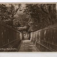
I didn't get to all the little leftover streets around the northeastern part of my area in today's wander, but I definitely knocked a few off the list, plus Lisa and I enjoyed the walk, and didn't get rained on too badly. We spotted the hotting-up of Wisteria season, checked out Birdcage Walk (both old and new), ventured onto the wrong side of the tracks1 and generally enjoyed the architecture.
1 Well, technically we probably shouldn't have been on the grounds of those retirement flats, but nobody started chasing us around the garden with a Zimmer frame
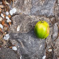
This seemed to augur well, given that we were heading for Lime Walk. This is, oddly, not the first piece of random fruit I've come across unexpectedly on my wanders.
She was a gifted and prolific inventor, by all accounts, though apparently the news stories from a year or two back about her having had significant design input into the Clifton Suspension Bridge were due to an erroneous entry in the Oxford Dictionary of National Biography, oddly.
I have The Portable Emerson on my "incoming" bookshelf, I think, but I'm not getting through them very quickly at the moment.
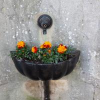
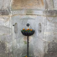
It's nice to see one of Bristol's defunct fountains being put to some kind of purpose.
This basement club will be more student flats soon, by the looks of it. Though I actually took this photo to remind myself of a possible plot point for a story I'm writing...
I'm now a member of the Cliftonwood and Hotwells Improvement Society. I kept on coming across things they'd done that I approved of, so it seemed like a good idea.
Victoria Square Underpass
06 May 2021
I'm meant to be taking a little break from this project, but in my Victoria Square researches after my last walk I noticed a curiosity I wanted to investigate. The community layer on Know Your Place has a single photograph captioned, "The remains of an 'underpass' in Victoria Square".
Looking back through the maps, I could see that there really did used to be an underpass across what used to be Birdcage Walk. I can only guess that it was there to join the two halves of the square's private garden that used to be separated by tall railings that were taken away during WWII. Maybe it was a landscaping curiosity, maybe it was just to save them having to un-lock and re-lock two gates and risk mixing with the hoi polloi on the public path in the middle...
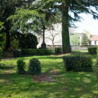
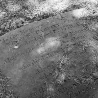
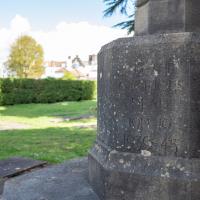
Anyway. Intrigued, I popped up to Clifton Village this lunchtime for a post-voting coffee, and on the way examined the remains of the underpass—still there, but only if you know what you're looking for, I'd say—and also visited a tiny little road with a cottage and a townhouse I'd never seen before, just off Clifton Hill, and got distracted by wandering the little garden with the war memorial in St Andrew's churchyard just because the gate happened to be open.
EDIT: Aha! Found this snippet when I was researching something completely different, of course. From the ever-helpful CHIS website:
When there were railings all round the garden and down the central path, in order that the children could play together in either garden there was a tunnel for them to go through. This was filled in during the 1970s but almost at the south east end of the path if one looks over the low wall the top of the arches can still be seen.
I wander on impulse down a little side-street I'd never really noticed before and find a curious cottage (Prospect Cottage, right) and a big 18th century listed house I've never seen before (Clifton Retreat, hidden behind the wisteria and other foliage ahead/left.)
If you'd shown me this photo before today, of a place I've been within spitting distance of thousands of times, I'd have not had a clue where it was. Bristol's fractal nature never ceases to amaze me.
And opposite Prospect Cottage, as if to give some direct contrast, the modern and anything-but-quaint goods entrance to the Nuffield Hospital.
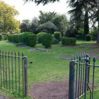
I'm going to call this the memorial garden. Don't know if it has an official name, but it's a railinged-off area with the war memorial in it...