Tagged: bristol
Jaunt to a Closed Coffee Shop
17 Nov 2020
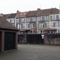
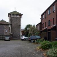
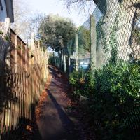
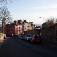
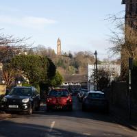
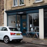
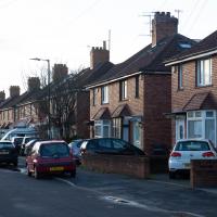
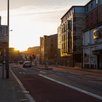
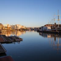
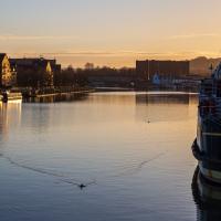
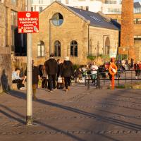
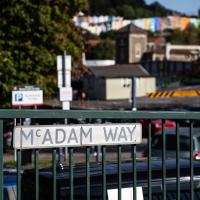
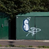
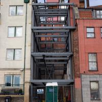
A fruitless wander, as Spoke and Stringer (who I thought might do a decent flat white) were closed, and the only other harbourside inlet offering were a bit too busy to wait at, especially as I'd spent some time wandering some of the convolutions of Rownham Mead. This last congeries of dull alleyways and brown-painted garages was at least somewhere I've never been before, in parts.
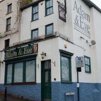
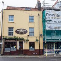
There are yet more plans to turn this pub into yet more flats. I heard from a few different people that the owner has a habit of renting it to people but making them responsible for repairs, which normally turns out to be a bad deal for them as the place is falling apart. Of course, I've only heard that side of the story from the renters. I've experienced it in a few different forms, and in some of them it was a truly excellent local pub.
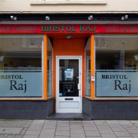
Up until the owner retired a few years ago, this was one of those great combination Chinese/fish & chip takeaway places, and I used to enjoy everything from the crispy chilli beef to the cod & chips.
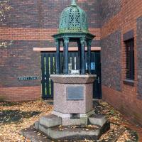
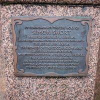
A bethel ship was a kind of floating church; it would moor up near other ships and the sailors could board it for worship.
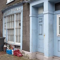
From what I can see in the National Archives, the Trinity Rooms was owned by Holy Trinity Church, which makes sense. I don't know what it's curently used for, though my guess would be that it was sold off and has been turned into flats.
I don't spend a lot of time in pubs, but if I had to choose a "local", this is the one I would choose. Welcoming, interesting, and often to be found with a nice fire burning in the winter. After the last time some fool drove their car through the front wall (this bend on the Hotwell Road appears to be a magnet for bad drivers), the boarding up was decorated with the bonnet badge of the offending vehicle, a Toyota, if I remember correctly.
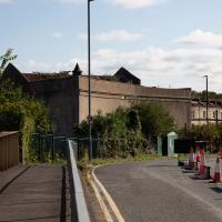
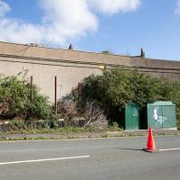
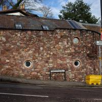
I've walked along the Hotwell Road on the other side of this wall a thousand times—possibly ten thousand. Never seen this side of it before.
Library, Bookshop, Coffee
03 Jul 2021
I was headed into town to return RA Gilbert's biography of AE Waite to the library and along the way I noticed that Dreadnought had finished their refurbishment, but wouldn't be open until midday. That left me some time to kill, so I bimbled around the old St Augustine's/Gaunt's area for a while, then headed up Park Street for a coffee and a snack to eat on Brandon Hill before heading home the way I'd came so I could pop in and buy a pamphlet on the Hot Well I'd been interested in for a while.
According to the listing, this plot has:
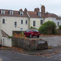
PLANNING GRANTED to erect a DETACHED MEWS HOUSE ( 1743 Sq Ft ) with GARAGE and courtyard garden.
Looks a bit of a tight fit, but it's a nice location and there are very few small whole houses in my neighbourhood, especially not modern ones. Round here it's mostly grand old Georgian stock that's been chopped up into flats, and even the "modern" blocks are getting on a bit.
Location-wise it might be a fair bit noisier than my place, because it's closer to the Hotwell Road and would also instantly become the closest house to Hotwells Primary's playground. On the other hand, unlike my listed building, you'd actually be able to have double glazing and there wouldn't be any immediate neighbours on any side...
I'll be interested to see what the price is like when it eventually gets built.
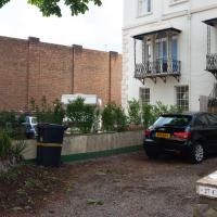
Up until recently it was just used as an off-street parking spot and always looked rather run-down, so I'm generally in favour of replacing it with a small house.
I imagine this is the house whose owners also own the plot with planning permission; it seems to be the end of their back garden.
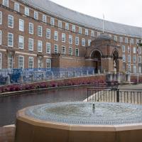
These nearest houses were originally called Chapel Row; they're an extension of the western end of Dowry Square, built 1725-1727. Most of the houses in this area were built from the 1720s onwards as the popularity of the Hot Well caused a demand for lodging space closer than College Green, where people generally stayed before.
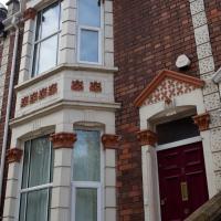
Number 262 here, the closest, is presumably owned by the same people who own the little plot of ground that's for sale, given that it's basically at the end of their back garden.
It was called Chapel Row because a chapel used to stand in the middle of this terrace, long before Carrick House was built at the far end.
On the ever-helpful Church Crawler you can see some pictures of the original chapel Dowry Chapel, and its successor, St-Andrew-the-Less. St Andrew (-the-Greater) was of course St Andrew's in Clifton Village.
Pevsner apparently said of St-Andrew-the-Less:
is an unforgiveable crime against the architecture of Dowry Square and chapel Row. Of no value either in its own Gothic forms. The spire is particularly nasty.
Personally, I thought it looked rather nice, but I'm used to Bristol's jumbletechture. It definitely lasted until c. 1963 as there's a picture of it around then (in the background of the devastation wrought by the demolition to clear the way for the Cumberland Basin Flyover System) in Hotwells - Spa to Pantomime.
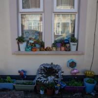
I think that's what these are, anyway. Erigeron. They cheer me up every time I walk past Holy Trinity at this time of year.
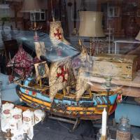
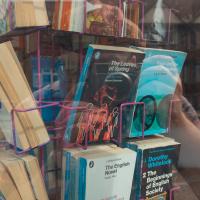
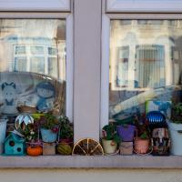
I could also do with a few of the "ANTI FOG LOZENGES" from the bottle at the front. This is the always-interesting window of Bristol Brocante.
A brocante in France is basically a flea market; the purported etymology I've seen is the Dutch word brok, meaning a piece or fragment.
Hurrah! Dreadnought are back after their refurb. I purchased the excellent pamphlet The Bristol Hotwell by Vincent Waite.
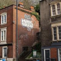
Though what caught my eye was the barely-visible slogan on the side wall in the middle of the picture: "I DID MY FIRST GRAFFITI HERE WAY TOO LONG AGO".
Anyway. Then I popped along the walkway to return the biography of AE Waite I've just finished, and to discover if the library's reference section had re-opened yet. It hadn't.
The Long Lunchtime at the End of the World
27 Nov 2020
I took an extra-long break at lunchtime today as I'd taken the day off my normal day-job to do the accounts for my previous side-job, which is still generating paperwork, though not much in the way of money. This took me through some undiscovered bits of Cliftonwood, including Worlds End Lane, which unexpectedly leads to White Hart Steps. That's certainly not where I expected the end of the world to lead to...
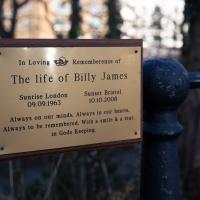
Sobering. A couple of years younger than me, from what I can find on the web he died when his motorcycle was in collision with a car at the nearby corner with Dean Lane.
I came up here drunk one night, searching for a shortcut home from somewhere around the Triangle. At least this time I was reasonably sure I'd not get out of the far end here.
Alma Vale
06 Dec 2020
I wasn't really feeling it when I set out today, on my first car-assisted wander. By the time I'd parked on Alma Vale Road in Clifton it was just starting to rain and I picked my way about in quite a desultory way. It felt strange, as I was very familiar with the area because I'd walked through it hundreds of times when I worked at the top of Whiteladies Road, and used to walk up the hill from Hotwells and through Clifton to get there, and back again, every day.
Then a complete coincidence seemed to make the change I'd been hoping for. I was standing taking a photo of Christ in the front garden of All Saints church when a couple of people walked out of the front door. I got talking with a lady I took to be part of the ministerial team, who invited me to come in and look around—something I'd always wanted to do on the morning commute. (I think we connected a bit when I recognised the name John Piper, who did the amazing windows—I learned about him while I was at Warwick, through his connections to Coventry Cathedral.
I left with much more of a spring in my step, wandered around the area a bit more, finally working out that the tennis courts I used to pass every morning are those of Clifton Lawn Tennis Club, and finally grabbing an excellent Hungarian sausage hot dog from the Budapest Cafe. I feel a lot better now than I did before I went out.
Sequel Injection
07 May 2021
I saw this tweet the other day and started thinking of my second Covid-19 vaccination as my "Sequel Injection" (to a geek, it's funny. You'll have to take my word for it.) Whatever you call it, this morning I went and got it.
It was in the same place I got my initial injection—my left arm! No, okay, it was at the Clifton College Prep School. I didn't take any photos of the event itself; the NHS production line is so efficient you barely have time to do anything else, even if the privacy of other patients wasn't a factor.
Along the way I mused at all the road resurfacing going on in Clifton, and also discovered a secret (okay, not-well-known and possibly slightly trespassey) way into Canynge Square, and on the way back I knocked off a few streets from my "leftovers list" of north-east Clifton. I've got much of Clifton done now, with the only obvious "to dos" on the east side of Whiteladies Road...
It was quite a long walk, and I'm feeling pretty tired now, though that might be the effects of the jab too, I suppose. Anyway. Tomorrow and Monday I'm walking outside Bristol, I think, and I imagine my feet will need some recovery time on Sunday, so it might be a while before I post another Wander.
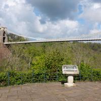
The Fujifilm X100T that I mostly use for these trips is a great camera, but it's also a fixed lens, approximately that of a 35mm focal length on a full-frame camera. So I quite often can't fit in whole buildings, whole terraces, or whole suspension bridges :D
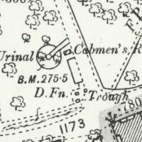
I tried to figure out what this used to be—didn't have a lot of luck, but the next snap is taken from an old OS map showing that this area has been a stand for public transport since long before the modern bus stop here.
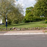
Looking at the old OS maps, it seems this must have been where all the local cabbies hung out. The Cabmen's Rest has a urinal, drinking fountain, and horse trough, all on this little corner. Perhaps the little wall marks the edge of an old shelter; there's a box on the map there but it doesn't give much away.
Ther's a little shelter/bandstand-looking thing in the background of a few historic photos from the area like this one of a horsedrawn omnibus but it's hard to tell what's where.
Map source: 1894-1903 OS 25” 2nd Edition, Know Your Place Bristol
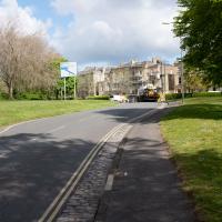
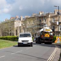
There were a lot of closed roads in Clifton this morning. I watched the white van at the end make its way carefully around the ROAD CLOSED signs at the village end of Observatory Road, drive past me, and get to where you can see it in the distance here before the driver was sent back with a flea in his ear from the workman on "stop the idiots driving through the newly-laid tarmac" duty.
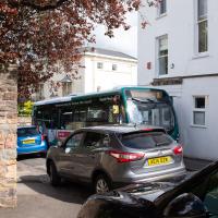
As well as confused van-drivers, the buses weren't having a great time of it, either, having to squeeze down narrow streets like Canynge Road rather than their usual broad avenues. Never seen a traffic jam here before.
I'd spotted in my Canynge Square researches that there might be a cut-through from a gate I'd seen in previous excursions to the side of the Regrave Theatre.
Bedminster, Ashton, Ashton Court sunset walk
12 Dec 2020
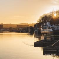
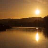
A walk with Sarah focusing on Ashton and the surrounds, taken on a day with really nice light around sunset. Just what I needed.
Harbourside Milestone
17 Mar 2021
The other day I realised (hello, Maggie!) that my next walk would be my hundredth, and that I'd done 393.4km so far. I figured it would be nice to get to 100 walks and 400km on the same walk, so I went for a nice long harbourside wander after work, rather than dashing out at lunchtime. As it turned out, we're just coming up to the time of year where I can leave the house at 5:30 in the evening and there's still just enough light to take photos by the time I've made it around the harbourside. Though only just, and mostly because I've got a full-frame camera that's not bad in low light...
Still, the evening light made a lovely change, and some of the photos turned out to be pretty good photos per se, rather than just record shots of my walk. I'm looking forward to more evening walks like this as summer approaches.
On the way around this evening I wandered through one of the oldest bits of the city to extend my walk and snapped some interesting bits of architecture, including an NCP car park(!) and a nighttime shot of one of my favourite subjects, the clock tower at the Albion dockyard.
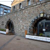
Spoke & Stringer were a long indoor cafe in the Beforetimes. Now there's three separate vending areas: fish & chips, brunch & tacos; coffee & shakes.
The idea here is that the development still leaves a clear line of sight from the harbour to the cathedral, along Cathedral Walk.
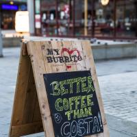
Cheeky. I also run a Cafe Signs Tumblr so I'm always on the lookout for good signage.
I'm afraid that this is a bit of a badly-curated wander, where I mostly just popped out to find out a little of the history of Underfall Yard and poke around the various open workshops, and, in hindsight, really didn't take pictures in any kind of coherent order. So there's a lot of pictures, but they don't really tell the story that, in hindsight, I seem to have been trying to tell, of the unusual electrical substation in Avon Crescent, the Bristol Electricity that predates the National Grid but is still in use, the history of the hydraulic power house... It's a bit of a mess.
But I suppose sometimes these wanders—always chronologically presented in the order I walked and took photos—simply will sometimes be a bit of a mess. Let's hope you still get something out of it, anyway...
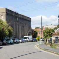
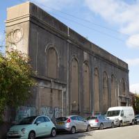
It's very hard to get a decent look at this building. This is the top half of the back of it.
This building is, or was, an electrical substation. I heard an unconfirmed rumour that the building itself is now actually empty, and that the entire substation guts are now in these boxes. I have no idea whether that's true or not.
You can see this once apparently bright and airy building has had every window bricked up.
I understand that something in or around this building still supplies the odd electrical requirements (specifically, 360V "Bristol voltage") for some bits of Underfall Yard, which is our next stop, so more about that when we get there.
While it's not a listed building, is is notable: it's one of the earliest reinforced concrete buildings in the UK, apparently, construction starting in 1905. I assume it was up by 1907, as that's when Undefall Yard installed their electric pumps.
This oddity of history predates the National Grid and was originally fed from Feeder Road power station (well, Avonbank, on Feeder Road, to be precise. We've seen a bit of that history before, as a line marker for the line from Portishead to Feeder Road.) It was connected to Feeder Road by 1906, with a 6,600V line.
I've added a couple of historic views of the building as the next two photos in the wander, but I'll also pop this link to a Loxton drawing of the Avonbank electricity works, 1908 here.
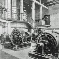
Via this Tweet and taken from KYP Bristol, showing the interior with a couple of Westinghouse rotary converters and a Peebles-La Cour motor converter, assuming this picture ties up roughly with this 1908 Institute of Mechanical Engineers' visit to works.
You can see a picture of similar Westinghouse converters to the two at the back in the Wikipedia rotary converter page and a Peebles converter that looks very similar to the one in the foreground on the cover of the Peebles motor converter catalogue in the sidebar of their entry in Grace's Guide. I'm guessing the additions on the ends of the Westinghouse converters were for different voltages? A rotary converter is basically a motor connected to a dynamo, so extra dynamos with different windings would give you different voltage outputs, I suppose, but I know very little about power generation.
And here's the Loxton picture of the exterior, from the Bristol Libraries collection. Seems such a shame to have bricked up those lovely windows.
In Between
06 Feb 2021
A lovely walk in the early spring sunshine with my friend Lisa. We headed directly for Jacobs Wells Road, to start off around the scene of one of our earlier walks, but this time took in Jacobs Wells from QEH upward, stopping to snap some photos of a Bear With Me, some interesting areas between Park Street and Brandon Hill including a peculiarly quiet enclave with a ruined old build I'd never found before, then crossed the Centre to grab take-away pies from Pieminister (I had the Heidi Pie) and head back to my place down the harbourside.
I guess I was wrong about them coming back to finish off the rest of the sign.
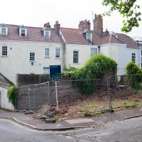
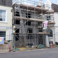
First it was a house, though a strange small one, from what I recall, then it was a ruin, then it was a gap, and now it's a structure and I imagine it will soon be a house again.
Need to head up a few of these. There's another street back there somewhere, plus the paths I've not walked on Brandon Hill
Unlike the other day, there at least wasn't water flooding out of the well house today.
I got interested in Bristol's medieval water supplies after poking around near Jacobs Wells Road and Brandon Hill. It was during that research I found out about a pipe that's still there today, and, as far as I know, still actually functioning, that was originally commissioned by Carmelite monks in the 13th century. They wanted a supply of spring water from Brandon Hill to their priory on the site of what's now the Bristol Beacon—Colston Hall, as-was. It was created around 1267, and later, in 1376, extended generously with an extra "feather" pipe to St John's On The Wall, giving the pipework its modern name of "St John's Conduit".
St John's on the Wall is still there, guarding the remaining city gate at the end of Broad Street, and the outlet tap area was recently refurbished. It doesn't run continuously now, like it did when I first moved to Bristol and worked at the end of Broad Street, in the Everard Building, but I believe the pipe still functions. One day I'd like to see that tap running...
There are a few links on the web about the pipe, but by far the best thing to do is to watch this short and fascinating 1970s TV documentary called The Hidden Source, which has some footage of the actual pipe and also lots of fantastic general footage of Bristol in the seventies.
On my walk today I was actually just going to the building society in town, but I decided to trace some of the route of the Carmelite pipe, including visiting streets it runs under, like Park Street, Christmas Street, and, of course, Pipe Lane. I also went a bit out of my way to check out St James' Priory, the oldest building in Bristol, seeing as it was just around the corner from the building society.
There are far too many pictures from this walk, and my feet are now quite sore, because it was a long one. But I enjoyed it.
The site of the Carmelite Priory that St John's Conduit carried water to from around the top of Park Street.
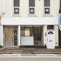
Looks like something's getting spruced up ready for opening. Good. This bit of the Hotwell Road needs some nice new shops, of any and all varieties.
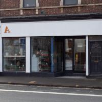
This place was joined up with the shop to the left as a hot tub sales showroom, and before that it was the View art gallery. Before that it was a brothel for a while, oddly, but I think the general community reaction was a bit too hostile for it to survive. Looks like it's now been separated from the next door shop.
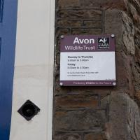
It's the home of the Avon Wildlife Trust now, but back in the day it was Brandon Hill Police Station. It's marked on maps as recent as the 1950s Bristol Town Plans. An interesting tidbit from Bristol Then and Now on Facebook:
One of the first police stations in Bristol, it was opened in 1836 - policemen from the station used the building housing the Jacob's Well as a bicycle store and many old bicycle lamp batteries were found in excavating the small entrance to the mikveh. The Police Station closed in 1967 and it is now the base of Avon Wildlife Trust.
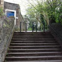
I was tempted to investigate, just to see if it still seemed to be in use as a private entrance to Brandon HIll, from presumably either QEH or possible the Field House at the end of John Carr's Terrace, but I knew I had a lot more walking to do, so didn't divert...
