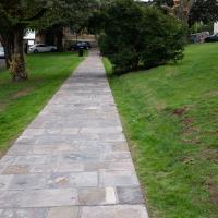
Tagged: landscape
A Long Wander Of Miscellany and Magick
08 Aug 2021
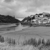
This was a wide-ranging wander. I started off crossing the river to Bedminster, to walk a single little cul-de-sac, Hardy Avenue, that I'd managed to miss on at least one previous walk. Then, pausing only to explore a few back alleyways, I headed for a few destinations related mostly by the Hughes family, who I've been researching a little as part of background for a possible novel, as several of them were involved in the Stella Matutina.
However, mostly it's the artistic side of the family I wanted to explore today, as that's where most of their public history lies (as you might expect, there's often not much in the public record about the workings of an occult organisation.) First I visited College Green, where the façade of the Catch 22 Fish & Chip shop still bears the work of Catherine Edith Hughes. Then I wandered up to the top of Park Street to pop into the Clifton Arts Club's annual exhibition, as Catherine, her half-brother Donald, his wife Hope and at least two other Hugheses were members. Donald was chairman for 40 solid years; Hope was Secretary for eight, and Ellard and Margaret Hughes, two more Hughes siblings, were members along with Catherine.
Finally I walked home with a small diversion to Berkeley Square, to confirm the location of Donald Hughes's house by checking for a particular plaque by the front door.
I must admit I'm not entirely sure where all this research is really leading me, but I'm finding it quite interesting to bump across the faint lines of history that link the Hermetic Order of the Golden Dawn, founded in 1888, to modern, quotidian Bristol.
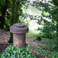
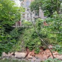
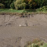
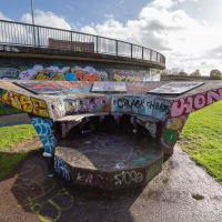
A little remnant of the Avon's history, I assume, gently rusting away on the bank by Cumberland Road
Museum of the Moon, and a Bit of Redland
21 Aug 2021
Lisa and I mostly went out to have a look at Luke Jerram's Museum of the Moon as its tour hit Bristol Cathedral—I missed it when it was previously in town, at Wills Hall, I think—but we also took a trek up to Redland. Lisa's kind enough to indulge my strange current fascination with the Edwardian eccentrics that made up the Stella Matutina, so we swung by a couple of places with a vague connection to the Bristol branch of the organisation. Well, it was good walking, anyway...
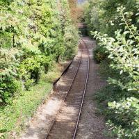
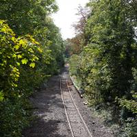
As a stunning bonus, one of the picture's descriptions has more information than you'd probably want on the Bristol Port Railway and Pier's Clifton Extension Railway line, but I did happen to coincidentally write up this wander after reading about the extension line during my lunch hour at work today. It's a thrilling life, I tell you...
More from ChurchDB:
"The order was founded by St Jeanne Jugan, after she rescued two poverty-stricken elderly women from the streets of Paris during the French Revolution. The Sisters' work continues today, in providing care for the elderly - for an account of this, see the article Celebrating the Little Sisters with big hearts published in the Bristol Post on 15th October 2012, reporting on the celebration of 150 years of their work."
And even more on Wikipedia, of course...
I was surprised to find that "thank-offering" is actually in Chambers' dictionary, and not at all surprised to find it means exactly what you'd expect.
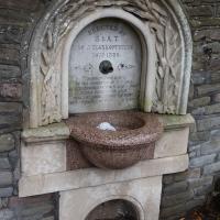
The inscription is from Psalm 114:
Tremble, thou earth, at the presence of the Lord, at the presence of the God of Jacob; Which turned the rock into a standing water, the flint into a fountain of waters.
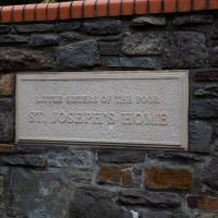
Can't resist a plaque. The original name of the organisation was "Guild of the Brave Poor Things", but that's Victorians for you.
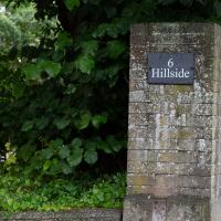
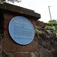
I don't know if there's any connection between the Bristol Hermes Temple and the Bristol Steiner School specifically, but I know that at least one of the Temple Chiefs met Rudolf Steiner and became quite enamoured of anthroposophy, so it's interesting that the school is so close to where Catherine Hughes, one of the first three chiefs, used to live, just down the road from here.
Mostly the Metal Animals of a Clifton Garden
30 Aug 2021
Lisa and I went for a longish walk, but I didn't take many photos. Mostly we just wandered and nattered. Unusually, my target was outside my 1-mile radius on Burlington Road in Redland, where I snapped quite a few photos of the collection of artistic animals by Julian Warren. This was mostly to provide a fairly arbitrary destination for a roundabout walk in Clifton...
I don't know enough about fruit trees to know what this was, but I can tell you that the fruit was apple-ish and very sharp indeed.
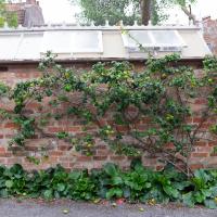
Unusual to see an espalier on a north-facing wall. This one faces the little car park behind Freeland Place
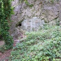
From an Avon Gorge Geology Excursion Guide I dug up:
Just south of the Observatory, on the right of the path is a children’s playground [ST 5667 7325] in the remains of a limestone quarry. In the back wall is a bricked-up adit, presumably representing the entrance to a former iron ore or lead mine (Fig. 10C). The roof of the adit is fissured and sparry, crystalline calcite can be seen in fissures.
The playground itself is in one of the the quarries used for the Suspension Bridge materials.
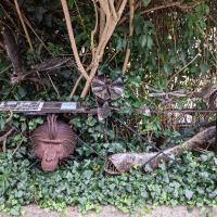
One of our mutual friends had mentioned that there was a house on Burlington Road with metalwork animals in the garden around here somewhere. It took us a while to find, but find it we did.
The artist is Julian Warren.
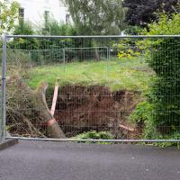
Well, I certainly don't remember Park Place having a nice path cut through it before, and it looks pretty new.
A Morning of Research and a Cafe in a Castle
25 Sep 2021
I needed to pop to the library, as they'd kindly dug a book out of the reserve store at the B Bond warehouse for me and emailed me to let me know it was ready. So, I took a little trip to town, straight down the Hotwell Road, and spent a few hours reading before stretching my legs with a walk to a new cafe in the actual castle (or remnants thereof, anyway) of Castle Park, before heading back home down the other side of the harbour. As well as books and coffee, I bumped into a remote-controlled pirate ship, which isn't something you see every day, even in Bristol.
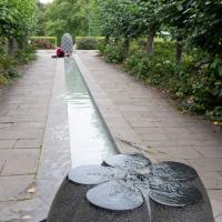
I like this little watery installation at Castle Park, so I try to cut through here if it's on my way.

I recently indulged myself by buying a little piece of history. I've mentioned Samuel Loxton and featured and linked to his drawings before, often in the eminently browsable Loxton Collection albums that Bristol Libraries has on Flickr. So when I saw a Loxton drawing of Hotwells pop up on eBay, I decided to get myself a little treat.
I don't think there's any Loxton drawing that features the road I actually live in—it's not very visible from anywhere else, not being one of these Clifton terraces that's perched at the top of a hill, or anything like that, and it's invisible in most views of the area. However, this Loxton drawing, Hotwells, Looking across the river from near the Clifton Bridge station, is probably the closest near-miss I've seen.
I decided to wander out one morning and see if I could reproduce the picture, and also take a photo or two of what's now become of the Clifton Bridge Station, which is still just about discernible in places.
(Then on an even stranger whim I decided to check out a possible little cut-through from Cumberland Road to the harbourside I'd been eyeing up on my commute to work, so walked to Wapping Wharf for a croissant via this potential new route, but that bit's not quite as interesting...)
This must be some kind of invasive species. Normally the inhabitants of this island are the apprently-native shopping trolleys.
Site of the Rownham Ferry. Follow the link for a charming Loxton ink drawing on Know Your Place, also viewable at the Bristol Libraries Flickr collection.
This was a later site for the ferry, which earlier was a tad further out along the river. It would have been a key crossing point at this end of Bristol before the arrival of any bridges near here. Before the Ashton Swing Bridge and the Vauxhall footbridge arrived, the next-nearest crossing point would have been the Vauxhall ferry, which was where Vauxhaull Bridge stands now, I think.
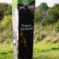
Okay, so here's the reason that the earlier rabbit had a big red cross through him, and that this one has been painted out. Bristol's graffiti community is currently trying to erase these rabbits after a terrible revelation about the man who had been painting them.
Here's the Bristol Post, on Damian Lasota, aka "Eldey" or "FollowMyRabbits":
A pervert with a penchant for grannies tried to rape one elderly woman in her home and sexually targeted another.
Damian Lasota was described by a judge as the "stuff of nightmares" after preying on the two lone females in Twerton, Bath.
His campaign of terror was halted after police installed CCTV at the women's homes and he was caught in action and arrested.
Lasota, 27, of Parry Close in Southdown, Bath, pleaded guilty to attempted rape, two charges of trespass with intent to commit a sex offence and two charges of exposure.
He appeared in the dock at Bristol Crown Court with a grey jumper draped over his head.
Judge Julian Lambert handed him a 20-year sentence, comprising of a 13-and-a-half year jail term and six-and-a-half years extended licence.
So, that's pretty damn terrifying, and also the reason why there won't be any more rabbits in Bristol. There's a little more info in this Somerset Live article.
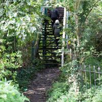
After carefully skirting the edges of the homeless people's camp that I accidentally found skirting the edges of the tall grass between the allotments and here, I came across my first destination: the footbridge from Clifton Bridge railway station. This is apparently the actual station footbridge, still in service for crossing the lines.
Many people in Bristol will know this as one of the chief ways people from this end of town used to get to Ashton Court, especially for the music festival or the balloon fiesta, before the shiny new Festival Way footpath was installed a decade or two back.
I've been across it before on my wanders, but I didn't know then that it was a remnant of a railway station, rather than just a standalone bridge.
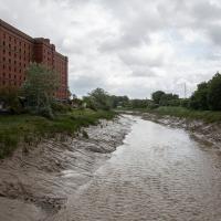
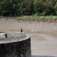
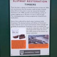
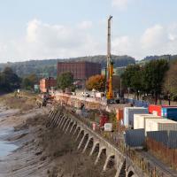
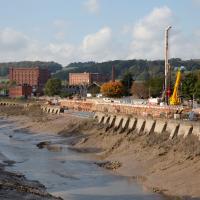
I'm afraid that this is a bit of a badly-curated wander, where I mostly just popped out to find out a little of the history of Underfall Yard and poke around the various open workshops, and, in hindsight, really didn't take pictures in any kind of coherent order. So there's a lot of pictures, but they don't really tell the story that, in hindsight, I seem to have been trying to tell, of the unusual electrical substation in Avon Crescent, the Bristol Electricity that predates the National Grid but is still in use, the history of the hydraulic power house... It's a bit of a mess.
But I suppose sometimes these wanders—always chronologically presented in the order I walked and took photos—simply will sometimes be a bit of a mess. Let's hope you still get something out of it, anyway...
Fresh Fields
17 Oct 2021
For the first time in a while, I had the time and energy to go further afield and knock off some new roads from my "to do" list. I headed through the first Hotwells Festival to Ashton and Bedminster to cross off a few of the suburban roads south of North Street.
First, though, I decided to try to reproduce an old photo of the now-demolished Rownham Hotel just around the corner from where I live...
Apparently the repair of the Chocolate Path itself is now underway here. I won't hold my breath. Shame, as it's within my mile and one of my favourite walks and I've had no chance to walk down it since long before I started this little project.
To give you an idea of what it's like down on the path, here's a photo from 2017 from behind where I'm standing on Vauxhaull Bridge here.
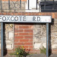
I presume a foxcote is like a dovecote, only for foxes. Nice to imagine them all there in their array of little foxholes.
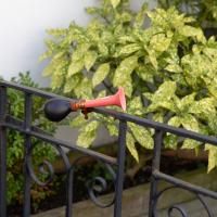
Makes a change from a doorbell. Foxcote road had quite a lot of these little boho touches; it's clearly one of those Bemmie streets that attracts the slightly eccentric type.
A Wide Angle View
30 Oct 2021
I had an unsuccessful wander last week, on Tuesday afternoon: my GPS died within about five minutes of leaving the house, and I didn't notice, plus I found hardly anything I'd been looking for. On the plus side, as I was wandering around Park Street I decided to nip into London Camera Exchange on the offchance they had a secondhand Canon 17-40mm lens. I've been thinking of buying one for around a year, I think.
Long story short: not only did they have one, but due to a mistake with their price labelling which they kindly honoured, I now have a shiny new (to me) wide-angle lens and it cost me less than £300, which is a very good price for one of these in good condition (and including a lens hood.)
So, rather than try to salvage Tuesday's walk, here's a walk where I basically just bimbled up to Clifton Village for a coffee and wandered around taking photos of as many wide views as I could find. I took a lot more photos than these seventeen, but as you might expect, a new lens takes some practice getting used to, so most of them ended up in the "outtakes" pile.
It's hard to snap this view, perhaps because nothing can convey the emotional context for me: the "nearly at home" feeling of wandering down from Clifton Village into Hotwells.
Ticking Off a Few Streets in Bedminster
31 Oct 2021
There were only a few streets left to wander in the more residential bit of Bedminster, so I thought I should target those today. The streets themselves weren't that notable, though Balfour Road has a contrasting mix of old and new housing. I tried to snap a few more interesting things along the way there and back, snapping all three of the familiar bond warehouses, nipping onto North Street to find some new street art, and finding a few pumpkins for good measure. It is hallowe'en, after all...
It wasn't that long ago that there were trains running down here, and pedestrians enjoying the chocolate path to the right of the line. One day, hopefully, they'll both be back...
Recreating a Loxton Drawing on a Lunchtime Jaunt
05 Nov 2021
I did do a much longer wander earlier in the week, but that'll take me some time to process (and cast a plethora of photos into the "out-takes" pile!) In the meantime, here's my lunchtime jaunt, taken to give myself a break from doing the company bookkeeping to send to my accountant so the taxman doesn't sling me in chokey.
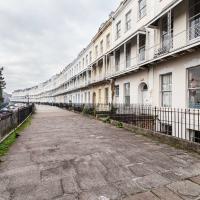
I've recently bought a slightly creased secondhand copy of Redcliffe Press's 1992 collection of Samuel Loxton drawings, Loxton's Bristol: The city's Edwardian years in black and white. It's a nice selection of Bristol Library's collection of the drawings. I'd noticed a drawing of 25 Royal York Crescent, a house I pass quite often, so I thought I'd wander up the crescent on the way to pick up some lunch and try to reproduce it.
On the way back I took a few photos of Clifton Hill Bank as the crowdfunder to make quite a lot of it into a wildflower meadow has just hit its target, so I figured some "before" shots might be a good investment for the future...
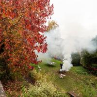
Autumn's a busy season in Royal York Crescent Gardens.
(This is also the reason the photos of Royal York Crescent that come along in a minute look slightly hazy! It's not my lens, honest...)
The crowdfunding effort has blown past its original £1400 target and stands at £1775 so far. The original target was to cover:
- £300 for wildflower seed to sow in the next few weeks
- £100 for non-plastic signage explaining what’s happening – crucial for public support
- £1,000 for plug plants to go in next spring
They also say that most of the existing popular daffodils will stay, which is nice, as that was my favourite spring feature of the bank.