Tagged: tree
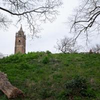
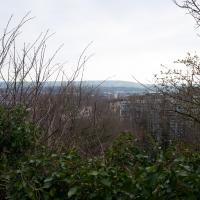
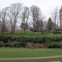
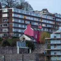
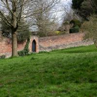
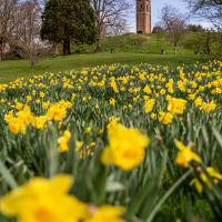
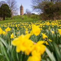
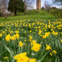
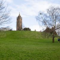
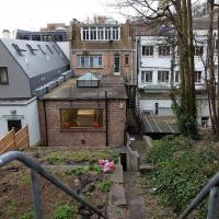
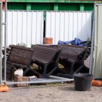
I wasn't going to take a very long walk on this nice spring evening; it just happened. I was going to knock off a path or two on Brandon Hill, home over centuries to hermits and windmills, cannons and Chartists, and then just wander home, stopping only to fill up my milk bottle at the vending machine in the Pump House car park.
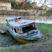
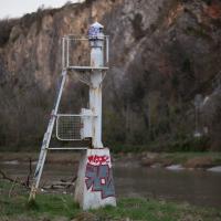
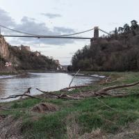
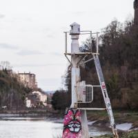
However, when I heard a distant gas burner I stayed on the hill long enough to see if I could get a decent photo of both the hot air balloon drifting over with Cabot Tower in the same frame (spoiler: I couldn't. And only having the fixed-focal-length Fuji with me didn't help) and then, on the way home, bumped into my "support bubble", Sarah and Vik, and extended my walk even further do creep carefully down the slipway next to the old paddle steamer landing stage and get some photos from its furthest extreme during a very low tide...
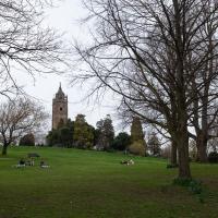
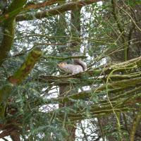
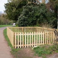
The squirrels of Brandon Hill aren't actually that wild, in fact; they're very, very accostomed to humans.
Towpath Evening
25 Mar 2021
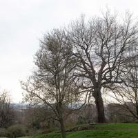
I was honestly just about to do the homework from my oh-so-thrilling ITIL course when my friends Sarah and Vik asked me if I'd like to come out for a wander down the towpath with them. I enjoyed the company, the evening light and the delicate clouds.
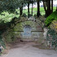
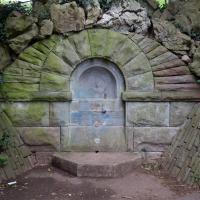
I got interested in Bristol's medieval water supplies after poking around near Jacobs Wells Road and Brandon Hill. It was during that research I found out about a pipe that's still there today, and, as far as I know, still actually functioning, that was originally commissioned by Carmelite monks in the 13th century. They wanted a supply of spring water from Brandon Hill to their priory on the site of what's now the Bristol Beacon—Colston Hall, as-was. It was created around 1267, and later, in 1376, extended generously with an extra "feather" pipe to St John's On The Wall, giving the pipework its modern name of "St John's Conduit".
St John's on the Wall is still there, guarding the remaining city gate at the end of Broad Street, and the outlet tap area was recently refurbished. It doesn't run continuously now, like it did when I first moved to Bristol and worked at the end of Broad Street, in the Everard Building, but I believe the pipe still functions. One day I'd like to see that tap running...
There are a few links on the web about the pipe, but by far the best thing to do is to watch this short and fascinating 1970s TV documentary called The Hidden Source, which has some footage of the actual pipe and also lots of fantastic general footage of Bristol in the seventies.
On my walk today I was actually just going to the building society in town, but I decided to trace some of the route of the Carmelite pipe, including visiting streets it runs under, like Park Street, Christmas Street, and, of course, Pipe Lane. I also went a bit out of my way to check out St James' Priory, the oldest building in Bristol, seeing as it was just around the corner from the building society.
There are far too many pictures from this walk, and my feet are now quite sore, because it was a long one. But I enjoyed it.
I was tempted to investigate, just to see if it still seemed to be in use as a private entrance to Brandon HIll, from presumably either QEH or possible the Field House at the end of John Carr's Terrace, but I knew I had a lot more walking to do, so didn't divert...
I bumped into my friend Lisa in town during yesterday's wander, and we decided to have a wander today, too. We managed quite a long ramble, starting up through Clifton and nipping down Park Row to investigate the two tower blocks I'd noticed popping up behind Park Street yesterday, then took in a few roads I'd not managed to get to before, including cutting through the grounds of Bristol Grammar School.
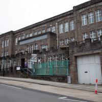
One of the world's largest archives of British Theatre History. I had no idea it was there.
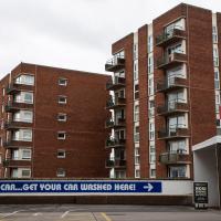
Tucked between Park Row and Park Street, you don't get many sightlines of these little towers.
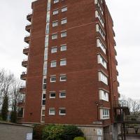
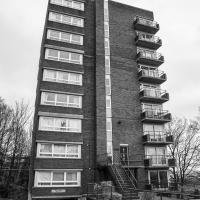
Apparently you pay somewhere around a thousand pounds a month for a place here. Given that each flat has two double-bedrooms and that there's off-street car parking, that seems about right for the location.
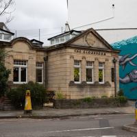
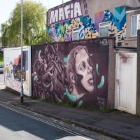
A lot going on here. The little orange thing that looks like a cross between a litter bin and a buoy is the heat vent for the electrical substation that's below the double metal doors in the pavement to its left. Then in the middle is an Edwardian toilet converted to a cafe, though the last time I was in there it was hosting an art exhibition. Finally on the right is a mural that I completely missed when taking this photo because I was concentrating so much on the old lavvy!
Hotwells Evening
29 Mar 2021
Just a little potter around Hotwells with Sarah and Vik. I didn't visit any new streets, but I liked a couple of the photos a lot.
Coffee Run
31 Mar 2021
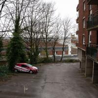
Not a literal run, but I didn't hang about, as I had a job interview to get to (I was an interviewer, not the interviewee, but you still have to be there on time...) Along the way to pick up a lunchtime coffee I mostly seemed to take photos of the high tide, though I also came across a bit of outreach work for small spiny mammals...
Swinging By Sydney Row
01 Apr 2021
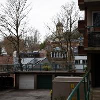
Another workday, another quick coffee excursion. This time I decided to swing past Sydney Row on the way back from the marina car park where Imagine That have their horsebox. I didn't know until recently that the terrace was built for workers at the adjacent dockyard.
I've also gradually come to the conclusion that I don't really think very two-dimensionally when it comes to finding my way around or associating one place with another. I only realised in the last few days that the odd industrial building that takes up the other half of Syndey Row, the one that's always covered with graffiti, is the back of the dockyard works. In my defence, as it's tucked away in a corner of the little industrial estate that I've never ventured into (I rarely find I have a need for the products of safety valve manufacturers), I don't think I've ever seen the front of the building...
I made a "that doesn't auger well" pun on Twitter but hardly anyone noticed it. #dadjoke
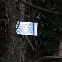
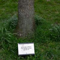
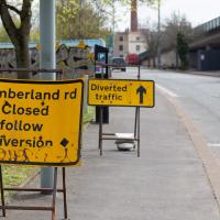
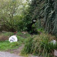
That website doesn't seem to be there, which seems a bit odd for a sign that's only just gone up.
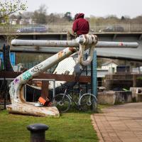
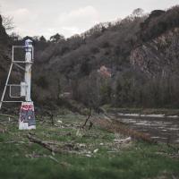
Somebody told me that the four anchors at the corners of Cumberland Basin point to points of the compass. I'm not sure there's that much consistency. The other seem to point NW, NE, and SE; this one seems to be about ten degrees off due east. Maybe I should go down with my compass and check :D
Clifton Village Lunchtime Coffee
07 Apr 2021
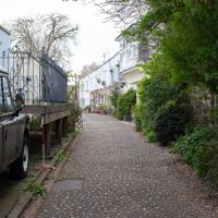
Unusually for my recent lunchtime coffee trips, I managed to find a new road to walk down: Caledonia Mews, which has a little entrance off Princess Victoria Street and runs between it and Caledonia Place. I've noticed it before a couple of times—if you look up from Princess Victoria Street you can see some of it, standing tall above the low buildings on the street itself—but until last night I'd not set foot in it, I think.
As well as focusing on this charming little mews, I looked in on the demolished site of the old WH Smith, and spotted what I think is part of the now-private-houses St Vincent Rocks Hotel that I'd not really noticed before, tucked away between Sion Lane and Sion Hill.
The entrance is on Princess Victoria Street, but I imagine based on the name that it was built as a mews for Caledonia Place, which lies on the other side, forming, with West Mall, the surrounding streets of the Mall garden.
The end of the road. Looks like there's some garden access by a little footpath, but that's obviously rather more private
For some reason I always think of Princess Victoria Street as running north-to-south, but that's because of my terrible sense of direction, I suppose, as it's really more east-north-east.
It's a lovely little mews, and looks very well-kept. I like the way that despite being fairly uniform in size and height that things are a bit more mismatched and higgledy-piggledy once you look a little closer.
I think the corridor you can see running from the back of the building on Sion Hill to the building on the right, on Sion Lane, is part of the old Saint Vincent Rocks Hotel. It was converted into houses, and the front bit, just the main building on Sion Hill, called Trafalgar House now, was on the market for £1,550,000 back in 2019.
The listing mentions:
To the rear a late C19 long brick extension raised on open arches
...anyway. I think it's likely the Sion Lane building was a hotel annex, though I think it's separate flats now. I wonder which of the two sides owns the corridor between them, assuming it really is a corridor? Or maybe even that's flats now...
Next time maybe I'll wander across the green bit and see what I can see over the wall. I think the area just used to be the hotel car park, but there might be more interesting things to see.
Long Bemmie Wander with Lisa
11 Apr 2021
My friend Lisa joined me again, this time for a long wander through "Bemmie". In fact, I tweeted recently using "Bedmo" as my abbreviation for Bedminster, and apparently there's something of a culture war going on. From what I can glean, the longer-term residents call it "Bemmie" and consider "Bedmo" a name made up by hipster gentrifiers.
I had no idea, but then I didn't grow up around here, and I don't live in Bedminster, and I'm not a hipster. I'm not sure I've ever gentrified anywhere, either; Hotwells was already quite gentrified by the time I arrived. I probably just lowered the tone a bit.
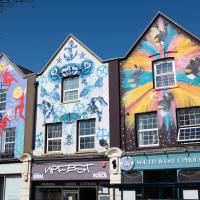
Anyway. Lisa and I entered Bemmie by the traditional toll gate (though actually you'd only have paid if you were coming from the Long Ashton direction, not merely nipping across from Hotwells) and then almost literally combed the streets to knock several new roads off my list of targets. Along the way we saw lots of street art, as you'd expect, and admired the area's panoply of gorgeous knockers.
The reason Ashton Gate is called Ashon Gate is because it's the site of the former turnpike gate between Bristol and Ashton (now known as Long Ashton.) This is the actual toll house, still standing. "The Toll House closed in 1866 and was incorporated c1980 with Toll House Court", says the listing.
Toll House Court is now used by Second Step, a mental health charity, as part of their High Support Accommodation programme to combat homelessness.
The new development on the site of the old brewery (which I visited once for a behind-the-scenes peek with some food- and beer-blogger friends) isn't going down that well with the neighbours.
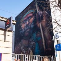
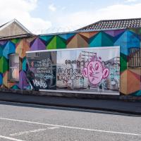
A piece by Dale Grimshaw. There's a great little piece on this here at Diff Graff, including some details of the migrating swarm of bees that interrupted the painting...

Not sure what this collection of buildings around a courtyard is at the end of Exmoor Street. This didn't seem to be its front entrance. Maybe I've seen it from the other side at some point, but I can't put two and two together...
Aha! After a bit of searching on a map, yes, I found them: this is actually the back of the houses in the elbow of Grenville Road, in the distance on this pic. It's just called The Mews, I think.
Better Look at an Extension
14 Apr 2021
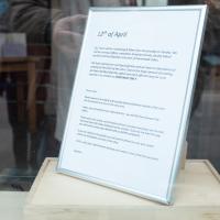
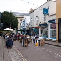
Apart from a lovely coffee and a slice of Victoria sponge from Twelve, there weren't any new sights on this little lunchtime jaunt except for a slightly better look at the long raised extension at the back of the St Vincent's Rocks Hotel, where I at least got to see the arches it's raised up on. I also got a fair bit of exercise by walking up the Zig Zag to get there, and saw far more people out than I have in months, what with the lockdown having just been significantly lifted. As I walked past The Mall pub they were turning people away from their already-full garden, and the (outdoor) cafe tables were pretty full up.
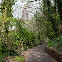
I'll know I'm fit—if it ever happens—when I can get up the Zig Zag without having to stop for a breather. In my defence, it is built up the side of a literal cliff.