Tagged: bristol
A Quick Swing Past Ashton Court
05 Jun 2022
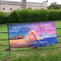
Another day not dissimilar to my last wander: I'm feeling a bit tired and rather than just moping around the house I thought I'd find some tiny bit of somewhere that I'd not yet walked and get outdoors. This time I headed for the Tobacco Factory Market in Bedminster, as I often do, but went the long way around via Ashton Court Mansion as I knew there were some footpaths and a small section of road I'd not ticked off up there. Finishing all the Ashton Court footpaths will be quite a long job, but you've got to start somewhere...
I did feel rather better by the time I got home, and, pretty much astoundingly given the weather forecast, managed to avoid the rain completely.
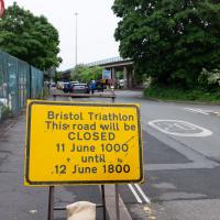
Ah, so it's the triathlon next weekend, then. The swimming bit is done in the Cumberland Basin, so I expect they'll be draining it and re-filling it with fresher water towards the end of the week. I wouldn't fancy it, even in a wetsuit.
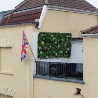
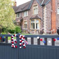
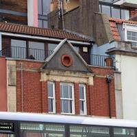
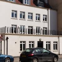
First hint of Jubilee-related decorations on this rather odd balcony at the bottom of Granby Hill. The other decoration on this building is a peeing "KEEP YOU JOB KEEP THE POUND" sticker in the next window along that looks like it dates from the 1990s.
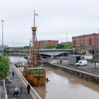
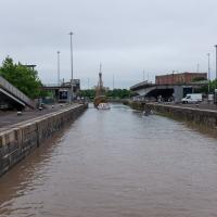
Fairly typical Bristol scene here, as the traffic is held up for a bridge swing caused by a replica of a 15th century caravel.
I'd normally walk over those open lock gates she's just sailed through, but it's easy enough to walk down to the gates at the river end.
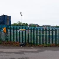
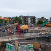
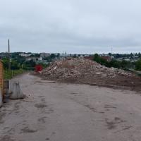
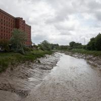
Looks like work has finally started on the new flats on the site of the former railway depot/concrete factory/Bristol International Exhibition site.
Yup, it's definitely all kicking off. They'll probably manage to build an entire development here before the Council finish fixing the bit of Cumberland Road that collapsed just around the corner.
The more I research it, the more I find that Hotwells had far better transport links back in Victorian and Edwardian times than it has today. Along with buses that went to more useful places than the City Centre, there were trams, the funicular up to Clifton, the landing stage for paddle steamer services and two railway stations all within easy walking distance of me.
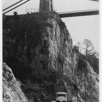
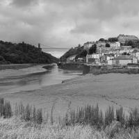
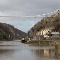
Today I took a day off work as preparation for doing the bookkeeping for my tax return1, and took a wander along to the site of what would have been my nearest station, Hotwells (or Clifton, as it started out in life), nestled in the shadow of the suspension bridge, the Bristol terminus of the Bristol Port Railway and Pier.
From there I wandered down the Portway, following the original line, until I got to the area around Sneyd Park Junction, where the tunnel from the slightly later Clifton Extension Railway joined up with this originally-isolated BPR line. Then I headed up to Clifton through the "goat gully" at Walcombe Slade, seeing the few above-ground bits of evidence of the tunnel (which is still in regular use) along the way.
It was a lovely day, and a good walk, and it was interesting to daydream of the times when I could have walked a few minutes from my flat down to Dowry Parade, caught a short tram ride to Hotwells Stations, and then headed from there to Avonmouth, perhaps even to board a transatlantic passenger service. The completion of the Clifton Extension Railway that linked the Avonmouth station with Temple Meads made relatively direct transatlantic travel from London via Bristol possible, with passengers travelling up from Paddington to Temple Meads, on to Avonmouth on the Clifton Extension Railway and Port Railway and Pier line, then perhaps catching a Cambpell's paddle steamer—which sometimes acted as tenders for large steamers—to a larger ship that was headed out for Canada, say.
1 I've learned that the best approach is to take two days off and deliberately do something that's not my bookkeeping on the first day, as otherwise I just inevitably end up procrastinating and feeling guilty on the first day no matter what. I have an odd brain, but at least I'm learning strategies for dealing with its strange ways as I get older...
2 Information mostly gleaned from Colin Maggs' The Bristol Port Railway & Pier and the Clifton Extension Railway, The Oakwood Press, 1975.
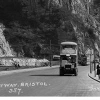
Here we see the Portway road, presumably fairly shiny and new, after many, many things, including the railway line from Hotwells to Sea Mills, were removed to make way for it. As you can see, they've done a splendid job of redeveloping the space where the station was into a little mini-park area, back in the day when the traffic wasn't a constant rush of noise and fumes and you didn't have to scamper across like you were playing a game of Frogger. It might well have been a pleasant place to sit. It certainly wouldn't be now.
Also, guess what there is fencing in the park area? Yes, some nice iron railings. I have no idea whether these are same ones I found—today's seem in surprisingly good nick considering this photo would have likely been taken almost a hundred years ago, and also how many railings were torn up during WWII.
This photo was taken before the war, as you can see a tram still running in the background—a Luftwaffe bomb took the tram system down in 1941 and it was never replaced. It also was obviously taken after 1926, as the Portway opened to traffic on 2 July 1926, having cost £800,000 to build, about £47m in today's money. So, that fixes it to a 15-year period, I think, but I'm not enough of a historian to be able to pin it down further.
Bottom section of the postcard. I like the way there's a bus and a tram in it, but I'd quite like the bus not to be there so we can see the whole of the former station site. Motion blur makes it hard to figure out the bus and tram details.
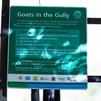
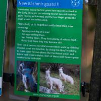
People know this as the "goat gully" these days, but the official name is Walcombe Slade. (So valleyish they named it twice, perhaps, as both "combe" and "slade" mean "valley".)
I did not see hide nor hair of a single goat the entire time I was in the goat gully. I clearly need to spend a bit more time there.
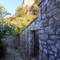
I'm pretty sure from looking at some maps that this is the gate that would have led to Prince's Lane, if it were still passable.
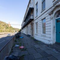
St Vincent's Parade looking a bit more run-down than normal. This street, like the one I live in, was built as lodging houses for visitors to the hot wells. I imagine it was quite a pleasant aspect before later developments like the building of the Portway.
I didn't go inside, just shot through the gate with a steady hand. I have been in there, though, on one of the open day tours.
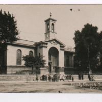
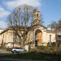
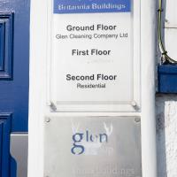
I headed to Bedminster to do a crossword with my support bubble today. On the way I delved into a couple of bits of Hotwells history, first of all snapping a "now" shot to go with a historical photo of Holy Trinity I happened across recently, and second of all to snap the Britannia Buildings.
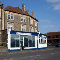
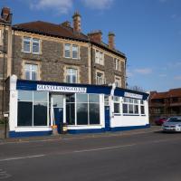
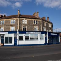
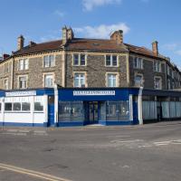
The Britannia Buildings are a little strip of offices on a corner of the Hotwell Road. They've mostly been the headquarters of a cleaning company for years, but I've often wondered what this distinctive curve of offices, its ground floor standing proudly out from the upper floors, used to be. Well, after my last wander, where I poked about the landing stage just down the road, I found out! Researching the paddleboat company P&A Campbell I came across this nugget in The A-Z of Curious Bristol, by Maurice Fells (£):
The firm of P & A Campbell was the main steamer operator in the Bristol Channel, with its local headquarters in offices close to the Hotwells pier and overlooking the harbour at the Cumberland Basin. Campbell's named their offices Britannia Buildings, after one of the ships in their White Funnel Fleet.
So! Turns out the Britannia Buildings were named after a paddle steamer—you can see some pictures of Britannia here.
In related news, I've now bought three of Maurice Fells' local history books, and they were hand-delivered by the author on Sunday, a half-hour after I ordered them online (through a message exchange on Nextdoor!) Not even Amazon Prime has managed to deliver me anything that quickly...
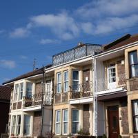
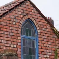
Noticed this interesting roof feature on 14 Oldfield Place as I was crossing the road to get a longer view of the Britannia Buildings.
The Britannia Buildings were named for a paddle steamer in the P&A Campbell fleet, who used to have thier headquarters here.
There's some pictures of the Britannia, built in 1896, on the paddlesteamers.org site
Quick Around-the-Harbour Wander with Lisa
20 Mar 2021
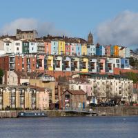
My friend Lisa was meeting another friend for a walk near the suspension bridge, so we fitted in a quick harbourside loop from my place first. We discussed gardening (we're both envious of the gardening skills of the Pooles Wharf residents; we can just about keep herbs alive, whereas they're growing heartily-fruiting lemon trees outdoors in England along with everything from bonsai to magnolias), cafes, work and architecture, among other things.
I've probably snapped this before, as it's just the kind of detail that catches my eye every time.
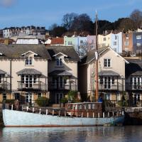
There's a lot of pretty amazing gardening goes on on the harbourside stretch between the Pump House and the Grain Barge.
This was one of the details I used to line up my "after" pic of Mardyke with the 1930s "before" pic on my last wander.
Something smelled very nice when we wandered past here. Maybe I'll have to give them a try for lunch one day this week.
Strangers' Burial Ground
04 Dec 2020
I tried to find the Strangers' Burial Ground the last time was up in Clifton, but I'd not realised that Lower Clifton Hill continues further on after the turning with Constitution Hill. Sadly it was chained shut, but it still looks beautifully-maintained, perhaps by the same man referenced by this story from John Hodgson, which helped me find it. Apparently Thomas Beddoes is buried here.
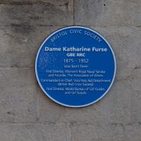
Now that's some serious achievement:
Dame Katharine Furse, GBE, RRC (née Symonds; 23 November 1875 – 25 November 1952) was a British nursing and military administrator. She led the British Red Cross Voluntary Aid Detachment force during the First World War, and served as the inaugural Director of the Women's Royal Naval Service (1917–19). Furse was also the first Director of the World Association of Girl Guides and Girl Scouts (1928–38).
Although, given the sign, perhaps I shouldn't have. But I didn't think they'd object terribly. I've actively interested in living here; a couple of flats have popped up on the market in recent times and the views are amazing.
A New Wander, a New Cafe
21 Apr 2021
Obviously, I was trying to connect to the industrial history of the Canon's Marsh area, to the old gasworks, the docks railway, the warehouses they blew up to make way for all the rather soulless modern stuff (though I do like the Lloyds building, at least.) But what I mostly got out of today's walk is a new cafe to go to for my lunchtime outings. It's perhaps a little closer than both Imagine That and Hopper Coffee; not quite as close as Foliage and Twelve up in Clifton Village, but also not at the top of a steep hill.
No, not the mediocre Costa, but only a little way away from there: Rod and Ruby's, which opened in 2018 and which I've seen in passing several times but never popped into until today. What can I say? I was foolish. Great flat white, lovely interior, astoundingly good cannoli.
Sometimes you just have to get your head out of history and enjoy a pastry.
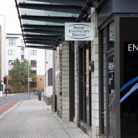
Here's a weird thing that I always remember when I spot the endoscopy centre: in January 2019 there was a "Major emergency response after incident in city centre", where "Six taken ill after mystery substance is hurled from window near Harbourside".
As far as I know, the Bristol Post—who back then were basically just a Twitter aggregation service rather than an actual newspaper—never did any follow-up stories on what the substance was, or what on earth this was all about, but I do know the window that they mystery substance was hurled out of (or possibly into, the story's a little self-contradictory on that point) was a window of the Prime Endoscopy centre. The mind boggles.
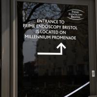
I was trying to find the Endoscopy centre's back door for a visual pun, but the only one they've got the sign on is the side door, which is far less funny. Still, I tried.
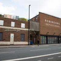
I know very little about the history of these buildings. There's a removals firm called Robinsons with some links to Bristol, and a building in Brimingham with an old sign saying "Robinsons Furniture Depositories", so I suppose it's possible this is a long-defunct furinture repository for a removals firm. Last planning application I can find is from 1998, before I even moved to Hotwells, granting permission to demolish "two storey office building and single storey store", which very much sounds like these two buildings.
The bit on the right still has a sign up saying it's Gnodal and Bioinduction—the firms whose car park is around the back—though Gnodal is defunct and Bioinduction sadly don't have any pictures from the Bristol office on the one-page website.
I really must poke my nose in and see if there's anything more than the apparently-tiny couryard back there.
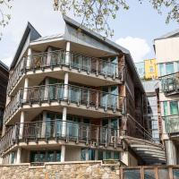
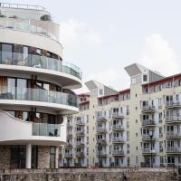
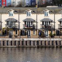
I actually quite like this one, especially the pointed fronts of the living spaces. Decent size balconies, too.
A Long Wander Of Miscellany and Magick
08 Aug 2021
This was a wide-ranging wander. I started off crossing the river to Bedminster, to walk a single little cul-de-sac, Hardy Avenue, that I'd managed to miss on at least one previous walk. Then, pausing only to explore a few back alleyways, I headed for a few destinations related mostly by the Hughes family, who I've been researching a little as part of background for a possible novel, as several of them were involved in the Stella Matutina.
However, mostly it's the artistic side of the family I wanted to explore today, as that's where most of their public history lies (as you might expect, there's often not much in the public record about the workings of an occult organisation.) First I visited College Green, where the façade of the Catch 22 Fish & Chip shop still bears the work of Catherine Edith Hughes. Then I wandered up to the top of Park Street to pop into the Clifton Arts Club's annual exhibition, as Catherine, her half-brother Donald, his wife Hope and at least two other Hugheses were members. Donald was chairman for 40 solid years; Hope was Secretary for eight, and Ellard and Margaret Hughes, two more Hughes siblings, were members along with Catherine.
Finally I walked home with a small diversion to Berkeley Square, to confirm the location of Donald Hughes's house by checking for a particular plaque by the front door.
I must admit I'm not entirely sure where all this research is really leading me, but I'm finding it quite interesting to bump across the faint lines of history that link the Hermetic Order of the Golden Dawn, founded in 1888, to modern, quotidian Bristol.
Currently the University of Bristol's Beacon House, it was originally the Queens Hotel, built by William Bateman Reed, who also built a stretch of Victoria Square, among other things. Every Bristolian older than thirty probably still thinks of it as "the old Habitat building", though. I've got curtains in this very room that were bought there...
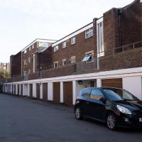
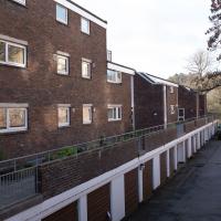
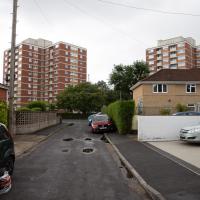
This may be a more interesting view than you'd think at first sight. Whitemead and Winterstoke House, with Southbow House out of sight on the far side, were finished in 1962, as the post-War housing crisis continued. There's a fascinating article in the Bristol Post about them, especially Whitemead House, the block on the left here, which was famously used for external scenes in Only Fools and Horses after filming moved to Bristol, standing in for the fictional Nelson Mandela House in Peckham where the Trotters lived.
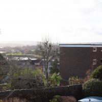
My guess is that these rental parking spaces are very popular when there's a match on at Ashton Gate. I could hear the cheering coming from the stadium from my front room in Hotwells over this weekend (I'm writing this on October 3, 2021, as I've got a bit of a photo-processing backlog!) so it seems that biggish matches—either football or Rugby or both—are back on.
I was just about starting to feel better—the antibiotics seemed to have kicked in for my dental issues, and it had been some days since I'd left the house, and I was at last starting to get itchy feet. So, a wander. But where? Well, there were a few industrial bits near Winterstoke Road in the Ashton/Ashton Vale areas of Bristol that needed walking. I knew they were likely to be quite, well, unattractive, frankly. So why not do them while I wasn't feeling exactly 100% myself? Maybe it would fit my mood. Hopefully you're also in the mood for a bit of post-industrial wasteland, for that's what some of this feels like...
Then, at the last minute, I thought again about the Bristol International Exhibition—I've got a book about it on the way now—and that gave me another goal, which could just about be said to be in the same direction, and I decided to walk significantly further than my normal 1-mile limit and try recreating another historical photo...
Sadly I don't know much about the Ashton area; it's just on the edges of my mile and I rarely have cause to go there. It's brimming with history, I'm sure: the whole South Bristol area rapidly developed from farmland to coal mines to factories to its current interesting mixture of suburbs and industrial work over the last few hundred years. As a more working class area less attention was paid to it by historians, at least historically-speaking, than the Georgian heights of Clifton, and much of it has been knocked down and reinvented rather than listed and preserved. I see here and there some of this lack is being addressed, but I'm afraid I'll be very light on the history myself on this wander, as most of my usual sources aren't throwing up their normal reams of information as when I point them at Clifton, Hotwells or the old city.
Source: Bristol Archives, Vaughan Collection.
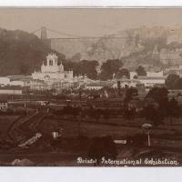
Here we look, apparently from Bedminster Down, towards the "white city", the Bristol International Exhibition buildings of 1914.
This is the photo I've trooped all this way to reproduce. Have I managed to find the right spot?
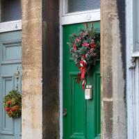
I think the whole of (admittedly-short) Albemarle Terrace had wreathes on the doors. Nice.
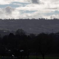
These are some hills I'm not heading for today, but I love the distant view of Dundry from Hotwells. The silhouetted church towards the left is St MIchael's Church, Dundry, whose tower was built in 1481.
The other towers around Dundry have more recent heritage. I believe Dundry East transmitter still sends out the analogue signal for BBC Radio 4, and lets me listen to The Archers on an old Roberts radio when I'm doing my cleaning on a Sunday morning. Some bits of my life are still quite old-fashioned.
This may be somewhere around my actual destination today, though perhaps a little too much toward the east.
The buildings and green space on the hill in the background are the Knowle West Health Park. I'm pleased to have figured this out by using an OS map and a ruler and projecting a line from where I'm standing through the Tobacco Factory flag that you can just see poking up from Bedminster (you can see it on the corner of the building in this earlier pic](https://omm.gothick.org.uk/image/7175), then looking for densely-packed contour lines further out of town. Very old-school, but it worked!
I'm probably heading in more of a Bedminster Down direction. It's a similarly elevated green space further west, which is hidden behind the bond warehouse on the right in this pic.
I nearly didn't take this photo, having snapped this view so many times before, but I do find it almost completely irresistible.
I've often wondered about writing some kind of neural-computing based app that could look through all of my photos for snaps of this view and mash them all together into a time-lapse, or something, but that would be quite the project.
Here's the BBC report. This was posted on a telephone junction box in the "Daveside" area, the little strip of Festival Way that's used as a skate park in between the old railway depot and the White City allotments.
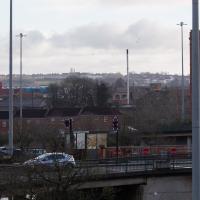
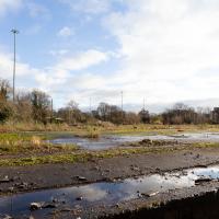
A better view of the ex-railway depot and part of the former Bristol International Exhibition site that I've mused about before. That's why we're on this wander, in fact: curiosity about an old photo of the site. But not a photo from round here: one taken from quite a ways beyond my normal mile radius. It's going to be a bit of a hike.
There will also be some terrifyingly industrial bits of south Bristol along the way, so be prepared for a bit of urban decay and industrial scenes.
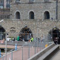
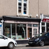
I noticed I had a few things on my "potential wanders" list that could all be done relatively close to home, and in a fairly straight line, so I set off at lunchtime to recreate a photo of a now-defunct pub, wander behind a Spar (which turned out to be more interesting than I'd expected, but I admit it's a low bar) and spend some time browsing in Dreadnought Books before coming home via a coffee from Spoke & Stringer, a little diversion up Gasworks Lane and a tiny bit of the Rownham Mead estate I'd somehow previously skipped.
On St George's Road. This is where I ended up spending most of my stopping time on the walk. I managed to resist most temptations and came away having only spent £2 on a paperback of The Mill on the Floss. I read Silas Marner a while back and really liked it, so I've been wanting to try some more Eliot.
I shall add it to my tsundoku collection.
Uncredited apart from "from our archives" and undated, this photo appeared in this article on Hotwells in the Evening Post and made me want to re-create the same view today.
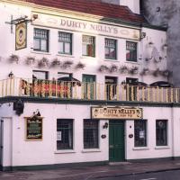
The pub had a few changes of name over time—in the Bristol Then and Now Facebook group people recall this being the Spring Gardens in the 1950s, 60s and 70s. Someone remembers it turning into Durty Nelly's in 1995, but I swear it was back to being the Spring Gardens again by the time I moved to the area in 1999. Then it spent some time as La Demi Lune, which you can see on Street View in 2008, and then by 2009 it's back to The Spring Garden (without the "s").
So, from what I can work out, this snap was probably taken in the 1990s, most likely between 1995 and 1999.
This pub—which did good food, and had an extensive garden at the back, from what I remember, when it was the Spring Gardens in the early 2000s—is rather more bland in looks today, as we'll see in the next picture.
Here's the Spring Garden(s)/Durty Nelly's/La Demi Lune as it looks today. Rather dull modern accommodation, sadly. I understand they may have extended the building back into the garden to make it roomy enough to be flats.
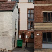
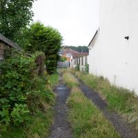
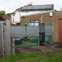
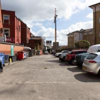
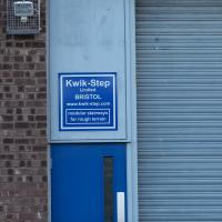
Here we are at the end of Pembroke Place, wandering a little alleyway I'd not previously filled in on the map. I didn't have high hopes for much of interest in this parking area behind Spar and Marcruss Stores. However, I did find something interesting, as we'll see in a couple of photos' time.
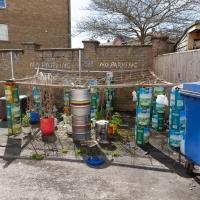
I can only guess that the Raj Bari restaurant has been trying to grow their own herbs and spices. Doesn't look that successful at the moment, to be honest, but maybe I'm looking at things that aren't in season...
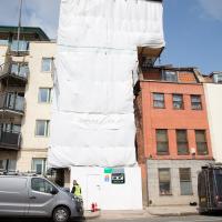
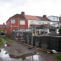
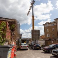
Not much to be seen in this direction except the crane on the site where they're busily filling a gap with new flats. We'll see the front in a little while.
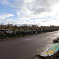
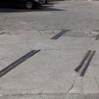
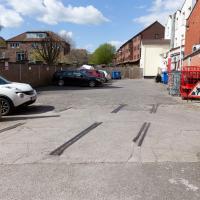
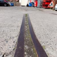
Remnants of the docks railway. These ran around the harbour to Ashton Avenue Bridge to the west, and along to the main Goods Depot at Anchor Lane to the east.
I think this may be the last visible remnant of the harbour railway on this entire stretch of the Hotwell Road. There may still be some tracks around Canons March—that whole area south of Anchor Road had a lot of rail lines—but I've not seen any others west of Jacobs Wells Road.
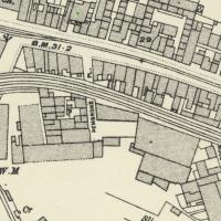
On Know Your Place you can check out old maps of Bristol. Sadly there doesn't seem to be an easy way of linking to a particular map/location. Still, here's a little screenshot of the 1898-1939 layer. These tracks are still there on the later 1949 map, so at least this section survived the war, I think.
Having checked Wikipedia I think this section, which ran from Canons Marsh to Ashton Avenue Bridge and then on to the south was created in 1906, and closed in 1965.
This map fragment will be © Ordnance Survey.
Quick Coffee
19 Nov 2020
A sunny day, and though I should have probably headed for less well-travelled territory I just headed over to the Marina to grab a flat white from Imagine That's horsebox café.
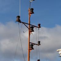
I'm not entirely sure why this little pole seems to need so many red lights, or what the tiny circular thing that looks like a specialist antenna is at the top (there's clearly a few other antennas, and I also have no idea what they're for.) Just part of the varied harbour infrastructure I walk past every day and would probably be fascinated to hear about if I knew who to ask...
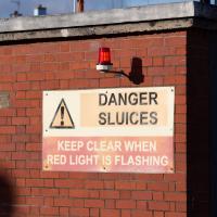
What, should I keep clear from this side? I'm assuming that this doesn't actually affect anything on dry land...
