Tagged: city
Nothing New
02 Dec 2020
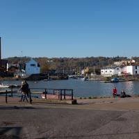
This may be the very first time I've gone for a One Mile Matt wander and not actually gone down any new roads, trod any new steps. I just wanted a coffee, frankly, so I went the same old way to Imagine That in the marina and back again.
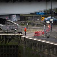
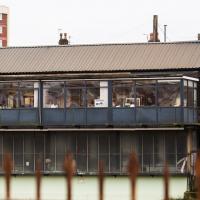
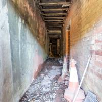
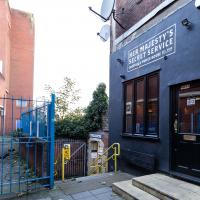
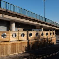
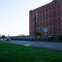
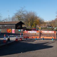
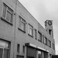
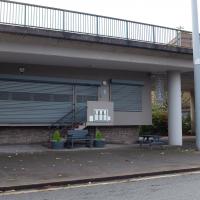
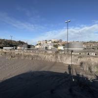
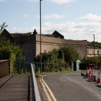
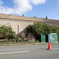
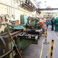
An office for one of the industrial places along Coronation Road; I think this is the back of the metal spraying yard rather than the tannery.
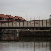
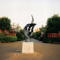
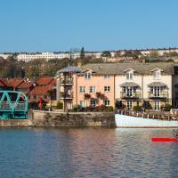
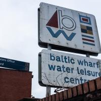
I shot this on a film camera when I lived at Baltic Wharf during the mid-nineties. Interesting to compare with the present day, I think. "Hand of the River God" by Vincent Woropay has lost its figure of Hercules carrying an obelisk in the meantime.
The more I research it, the more I find that Hotwells had far better transport links back in Victorian and Edwardian times than it has today. Along with buses that went to more useful places than the City Centre, there were trams, the funicular up to Clifton, the landing stage for paddle steamer services and two railway stations all within easy walking distance of me.
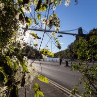
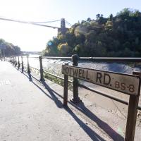
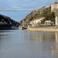
Today I took a day off work as preparation for doing the bookkeeping for my tax return1, and took a wander along to the site of what would have been my nearest station, Hotwells (or Clifton, as it started out in life), nestled in the shadow of the suspension bridge, the Bristol terminus of the Bristol Port Railway and Pier.
From there I wandered down the Portway, following the original line, until I got to the area around Sneyd Park Junction, where the tunnel from the slightly later Clifton Extension Railway joined up with this originally-isolated BPR line. Then I headed up to Clifton through the "goat gully" at Walcombe Slade, seeing the few above-ground bits of evidence of the tunnel (which is still in regular use) along the way.
It was a lovely day, and a good walk, and it was interesting to daydream of the times when I could have walked a few minutes from my flat down to Dowry Parade, caught a short tram ride to Hotwells Stations, and then headed from there to Avonmouth, perhaps even to board a transatlantic passenger service. The completion of the Clifton Extension Railway that linked the Avonmouth station with Temple Meads made relatively direct transatlantic travel from London via Bristol possible, with passengers travelling up from Paddington to Temple Meads, on to Avonmouth on the Clifton Extension Railway and Port Railway and Pier line, then perhaps catching a Cambpell's paddle steamer—which sometimes acted as tenders for large steamers—to a larger ship that was headed out for Canada, say.
1 I've learned that the best approach is to take two days off and deliberately do something that's not my bookkeeping on the first day, as otherwise I just inevitably end up procrastinating and feeling guilty on the first day no matter what. I have an odd brain, but at least I'm learning strategies for dealing with its strange ways as I get older...
2 Information mostly gleaned from Colin Maggs' The Bristol Port Railway & Pier and the Clifton Extension Railway, The Oakwood Press, 1975.
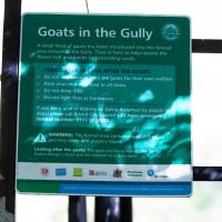
People know this as the "goat gully" these days, but the official name is Walcombe Slade. (So valleyish they named it twice, perhaps, as both "combe" and "slade" mean "valley".)
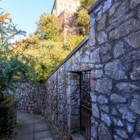
I'm pretty sure from looking at some maps that this is the gate that would have led to Prince's Lane, if it were still passable.
I didn't go inside, just shot through the gate with a steady hand. I have been in there, though, on one of the open day tours.
Not many people realise that it's still the Hotwell Road even out this far. It only becomes the Portway at the junction with Bridge Valley Road.
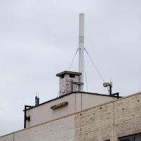
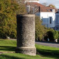
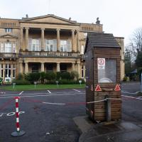
This is the Pembroke Road ventilation tower, sometimes known as the "pound tower", as it's next to the pound the Downs maintenance people use for equipment storage.
From To Keep Open and Unenclosed, the Management of the Durdham Down Since 1861, Bristol Branch of the Historical Association, 2005:
...construction of the tunnel began immediately at Cooks Folly Wood, the top of Pembroke Road and two other points. The Pembroke Road shaft was subsequently retained to ventilate the tunnel. The sinking of this shaft had reached rail level by May 1872 when Captain Beaumont's compressed air diamond drilling machine came into use. Most of the machinery associated with the diamond drilling machine was on the surface: the machine had a 4" diameter compressed air service from a 50 hp steam engine at the surface. By comparison, the engine to lift spoil and water from the tunnel was only 20 hp. The drill had to be cooled by water which was run into trucks and presumably wound to the surface. Dynamite charges were set in the holes after the dynamite had been softened by steam before use! On 10th May 1872 four pounds of dynamite exploded while being 'softened' at 2.30 a.m. blowing off the engine-house roof and smashing windows in the three houses facing the Downs at the top of Pembroke Road. Fortunately no-one was injured and when the glazier called at one house he found that the occupant had slept through the whole episode!
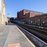
I think this is the very first time I've set foot on Clifton Down Station platform. I believe this is the platform for the "up" trains, if I'm getting my terminology right, but I think it's a fairly arbitrary choice, as much of the line is single track.
I have, however, spent an evening in there. They do a good Old Fashioned and an excellent Manhattan, from (somewhat hazy) memory.
Very Local
06 Nov 2020
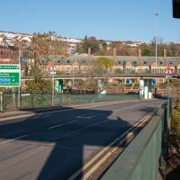
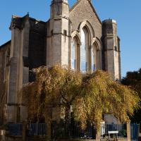
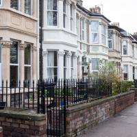
It's surprisingly easy to overlook the giant Wesleyan Grenville Chapel—now converted into flats—if you've lived here a while. Other sights that seem to slip from my memory include the modest Ashton Avenue, a tidy terrace of little houses on a road that presumably gave its name to the Ashton Avenue bridge.
There is no view of this chapel that isn't obsured by something, I think. Nice tree, mind. It's flats, now, of course.
Rear seating area at the under-flyover Lockside restaurant (The Venturers Rest, and Popeye's Diner as-was, as well as being Sid's Cafe in Only Fools and Horses.)
A Cliftonwood Revisit with Lisa
10 Jul 2021
Lisa had a couple of hours to spare before going up in a hot air balloon (exciting!) so we went for a quick local walk, revisiting a bit of Cliftonwood we've seen before, exploring the secret garden I'd visited before that I thought she'd enjoy (I didn't take any new photos there) and then pushing on to another garden, Cherry Garden. Last time we passed this way, I'd noticed the gate, but we hadn't gone in as I'd assumed it was private. I'd since found it on CHIS's list of communal gardens in Clifton, so I wanted to have a look inside this time, and try to figure out whether it was private-communal or public, and possibly Council-owned, like several of the other gardens in Clifton.
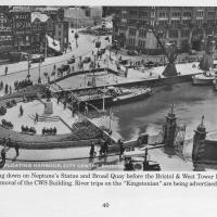
Photo taken from the book Bygone Bristol: Hotwells and the City Docks, by Janet and Derek Fisher.
You can see the gate from the previous photo at the start of Narrow Quay. Plenty of other changes in the area, too: the statue of Neptune stands at the head of the water; there are no Cascade Steps yet; cranes still stand on Broad Quay, and you can just about tell that there's still a main road running right across the middle of Queen Square in the distance.
The gate stands half-closed; presumably before the E and W sheds were converted into the cinemas, bars and restaurants of the Watershed and other publically-accessible attractions there was still some need to keep the (working) dockside a little more secure, and I'm guessing it might have been locked at night.
The gates are listed and have apparently been there since 1894.
The rather tumbleodown letters remind me of the tricks played with both Fawlty Towers and Sunshine Desserts.
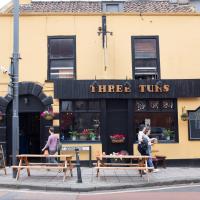
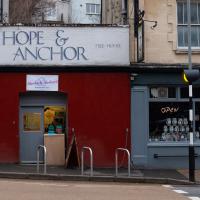
Seemed to be open and busy, which is good. It's always been a good, friendly pub, but I understand it's been on the verge of closure a couple of times recently.
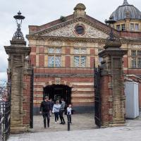
...with the end of "Jacobethan" Transit Shed "E". The end facing and baroque tower were apparently created to make looking this way from the centre a bit more pleasant; it's fairly plain further down. This is a smidge outside my one mile, but I was interested in the gates, having spotted them in a historic photo in one of my research books—see next pic.
There are some other pics from earlier times on the Watershed's web site, including one from 1981, not long before the E and W sheds were transformed into the complex that houses the excellent Watershed Cinema, their Cafe Bar, the Pervasive Media Studio and other modern features.
Underpass
25 Nov 2020
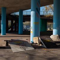
A quick lunchtime jaunt for coffee. I've often wondered about the dots on the wall of the underpass. Apparently they're not intelligible Braille. Maybe it's Marain :D
The Cumberland Basin Flyover System is indisputably ugly, I'd say. At least you get presented with the rather lovely pink of the Rose of Denmark when you get through it and swing around onto the main Hotwell Road into town.
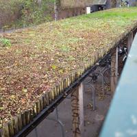
Given that it's on an unwalled bike shed, I doubt it's there for insulation. The CREATE centre my just have it there as an example of what an eco-friendly roof can look like, though.
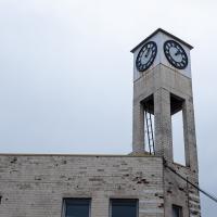
One of the other sides of this clock is very broken. At least these two show the same time, even if they're wrong. By my calculation, this broken clock is right six times per day.
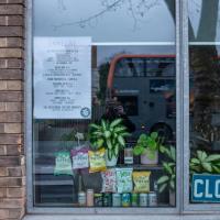
At least someone's still watering the plethrora of plants that are arranged in Spike Island cafe's windows.
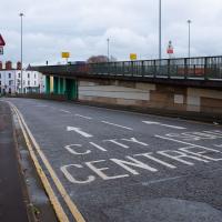
I don't think I ever crossed this bridge on foot before starting my "One Mile Matt" project.
When I first moved to Hotwells, there were still signs for the famous transport caff "Popeye's Diner", a well-known refuelling point for truckers on the way in or out of Bristol. It was also the cafe used for interior shots in some episodes of Only Fools and Horses. You can see it as it used to be in the "Trigger's broom" sketch, for one. These days it's a much posher affair, and they do a very good Eggs Benedict when they're open.
You can see a before/after comparison of how the interior looked when I moved to the area in the 1990s and how it looks now in this shot on Flickr that compares an Only Fools and Horses still with a modern shot.
I really must try another long-exposure with ND filters here; it looks very strange with the water made artificialy still like that, and I enjoy the effect.
Bower Ashton is an interesting little area just south of the river from me—in fact, the Rownham Ferry used to take people over from Hotwells to Bower Ashton, operating from at least the twelfth century to around the 1930s.
It's a strangely contradictory little area, with a cluster of old and new houses sandwiched in between the busy A-roads and significantly more industrial area of Ashton and the bucolic country estate of Ashton court roughly east to west, and also between Somerset and Bristol, north to south.
I've been around here before, mostly poking around Bower Ashton's arguably most well-known bit, the Arts faculty campus of the University of the West of England, but I'd missed at least Parklands Road and Blackmoors Lane, so I initially planned just to nip across briefly and wander down each in turn. On a whim, though, I texted my friends Sarah and Vik in case they were out and about, and ended up diverting to the Tobacco Factory Sunday market first, to grab a quick flat white with them, extending my journey a fair bit.
To start with, though, I nipped to a much more local destination, to see something that you can't actually see at all, the Gridiron...
(I also used this wander as a test of the cameras in my new phone. I finally upgraded after a few years, and the new one has extra, separate wide and telephoto lenses compared to the paltry single lens on my old phone. Gawd. I remember when speed-dial was the latest innovation in phones...)
You can still see some ladders in place, I can only presume they were there to get you down to the gridiron, but that is just a guess; information on it seems quite hard to find.
One last snap before we move on. I'm using the wide lens on the iPhone here, and have managed to include a silhouette selfie...
I decided to try out the three lenses on my new iPhone camera. This is the "telephoto" lens. It does a reasonably creditable job, though the phone is oversharpening things a bit and I'm not sure I like the colours much.
It's a nice little terrace, but given that it backs onto the city ground, I'd imagine you have to be a football fan to really enjoy it here.
At this point I've already abandoned my original plan of heading straight to Parklands Road, as some friends had texted me to say there were at the tobacco factory market and would I like to join them for a coffee? Best laid plans, so forth...
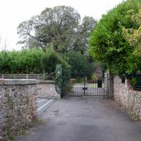
The original entrance to the Ashton Court Estate, apparently. The Clifton Lodge entrance is rather grander.
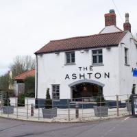
It's got the grazing field at the front and school playing fields at the back, and the road it's on isn't manic. Does this count as a Somerset "country" pub I can walk to?
This used to be called The Dovecote, but was gutted by fire in 2014 and re-opened under the new name the following year.
Aha! The end of Parklands Road, which, when I set out, was going to be my first target. Well, I got there in the end. Looks like the end is a gated-off residence, so it's just as well that alleyway was here. Following my nose has got me where I wanted to be...
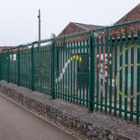
Can't find out much about this place. Not sure I've ever seen any activity there, but I probably only pass by outside normal Monday to Friday working hours. Looking back on a post-War OS map, it's marked as a concrete works, back in the day. There's a tiler and a mason registered at the address, so it certainly still has some connection with stone.
It's certainly not very decorative, with its razor-topped fencing. I suppose the gabions full of rip-rap are at least in keeping with a stone yard...
A Promenade on New Year's Day
01 Jan 2021
I wandered along the gorge today and found the entrance to the disused Portnalls Number 1 railway tunnel of the Bristol Port Railway and Pier. The door was unlocked, but as soon as I opened it I felt a sense of current habitation and decided discretion was the best option. There's a lot of people homeless in Bristol at the moment, and they don't need disturbing. For the same reason, I've omitted posting some pictures of a little encampment somewhat off the beaten track of the new Zig Zag, where I reversed direction as soon as I realised I'd come across a current habitation of some sort.
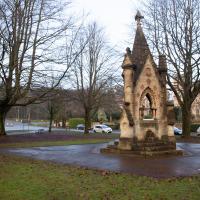
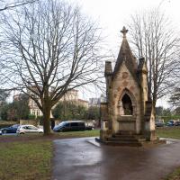
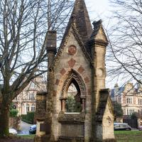
Up in Clifton it took me a little while to work out that the picture of the Promenade I was trying to reproduce was taken from the viewpoint I'd thought, it was just that the Alderman's fountain was moved from the top of Bridge Valley Road to the other side of the promenade in 1987, so trying to use it as my initial landmark wasn't very helpful!
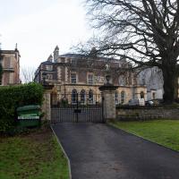
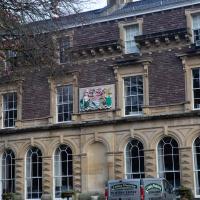
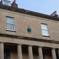
Finally I swung past the Society of Merchant Venturers, who presumably still own most of Clifton, having bought the entire manor, including Clifton Down, in 1676, and I imagine aren't in much danger of running out of money. That's true to their motto: indocilis pauperiem pati is apparently from the Odes of Horace, and translates as "will not learn to endure poverty"...
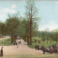
This postcard is from somewhere between 1900 and 1920, courtesy of the Historic England archive.
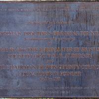
This is the view I was trying to recreate -- note that the Alderman Proctor's Drinking Fountain is now on the other side of the promenade (see my photo, next), having been re-sited in 1988 after apparently causing problems for the traffic at the top of Bridge Valley Road.
Engineer's House, built for Charles Pinney, who became mayor of Bristol. "t is now used as offices, a training centre and a conference venue." I love the little sentry box.
Apparently it was previously known as Camp House. I'd guess that may relate to the Iron Age camp on Observatory Hill.
One Albermarle Row, Granby Green and... People
12 Mar 2021
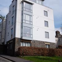
I was browsing some historical photos the other day, and came across "Rear of Unspecified House" in the Bristol Archives' John Trelawny Ross collection, and immediately recognised it as being the back of 1 Albermarle Row, just around the corner from me. I've not had much time to research the history of this odd little addition to Albermarle Row, or what happened to 1-4 Cumberland Place, number 4 of which used to be attached to the side of 1 Albermarle Row, but it was interesting to look at old maps for a few minutes and work out what used to be where.
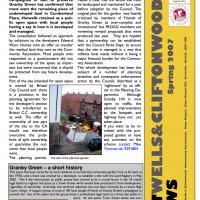
That all connects with the little local bit of land at Granby Green, too, as it used to be numbers 1-3 Cumberland Place. There was something of a planning battle over Granby Green, and I've included an old edition of Hotwells & Cliftonwood News that I found online, a copy of which would have been popped through my letterbox at the time.
I was also inspired by some old pictures of Hotwell Road to try to put a few more people in my pictures, though I set my pre-focus a couple of extra metres out from normal to make sure I didn't get too close to anyone!
There was a suggestion that the new green space below Wallace Place be called "Gromit Green" :D
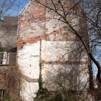
...or rather, the remaining imprint of 4 Cumberland Place on the side wall of 1 Albermarle Row. I don't know why the houses of Cumberland place on the right at the top of the hill disappeared. It seems to have been a gradual process; 1-4 are there on a 1946 aerial photo, then on the 1947-1965 OS maps number 1 has disappeared, and then in the jump to the modern day the whole lot's gone.
I'm afraid that this is a bit of a badly-curated wander, where I mostly just popped out to find out a little of the history of Underfall Yard and poke around the various open workshops, and, in hindsight, really didn't take pictures in any kind of coherent order. So there's a lot of pictures, but they don't really tell the story that, in hindsight, I seem to have been trying to tell, of the unusual electrical substation in Avon Crescent, the Bristol Electricity that predates the National Grid but is still in use, the history of the hydraulic power house... It's a bit of a mess.
But I suppose sometimes these wanders—always chronologically presented in the order I walked and took photos—simply will sometimes be a bit of a mess. Let's hope you still get something out of it, anyway...
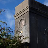
It's very hard to get a decent look at this building. This is the top half of the back of it.
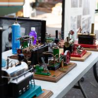
Part of the open day was this delightful collection of miniature steam engines and an on-demand explanation of how steam power works for anyone who was interested.
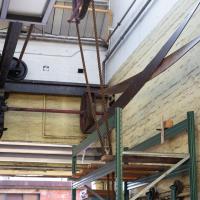
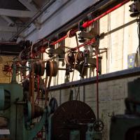
Most of the gear in this docks machine room is belt driven from a motor we'll see in a bit. The motor is electric but the drive system is pretty much the same as it was in the days of steam.
I should probably have started this little tour with a general view of the place, but I wasn't really thinking with a great sense of planning on this wander. I'm afraid the photos are all a bit randomly-ordered.
Jacob's Well Wander
01 Feb 2021
I just wanted to get some exercise, really, so I set out to knock off the lower bit of Jacobs Wells Road that I'd not managed to walk up yet. I set the new signboard that the community association had had erected as my destination, after reading about it on their blog.
As it turned out, I couldn't even read it, as the building that houses the actual Jacob's Well had water flooding out onto the pavement. I wonder if it was actual Jacob's Well water? Have the soles of my walking shoes been mystically blessed now?
You can't see much of the flood in the photos I snapped, but I did shoot a little video, too. Ed on Twitter said:
I spoke to the seller at the time with a view to buying it - I mentioned an old friend who grew up nearby remembers it flooding regularly. He swore blind my friend was wrong.
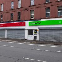
The first local electric bike shop was at the bottom of Jacobs Wells Road; it seems to have attracted some larger competition. I think this place was a sporting goods shop before, specialising in cricket equipment, if my memory isn't deceiving me. When the shutters are up, they've got a large range of electric bikes and scooters on display.
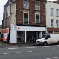
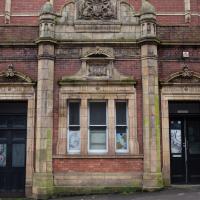
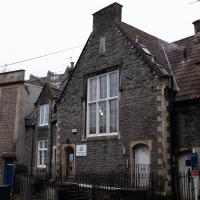
Now home to a tax accountant. It's on the "local list" but without much in the way of detail.
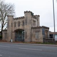
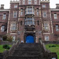
Main entrance to Queen Elizabeth's Hospital. One of those buildings that's easier to take photos of from significantly further away.
