Tagged: hotwells
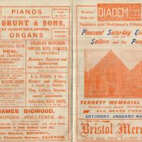
Since setting up a search for Hotwells on eBay I've mostly managed to restrain myself from buying much (or in one case, was outbid, luckily for my finances.) However, I couldn't resist a 1902 flyer for a singalong at the Terrett Memorial Hall, which would have stood five minutes' walk from my flat, overlooking Howard's Lock.
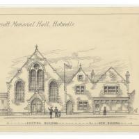
I've found out a fair bit about this non-denominational seaman's mission, including tracking down both a Loxton drawing and an aerial photo of it. The main thing that's eluded me, ironically enough, is finding out who Terrett was, so as a Memorial Hall it didn't do a very good job 😀.
EDIT: Ah! Did a little more digging and found that the Bristol Archives has a Bristol Dock Company document on file called "William Terrett, Esq.; corresp. etc. re proposed erection of a Mission Hall at Cumberland Basin, 1892", so that might be worth a look once the Archives are properly open again. Given that:
Sarah Terrett died suddenly on 25 November 1889, aged 53, after speaking at a meeting of the White Ribbon Army, the temperance organization she had founded in 1878. Following her death many people sent letters of sympathy to her bereaved husband, William. One of these, from the Rev. W. F. James, a minister of the Bible Christians, makes for especially interesting reading. The Bible Christian denomination, to which Sarah and William belonged, was one of the smaller Methodist connexions, and had its heartland in rural Devon, the area where she had grown up. James recalled the hospitality he enjoyed when visiting the Terretts’ home, Church House, in Bedminster, south Bristol...
...I wonder if William Terrett built the hall in memory of his late wife. They were clearly just the kind of temperance movement people who would've founded a seaman's mission to get people together to have a nice non-alcoholic singsong rather than a night out on the tiles.
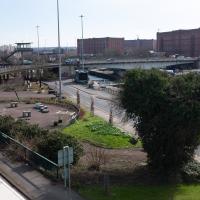
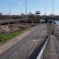
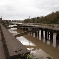
Anyway. This walk to grab a coffee from Hopper Coffee in Greville Smyth Park was mostly an excuse to post the leaflet, a few other things I found related to it, and some pictures of how the site looks now. I would suggest that the present day is not an improvement.
This was my random eBay purchase. I had no idea that the Terrett Memorial Hall had ever existed until I saw this leaflet up for sale.
There's some information on the hall on the Places of Worship database; as you can guess from the title of the leaflet it was basically a seaman's mission, with the aim "to promote the social, moral and religious welfare of sailors and provide sleeping accomodation for seamen, also free beds for destitute seafarers"
My favourite random thing on this leaflet is probably that the Surgeon Dentist is called Mr Heal.
The Loxton Collection, part of Bristol Library's Reference collection, has over 2000 pen and ink drawings that were created by Samuel Loxton in the first decades of the twentieth century for the Bristol Evening Post and Bristol Observer.
Helpfully, many of them have been scanned and posted to Flickr; you can browse more Loxton drawings including this one in the album "Loxton Illustrations: Part 3" (this picture is item #Q1071), and browse more albums of the drawings from the Library's albums page
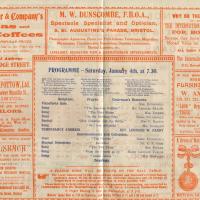
I find the adverts fascinating. My first optician in Bristol was Dunscombe's on St Augustine's Parade, so they were there a long time. They've closed now (or at least moved) but were still there as recently as 2008, I think. Interesting to see gas lighting systems being advertised, too!
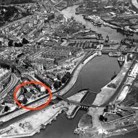
I was fairly sure the Terrett Memorial Hall would have faced Entrance Lock—after all, they'd be wanting to drum up trade from sailors!—and I eventually came across an aerial photo from 1934 on the ever-helpful Bristol City Docks website's Cumberland Basin page that confirmed my hunch.
I haven't had the time to find out when it was demolished, but the whole Cumberland Basin Flyover System (which you can see being built on that web page) had replaced this area by the mid-1960s.
This is photo PBA487 on that page, I think courtesy Bristol Museums Galleries and Archives.
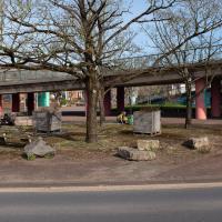
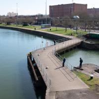
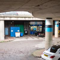
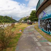
If the Terrett Memorial Hall were still there, its frontage would be roughly where those boulders are between the curve of railing in the middle of the picture and the flyover up to the Plimsoll Bridge a little further back, facing towards the lock gate you can just see on the other side of the road.
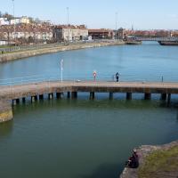
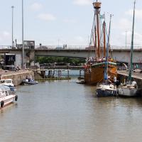
Here we'd be facing Terrett Hall square on. Crouching at work in the middle of the picture is one of the tireless people who are constantly found sprucing up Cumberland Piazza (or at least trying their best to make it look a little less awful.)
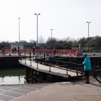
Complete with a fisherman. Quite at the moment, but as a sport it does at least already have a reputation for social distancing.
Library, Bookshop, Coffee
03 Jul 2021
I was headed into town to return RA Gilbert's biography of AE Waite to the library and along the way I noticed that Dreadnought had finished their refurbishment, but wouldn't be open until midday. That left me some time to kill, so I bimbled around the old St Augustine's/Gaunt's area for a while, then headed up Park Street for a coffee and a snack to eat on Brandon Hill before heading home the way I'd came so I could pop in and buy a pamphlet on the Hot Well I'd been interested in for a while.
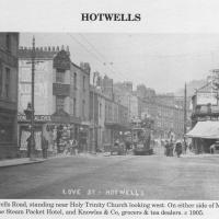
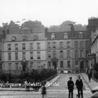
Circa 1905. See the previous photo for the modern-day version. Several of the houses on display were destroyed during the blitz of 24 November, 1940.
I'd never heard of this being called Love Street before. It does seem that it was, though: I just searched through all the various digital research materials I've gathered during this project and found this tidbit in A Bristol Miscellany:
It is proposed to drain the whole of this district by means of a low level sewer commencing at the bottom of Woodwelllane or Jacobs Wells road nearly opposite Woodwell crescent passing along the whole length of the Hotwell road and Love street to Dowry square continuing along in front of Dowry Parade and the Gloster Hotel passing the bottom of Granby Hill in front of Ashton place to Saint Vincent's Parade at which point it will receive the sewage from the Royal York Crescent, the West Mall and Caledonia Place, from which point it will continue along in front of Hotwell House underneath the rocks to the towing path in front of Point House at the Round Point to the present outlet of the High Level Sewer District being about 1,100 yards below the Hotwell House.
...but no other mentions than that one. Looking around the web, I can see a few more references, including this delightful business card for Hotwells gardener John Waldron.
I did idly wonder if "Love Street" might've been a euphemism for something, at some point? There were an awful lot of sailors coming off boats nearby! But perhaps it was simply a nice name for a nice stretch of road...
Photo from Hotwells and the City Docks, ISBN 9781899388288
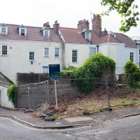
According to the listing, this plot has:
PLANNING GRANTED to erect a DETACHED MEWS HOUSE ( 1743 Sq Ft ) with GARAGE and courtyard garden.
Looks a bit of a tight fit, but it's a nice location and there are very few small whole houses in my neighbourhood, especially not modern ones. Round here it's mostly grand old Georgian stock that's been chopped up into flats, and even the "modern" blocks are getting on a bit.
Location-wise it might be a fair bit noisier than my place, because it's closer to the Hotwell Road and would also instantly become the closest house to Hotwells Primary's playground. On the other hand, unlike my listed building, you'd actually be able to have double glazing and there wouldn't be any immediate neighbours on any side...
I'll be interested to see what the price is like when it eventually gets built.
Up until recently it was just used as an off-street parking spot and always looked rather run-down, so I'm generally in favour of replacing it with a small house.
I imagine this is the house whose owners also own the plot with planning permission; it seems to be the end of their back garden.
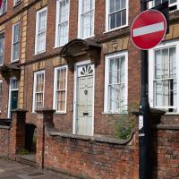
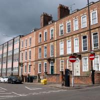
These nearest houses were originally called Chapel Row; they're an extension of the western end of Dowry Square, built 1725-1727. Most of the houses in this area were built from the 1720s onwards as the popularity of the Hot Well caused a demand for lodging space closer than College Green, where people generally stayed before.
Number 262 here, the closest, is presumably owned by the same people who own the little plot of ground that's for sale, given that it's basically at the end of their back garden.
It was called Chapel Row because a chapel used to stand in the middle of this terrace, long before Carrick House was built at the far end.
On the ever-helpful Church Crawler you can see some pictures of the original chapel Dowry Chapel, and its successor, St-Andrew-the-Less. St Andrew (-the-Greater) was of course St Andrew's in Clifton Village.
Pevsner apparently said of St-Andrew-the-Less:
is an unforgiveable crime against the architecture of Dowry Square and chapel Row. Of no value either in its own Gothic forms. The spire is particularly nasty.
Personally, I thought it looked rather nice, but I'm used to Bristol's jumbletechture. It definitely lasted until c. 1963 as there's a picture of it around then (in the background of the devastation wrought by the demolition to clear the way for the Cumberland Basin Flyover System) in Hotwells - Spa to Pantomime.
I think that's what these are, anyway. Erigeron. They cheer me up every time I walk past Holy Trinity at this time of year.
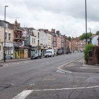
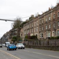
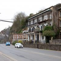
At what was apparently, at some point, called Love Street, but is now just another section of Hotwell Road. See next picture for the c. 1905 view and more information on "Love Street".
In which our intrepid hero levels up.
Quite a line-up. I'm afraid to say I've only read the obvious writer here; I've just popped Angela Carter's The Bloody Chamber on my "to-read" list to try and make up for that, but it's quite a long list right now.
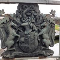
Most of Bristol's bridges have the coat of arms on them. Not quite sure what's going on with the snake.
A Morning of Research and a Cafe in a Castle
25 Sep 2021
I needed to pop to the library, as they'd kindly dug a book out of the reserve store at the B Bond warehouse for me and emailed me to let me know it was ready. So, I took a little trip to town, straight down the Hotwell Road, and spent a few hours reading before stretching my legs with a walk to a new cafe in the actual castle (or remnants thereof, anyway) of Castle Park, before heading back home down the other side of the harbour. As well as books and coffee, I bumped into a remote-controlled pirate ship, which isn't something you see every day, even in Bristol.
The sign about the wildflower meadow on Clifton Hill Bank is part of the consultation I mentioned the other day.
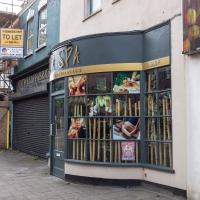
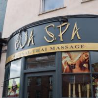
It's nice to see a new business open up on this stretch of the Hotwell Road. Since Asia Channel disappeared (and took with it my favourite local source of crispy beef) and the Hotwells Pine folks retired, it's all been looking a bit tatty.
This place has already garnered several good reviews from locals on Nextdoor and Google Reviews. I must try it at some point.
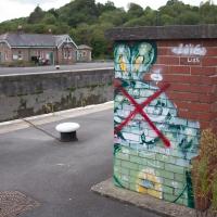
There's a deeply disturbing reason that this rabbit has been crossed out, but I've written that up in a later Wander, so you'll have to wait for an upcoming photo in October.
It's bad enough that the terrace opposite was demolished, without some hurriedly-qualified HGV reversing into the new1 buildings on this side...
1 I suppose "new" is relative. But on most of the maps I've been looking at recently these flats don't exist yet. I think the earlier buildings included a smithy and at one stage what looks like a tap-room, the Stork Tap, for the larger Stork pub that used to occupy what's now Stork House on the main road below. You basically couldn't move in Hotwells without falling into a pub throughout most of its history. The modern-day suburb seems positively teetotal in comparison...
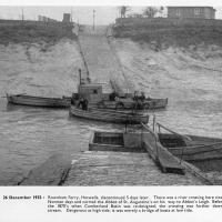
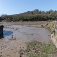
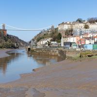
I mostly went out to hang out with my friends Sarah and Vik in Bedminster, but along the way I thought I'd take a closer look at something a little nearer home: the last crossing point of the Rownham Ferry.
And here's the picture that inspired this little local visit today. A week or so back I was browsing the boxes of books at Rachel's and Michael's Antiques on Princess VIctoria Street, and flipping through their collection of Reece Winstone books. Winstone's famous Bristol As It Was series are an amazing documentary source created by a man who loved both photography and Bristol and effectively became Bristol's foremost documentary photographer for decades. A lot more of Bristol's history is visible today because of him.
In the Bristol As It Was 1939 - 1914 book I saw this picture of the Rownham Ferry. Unfortunately the book was a first edition and priced at £20, so I ordered a cheaper edition from an independent dealer in Stockport when I got home! (Let's consider that as me leaving the rare first edition for the true connoisseurs, rather than just being cheap.)
Here we see the ferry just five days before its closure on the last day of 1932. Looking closely, it seems to be perhaps operating as a reaction ferry, with the boat tethered to a static line across the river, and the ferryman using the rudder to turn the boat and use the power of the flowing water to shuttle the boat from side to side. Clever!
Photo © Reece Winstone Archive. (I recommend buying the books if you like old photos of Bristol. They're amazing!)
That reminds me; I must re-read Iain M Banks's Use of Weapons again. In the novel he used the name Size Isn't Everything for one of the Culture's General System Vehicles, a spacecraft approximately 80km long... In the Culture, spacecraft are sentient and Culture ships choose their own names, often ironically.
He we have something of the opposite size of craft.
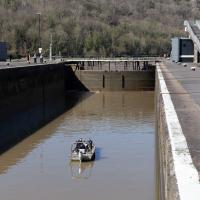
You don't often see Entrance Lock cycle at this kind of tide, but a little boat like that doesn't need a lot of water in the river to manoeuvre.
If you were following this route you'll have noticed I just magically took a shortcut through a bunch of houses. That's because I've elided the bit of the route that goes to Sarah and Vik's place and stays there for an hour or two.
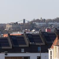
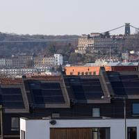
A sign of the times: all the new build homes of Balfour Road have solar panels on top. I bet they're grateful of that, given the current energy price crisis.
It's interesting to be able to look pretty much a mile back and see the familiar buildings of home. Descending from the top right in the distance we can just see the Observatory on Observatory Hill, then the end of Royal York Crescent, then the Paragon just eclipsing the suspension bridge, then below the bridge on the left there's Windsor Terrace and the more modern Windsor Court flats just visible behind the Bedminster foreground.
Dowry Square Jaunt
16 Nov 2020
A quick lunchtime jaunt to Dowry Square, which is very close to me but, being effectively a cul-de-sac as well as a square, I've probably only circumnavigated a couple of times in the last couple of decades.
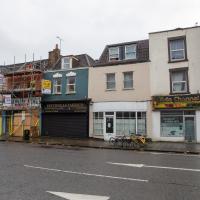
I believe the Hotwells Pine owners decided to retire, like the owner of the fish & chip shop a little further along. Asia Channel did excellent food, but had some kind of family crisis and closed down quite abruptly, sadly. The dentist on the end seems to do a good trade, and Hotwells Fabrics is still going. The one in between them and Asia Channel has been threatening to turn into a deli for a few years now, I think, but perhaps that's fallen by the wayside. Seems a terrible shame when we could do with a few more good local shops. Hotwells has definitely thrived more than this, in the past.
From The Bristol Hotwell, by Vincent Waite:
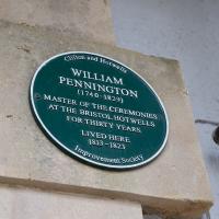
The Bristol Hotwell was, of course, much smaller than the neighbouring spa of Bath, and it was in no sense a rival but rather a supplementary cure, for many people combined visits to the two resorts. After 1785 the Hotwell imitated Bath by appointing a Master of Ceremonies, "William Pennington Esquire," who wore a gold medallion strung on a blue ribbon to emphasise the dignity of his office. In order to preserve decorum in the public entertainments he issued the following regulations:
- That a certain row of seats be set apart at the upper end of the room for ladies of precedence and foreigners of fashion.
- That every lady who has a right of precedence deliver her card to the Master of Ceremonies on her entering the room.
- That no gentleman appear with a sword or with spurs in these rooms, or on a ball night, in boots.
- That on ball nights when minuets are danced, ladies who intend dancing there will sit in a front row for the convenience of being taken out and returning to their places.
- That on all occasions ladies are admitted to these rooms in hats, not excepting the balls given to the Master of the Ceremonies.
- That the subscription balls will begin as soon as possible after 7 o'clock and conclude at 11, on account of the health of the company.
- It is earnestly requested that when a lady has gone down the dance she will be so polite as not to retire till it is concluded.
I never need to walk down Polygon Road or Dowry Road. I couldn't say I've not been down these streets at all before the One Mile Matt project, but if I have it's been vanishingly rare and so long ago I don't remember it.
Easter Monday Gardens and Flowers
18 Apr 2022
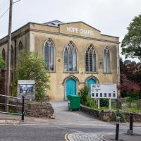
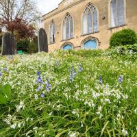
I didn't really set out with a theme of flowers and gardens in mind for this walk. I just fancied heading up to Clifton Village to get lunch. As it turned out, though, Spring was springing, so a minor theme emerged as I started off with the graveyard flowers of Hope Chapel and wandered up to see the beginnings of the new wildflower garden at Clifton Hill Meadow.
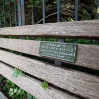
The bench at the top of Clifton Vale doesn't really have a view, and it's squeezed into an awkward little corner in the tight dogleg turn up to Goldney Avenue. On the plus side, Clifton Vale is very steep and many people are grateful for the opportunity it provides for a breather.
I last used it when showing my friend Heather the way back to her hotel in Berkeley Square after a meal in the Pump House. It's a fairly direct route to take, but even a local like me who's used to the hills around here can feel the need for a short rest here before pressing on to the heights of Clifton.
There will be a minor theme of flowers and gardens for this little trip. We'll start at Hope Chapel, though this is more a graveyard than a garden.
I first heard of Clerihews in the Times crossword: The Clerihew is:
a whimsical, four-line biographical poem invented by Edmund Clerihew Bentley.
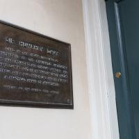
The reason it's relevant to this plaque on a house just around the corner from mine is that the very first Clerihew was written about Sir Humphry Davy:
Sir Humphry Davy
Abominated gravy.
He lived in the odium
Of having discovered sodium.
(Sir Humphry is indeed credited with having been the first to isolate sodium, six years after moving out of this house...)
A lovely garden. Sadly a little lacking in facilities at the moment, after some scrote (or presumably a team thereof) had it away with their cast iron table and chair set at the end of March. This is why we can't have nice things, etc. etc.
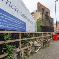
Where fly tipping happens, more like. This scrap of land (with a public bench hidden on the far end, against the back fence behind the red bins) has been a bit of an eyesore for years. I've never been a fan of public billboards.
Recently, though, a property developer has applied for planning permission for a block of flats here, and apparently fenced off the bit where the main entrance will be, even though it's fenced in this little corner of land that everyone assumed was public, council bench and all. And now it's attracted fly tippers, it seems.
I've tweeted at the councillor for the area, Alex Hartley, and he's said he's alerted the council and will try to investigate it/get it cleaned up, so here's hoping...
In the long run, maybe there will be some new flats instead of an ugly billboard and some dull fencing, and I'm all for that.
I've taken plenty of snaps looking at Holy Trinity from the road, but I think this may be my first looking at the road from Holy Trinity.
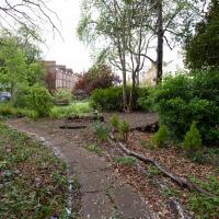
There was a somewhat precarious path in the road protected by those yellow plastic barriers to get around some holes being dug in the pavement. I chose the safer route through the church garden and thought I might as well take a pic from the main entrance.
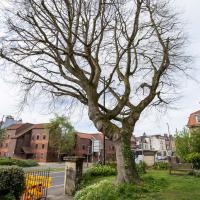
On a previous wander I posted a historical photo of the church including this tree, and one from the modern day.
It's grown up quite a lot in the last hundred years...
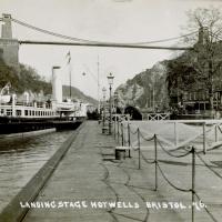
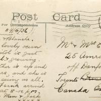
I bought a vintage post card from eBay this week. It's a well-known photo of the Hotwells landing stage, showing what's likely to be a P&A Campbell paddle steamer moored there. (Just yesterday I snapped a photo of their buoy on display at Underfall Yard with its information sign.) It was posted from here to Canada in 1936, and has now returned via a presumably quite circuitous route.
Local journalist Maurice Fells (really local—I could probably hit his house with a well-flung teacake from here) notes in The A-Z of Curious Bristol (£) that:
For tens of thousands of people, the pier at Hotwells was the starting point of their day trip as they boarded steamers with names like Glen Avon, Glen Usk and Britannia. The salty tang of the sea was never far away as the steamers headed for Ilfracombe, Weston-super-Mare, Clevedon and Portishead on the Devon and Somerset coast and Barry, Porthcawl and Tenby in South Wales.
The landing stage is long-abandoned. A variety of economic issues, including fuel prices, the increasing prevalence of the motor car, the construction of the Severn Crossing giving easier access to Wales, and the collapse of Clevedon Pier during safety testing in 1970, which prevented larger pleasure boats from stopping at the resort, all led to dwindling trade.
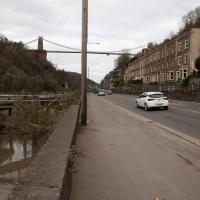
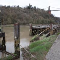
I went to have a poke about there today, not staying for long as it's a cold day and the wind was biting. I couldn't reproduce the postcard's view—you'd need to risk life, limb and presumably a trespass prosecution—but I did try to judge the rough viewpoint and angle of the photo by lining up with Rock House, the Colonnade and the Suspension Bridge and snapped a photo looking back to where the original photographer would have stood on the pontoon.
This Bristol City Docks history page has many good photos of the landing stage and the nearby Port and Pier Railway line (whose tunnel I was in the other day) and the Hotwells Halt railway station, which was just the other side of the suspension bridge from here.
Not sure what the gap was for, or what the metal bridge-like-thingy that's gently rusting into the water was for, either.
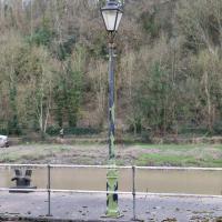
On closer inspection, this looks similar, but not the same as the lamp posts in the picture.
I think this roughly lines up with the viewpoint in the picture. You can just see the suspension bridge stanchion in about the right place behind the tree above the Colonnade.
I've been pretty awful at reading so far this year, apparently averaging about one book per month. That's a far cry from 2019, say, where I got through 41 books in the year. Today's wander was prompted by my rubbish reading, as I needed to go hand back some books to the library, because I'd managed to renew them so many times that I hit the limit on renewals. Oops. Several of them were still unread.
So, off to the Central Library for me, tail between my legs. On the way there I did my best to recreate a historical photo of Dowry Square; while I was in the area I walked under the adjacent Norman arch and poked around behind the Cathedral, and I also had a little diversion to the city centre and came back along the south side of the river, hitting some trouble with the lock gates as I finally crossed the harbour back towards home.
I don't know anything about this photo, really; I saw it pop up on eBay in one of my automated searches for "Hotwells" and this nice, open view of Dowry Square, which is a lot more overgrown these days, made me click that "buy" button. This is a print from a negative in a private collection but more that that I can't really tell you. The "Hepworth" could be Watler Hepworth, as it seems there was a Bristol photographer of that name in about the right period, which I"m guessing to be sometime between the First and Second World Wars. The tram rails and electrical lines are still in place, as you can see.
One nice detail is the Bass signs in the windows of what was clearly still back then the York Hotel on the corner of the square. There's some pictures of what I've been assuming is the main bar entrance that faces onto the main road and remains quite well-preserved in a moment...
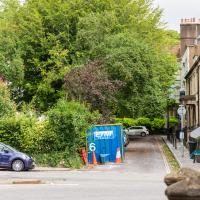
The same view these days is a lot less romantic, especially with the temporary crate from some roadworks sitting at the corner of the square.
I don't blame anyone who lives this close to the Hotwell Road (and can't get double glazing fitted because it wouldn't be in keeping with the character) for wanting a lot of trees and bushes in between them and the roar of the traffic, but I think it's objectively a lot less appealing to the eye with so much shrubbery in the way. Probably good for the local wildlife, though.
It's less obstructive in winter, as you can see from this earlier photo taken from the back of the square looking back toward me.
Samuel Taylor Coleridge and Robert Southey both spent time in the garden of the square, apparently—I wonder what they'd make of it today?
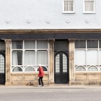
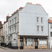
Off to the side of the photo we've just seen is the pub frontage on the Hotwell Road, apparently a later addition. The listing says
The right-hand return has a late C19 ashlar public house front with 5 panelled pilasters and foliate capitals to left-hand and central doorways, 2 windows with tripartite frames and semicircular-arched panes below, panelled aprons and dentil cornice.
Nowadays known as York House, and apparently offices, this was originally built by George Tully, like a lot of the rest of the square.
According to this Heritage Statement about No. 10 by Mark Hines Architects he started building in 1723, imagining accommodation houses for Hotwells visitors, but later built this large hotel and other buildings like the Clifton Dispensary at No 12 as the spa became more popular and the square evolved into a centre of medicine. I'm a little confused by that claim as the York Hotel went up c. 1780, according to the listing, when Tully had been dead for ten years, but perhaps it means he planned it before he died.
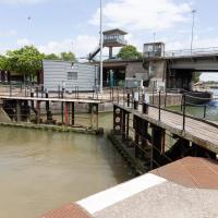
While I was taking the last few photos I'd been hearing the two-tone alarm signal of a bridge swing, so I knew something would be going on at the lock when I got here. This time, though, I got more than I bargained for.
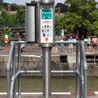
I was coming up to cross at these lock gates like normal when I saw that the lock keeper operating the hydraulics was having some difficulties. Sure enough, after a few attempts at closing the gates, it became apparent that they just weren't having any of it. They were getting this close to closing and then jamming.
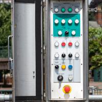
...which was good in some ways; I've always been curious about the control panel for the lock gates, and as the lockkeeper went to have a closer look at the gates themsevles I took this snap and, in the next photo, a close-up.
There's something very pleasing about industrial switchgear to me. This is comparatively modern, put in the last time the lock gates were replaced/refurbished, from what I remember, but still has that pleasingly 1950s look of good solid gear.
As you can see, there were quite a lot of boats waiting to leave Bristol for a jaunt down the river, most notably the Matthew, and Bristol Packet's Bagheera.
One Albermarle Row, Granby Green and... People
12 Mar 2021
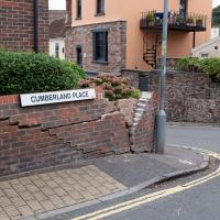
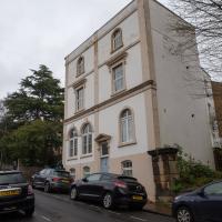
I was browsing some historical photos the other day, and came across "Rear of Unspecified House" in the Bristol Archives' John Trelawny Ross collection, and immediately recognised it as being the back of 1 Albermarle Row, just around the corner from me. I've not had much time to research the history of this odd little addition to Albermarle Row, or what happened to 1-4 Cumberland Place, number 4 of which used to be attached to the side of 1 Albermarle Row, but it was interesting to look at old maps for a few minutes and work out what used to be where.
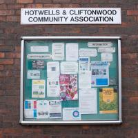
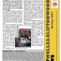
That all connects with the little local bit of land at Granby Green, too, as it used to be numbers 1-3 Cumberland Place. There was something of a planning battle over Granby Green, and I've included an old edition of Hotwells & Cliftonwood News that I found online, a copy of which would have been popped through my letterbox at the time.
I was also inspired by some old pictures of Hotwell Road to try to put a few more people in my pictures, though I set my pre-focus a couple of extra metres out from normal to make sure I didn't get too close to anyone!
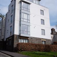
This modern block has appeared since I've lived in the area, so it must be newer than 1999, I think.
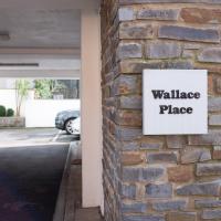
There was a suggestion that the new green space below Wallace Place be called "Gromit Green" :D
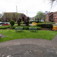
This was a hard-won green by all accounts. I remember the brilliantly-acronymed Friends of Granby Green popping leaflets through our doors to drum up local support for having it declared a Town Green to stop more development. See the next picture from some background, and a tiny picture of what it looked like before it was turned into this little green space.
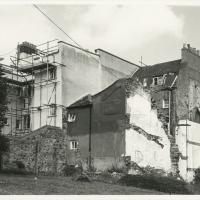
"Rear of unspecified house, Jun 1979"
As soon as I saw this photo, I thought, "That's not unspecified! That's 1 Albermarle Row!" I mean, it still looks like that today, and it's quite distinctive.
From the Bristol Archives, filed under "Bristol City Council: Urban Design and Conservation: Photographs by John Trelawny-Ross/ Photographs taken by John Trelawny Ross during the course of his work as conservation officer for Bristol City Council, within the Urban Design and Planning Department/Dowry Parade, Albermarle Row and St Vincents Parade"
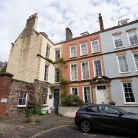
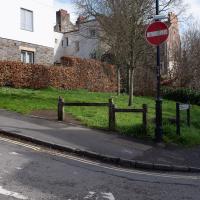
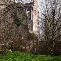
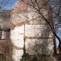
...or rather, the remaining imprint of 4 Cumberland Place on the side wall of 1 Albermarle Row. I don't know why the houses of Cumberland place on the right at the top of the hill disappeared. It seems to have been a gradual process; 1-4 are there on a 1946 aerial photo, then on the 1947-1965 OS maps number 1 has disappeared, and then in the jump to the modern day the whole lot's gone.
It's the school in the back of the council photo that relly confirms that the picture is of Albermarle Row.
